Cerro Azul is the southernmost active volcano on Isabela Island, Galápagos (Ecuador). On 18-19 March 2017, seismic activity increased on the SE flank of the volcano.
On the same day, the Instituto Geofisico Escuela Politécnica National (IGEPN), the organisation responsible for the monitoring of Ecuadorian volcanoes, issued a warning for a possible imminent eruption.
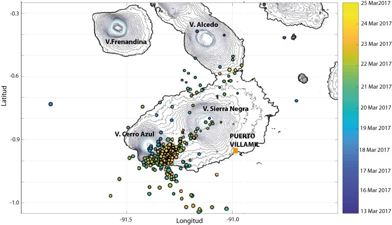
The recorded seismicity was composed of volcano tectonic (VT) earthquakes, consistent with processes of rock fracturing, with the majority of the events having magnitude ranging between 2.4 and 3. There were also sporadic events with magnitude up to 3.6 (see the second activity update released by IGEPN on 24 March).
The Sentinel-1 satellite acquired synthetic aperture radar data on 7 and 8 of March, prior to the onset of the seismic activity, and on 19 and 20 March, once seismicity started to exceed background levels both in terms of number of earthquakes and of energy release.
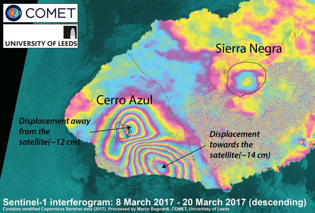
Applying SAR interferometric techniques (e.g. InSAR) showed significant deformation (up to 14 cm) in the region affected by the seismic swarm. More specifically, the InSAR data shows uplift at the southeastern flank of the volcano and contemporary subsidence centered at the summit of the volcano.

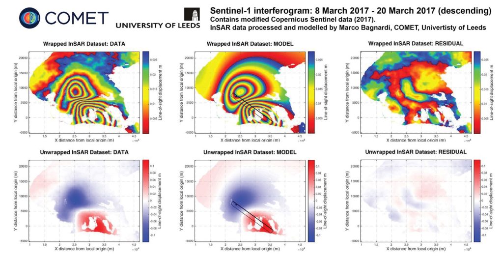
COMET researcher Marco Bagnardi, working with the IGEPN, carried out a preliminary analysis of the InSAR data and observed that the deformation (at least as of 20 March 2017) can be explained by the intrusion of a 20-40 million cubic meters sill at a depth of ~5 km beneath the surface of the volcano.

Such intrusion is likely to be fed by a 6 km deep reservoir, cantered beneath the summit of the volcano. The location of the intrusion well matches the location of the seismicity recorded by IGEPN.

Marco Bagnardi said: “Within ten hours from receiving the warning from IGEPN, we were able to get hold of the most recent Sentinel-1 data for the area, process them to form differential interferograms, invert the data to infer the source of the observed deformation, and pass on the information to our Ecuadorian colleagues.”
The seismic activity seems to be continuing today. IGEPN is currently proposing two possible scenarios for the evolution of this episode of volcanic unrest:
- the intrusion could reach the surface and feed an effusive eruption in the coming days or weeks, as happened in 1998 and 2008; or
- seismic activity and deformation could return to background level without the eruption of magma at the surface.
The next Sentinel-1 acquisitions will be on 1 and 2 April. They will hopefully shed more light on the nature of the magmatic intrusion and on its evolution since 20 March.
