COMET heads to Santiaguito, Guatemala

COMET heads to Santiaguito, Guatemala

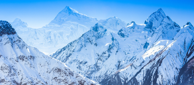
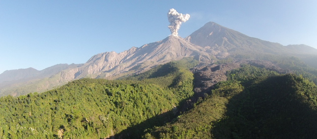
Scientists from COMET are participating in a workshop, funded by the US National Science Foundation, to study Santiaguito volcano, Guatemala.

SUAS shot of an explosion at Santiaguito volcano, January 9 2016

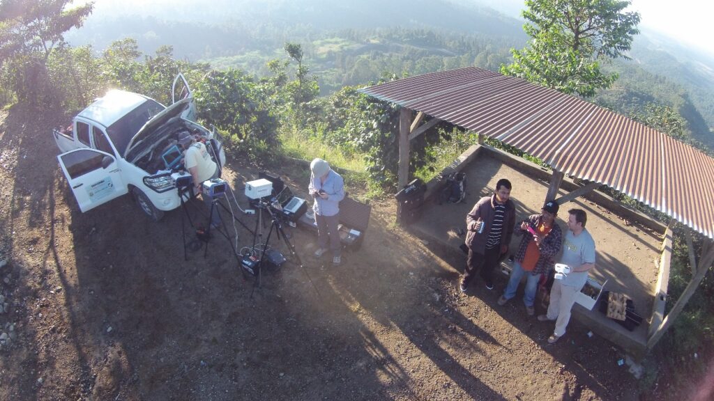
Matt Watson, Luke Western and Kate Wilkins have been in Guatemala since January 2nd, acquiring data with a range of instruments including three UV camera systems, three additional mini-UV spectrometers, a multispectral infrared camera, a lightweight infrared camera and a Phantom II Small Unmanned Aerial System (SUAS).

SUAS selfie showing an array of IR and UV cameras

The meeting, the first in a series of scientific and educational workshops to be held at an active laboratory volcano every two to three years, is lead by a selection of principal scientists who have different field-­based data collection expertise.

They, along with students and local scientists, conducted fieldwork just prior to the formal workshop.  During the main phase of the workshop additional participants, including other students and professionals, arrived and had an opportunity to both observe the field installations and participate in data collection.

Formal lectures, on both measurement techniques and recent findings on shallow conduit processes at Santiaguito, were given by the principal scientists on January 5th. Different groups then headed out for four days to make various observations and measurements of the volcano.

The focus for the following two days, the last of the workshop, was on breakout groups and hands‐on analysis of the multiple data types that were collected concurrently. Everyone participating in the workshop, including students and principal scientists, shared and received all the data products at the end of the workshop.

Following the workshop, analytical results, tools, and integrated products will be delivered to the participants and published electronically for the broader community.

Watson, Western and Wilkins, with Helen Thomas from Nicarnica Aviation, are now heading to both Pacaya and Fuego volcanoes. At Pacaya they hope to undertake a drone survey of the crater by adapting the Phantom II to fly the lightweight IR camera. At Fuego, they will acquire more imaging and spectral measurements of the volcano’s emissions and investigate installation of the multispectral infrared camera.

Kink in fault line below Nepal explains why Himalayas keep growing

An international team of scientists, led by COMET’s John Elliott, has shed new light on the earthquake that devastated Nepal in April 2015, killing more than 8,000 people.

In a study published in the journal Nature Geoscience, the scientists show that a kink in the regional fault line below Nepal explains why the highest mountains in the Himalayas are seen to grow between earthquakes.

Dr Elliott explained: “We have shown that the fault beneath Nepal has a kink in it, creating a ramp 20km underground. Material is continually being pushed up this ramp, which explains why the mountains were seen to be growing in the decades before the earthquake. The earthquake itself then reversed this, dropping the mountains back down again when the pressure was released as the crust suddenly snapped in April 2015.

“Using the latest satellite technology, we have been able to precisely measure the land height changes across the entire eastern half of Nepal. The highest peaks dropped by up to 60cm in the first seconds of the earthquake.”

Mount Everest, at more than 50km east of the earthquake zone, was too far away to be affected by the subsidence in this event.

The team, which included academics from the USA and France, also demonstrate that the rupture on the fault stopped 11km below Kathmandu. This leaves an upper portion that remains unbroken and will build up more pressure over time as India continues to collide with Nepal, and indicates that another major earthquake could take place within a shorter timeframe than the centuries that might be expected for the area.

Dr Elliott added: “As this part of the fault is nearer the surface, the future rupture of this upper portion has the potential for a much greater impact on Kathmandu if it were to break in one go in a similar sized event to that of April 2015.

“Work on other earthquakes has suggested that when a rupture stops like this, it can be years or decades before it resumes, rather than the centuries that might usually be expected.”

Study co-author Dr Pablo González, from the School of Earth and Environment at the University of Leeds and also a COMET member, said: “We successfully mapped the earthquake motion using satellite technology on a very difficult mountainous terrain. We developed newly processing algorithms to obtain clearer displacement maps, which revealed the most likely fault geometry at depth to make sense of the puzzling geological observations.”

The research paper, Himalayan megathrust geometry and relation to topography revealed by the Gorkha earthquake, was published online in Nature Geoscience on 11 January 2016.