Monday 15th April, 2024
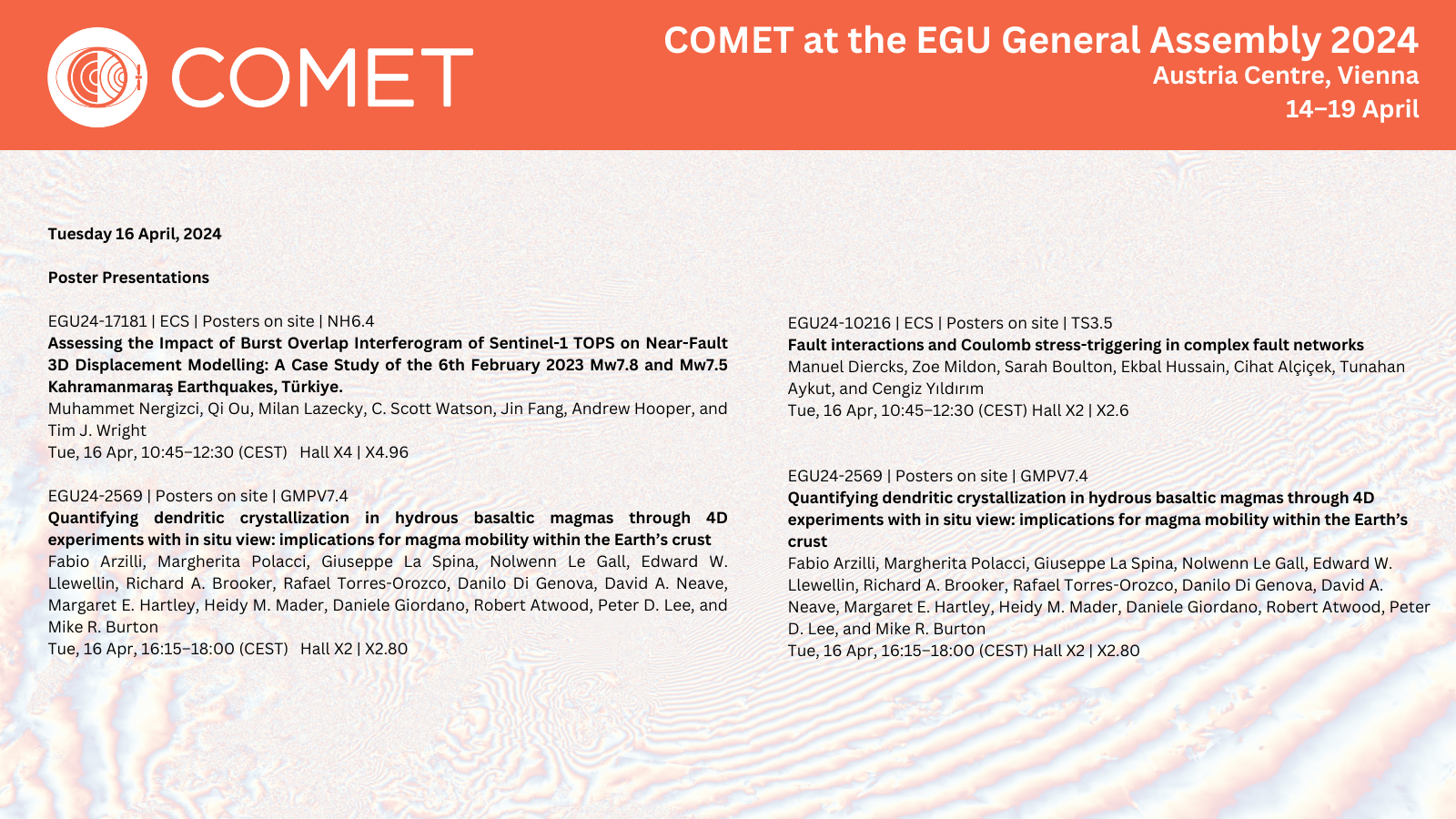
Tuesday 16th April, 2024
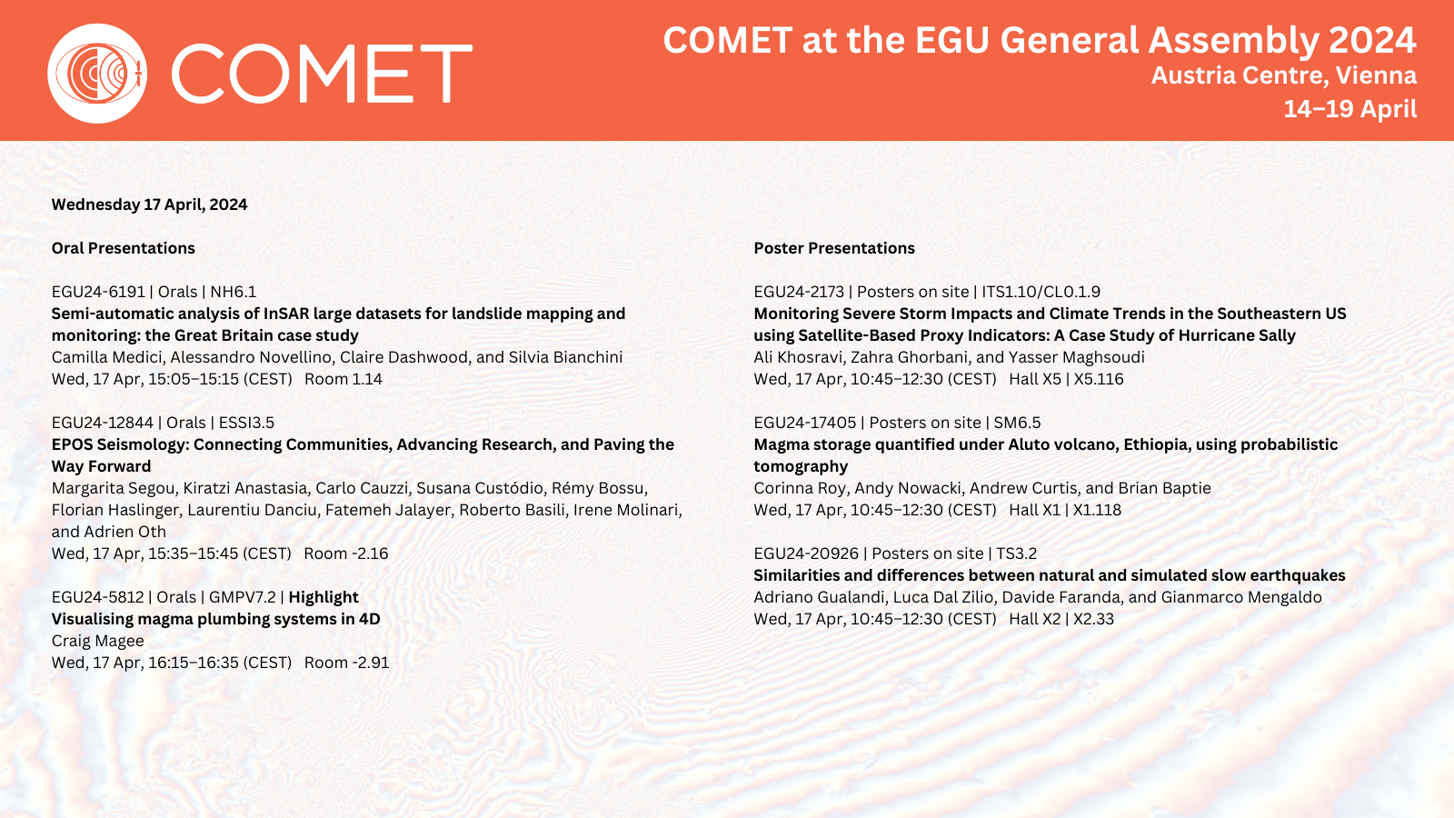
Wednesday 17th April, 2024

Monday 15th April, 2024
Tuesday 16th April, 2024
Wednesday 17th April, 2024
Today we celebrate all our amazing women at COMET and introduce you to some members of the COMET Directorate.
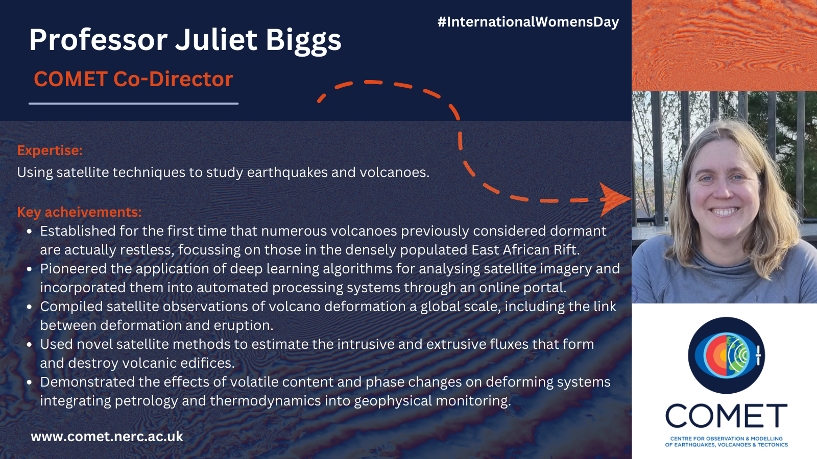
Meet COMET’s Co-Director Professor Juliet Biggs (Bristol), expert in using satellite techniques to study earthquakes and volcanoes.
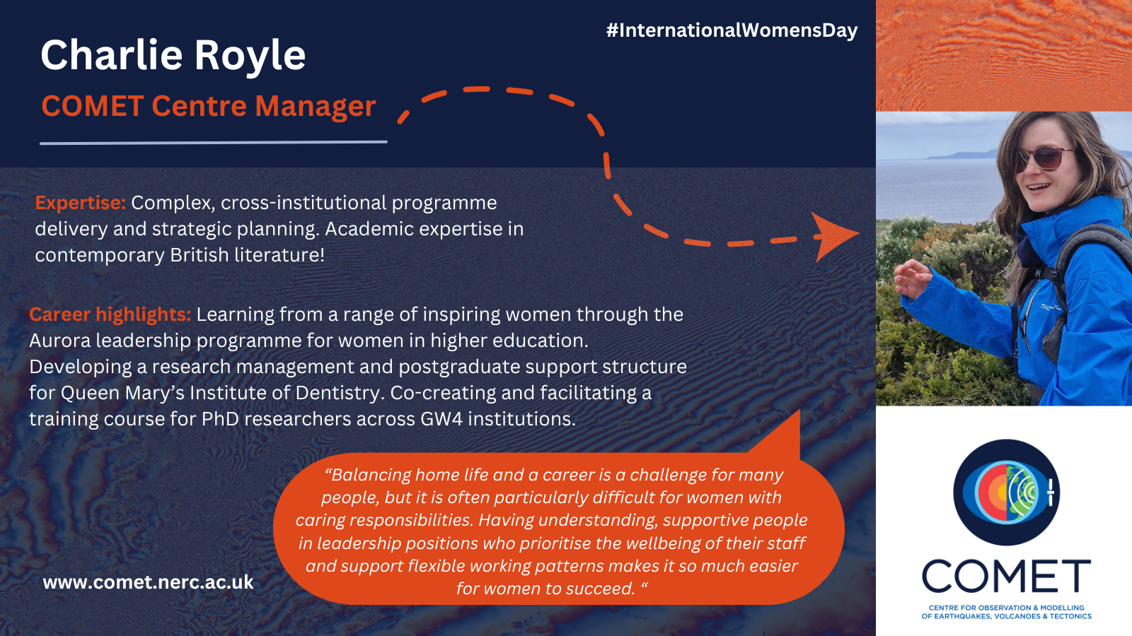
Meet COMET’s Centre Manager, Charlie Royle (Leeds), expert in complex, cross-institutional programme delivery and strategic-planning.
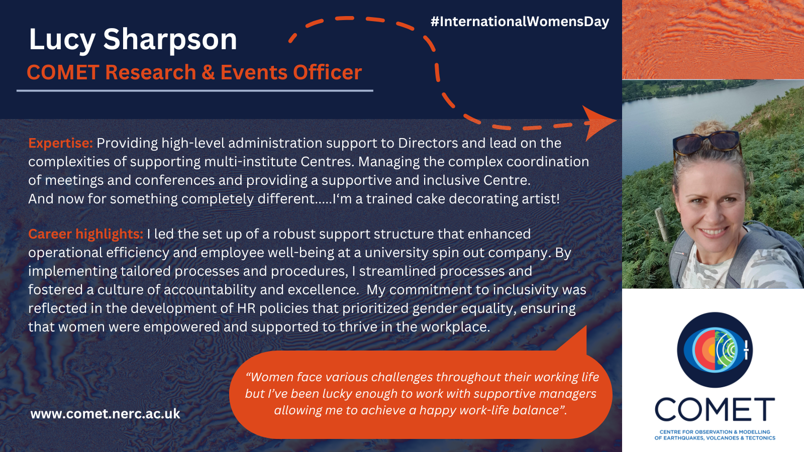
Meet COMET’s Research and Events Officer Lucy Sharpson (Leeds), expert in the complexities of supporting multi-institute Centres and event planning.
Meeting Time Zone PST
Monday 11th December
| Session Type | Start time | End Time | Location | Session Title | COMET Author/Speaker(s) |
| Poster | 08:30 | 12:50 | Poster Hall A-C – South (Exhibition Level, South, MC) | T11D-0192 Crustal Structure and Mantle Deformation across the Central African Plateau, Zambia: Evidence from Receiver Functions and Shear-Wave Splitting Analysis | Features Mike Kendall (Oxford) |
| Poster
|
08:30 | 12:50 | Poster Hall A-C – South (Exhibition Level, South, MC) | V11D-0099 Seismo-acoustic source mechanism of high-rate very-long-period seismicity at Yasur volcano, Vanuatu: Multi-parametric field studies | Features Tom Pering (Sheffield) |
| Talk | 08:40 | 08:50 | 2022-2024- West (Level 2, West, MC) | GC11C-02 Climate Projections Very Likely Underestimate Future Volcanic Forcing and its Climatic Effects | Features Anja Schimdt (Cambridge) |
| Talk | 09:10 | 09:20 | 158 – South (Upper Mezzanine, South, MC) | G11A-05 Tectonic, Climatic and Anthropogenic Deformation over the Tianshan Mountains | Qi Ou (Leeds) |
| Poster
|
14:10 | 18:30 | Poster Hall A-C – South (Exhibition Level, South, MC) | S13F-0419 Reassessment of Historical Earthquake Magnitudes using Earthquake Ground Motion Simulations and Global Fragility Functions | Aisling O’Kane (Cambridge) |
| Poster
|
14:10 | 18:30 | Poster Hall A-C – South (Exhibition Level, South, MC) | T13D-0248 Complex Martinique intermediate-depth earthquake reactivates early Atlantic break-up structures | Features Lidong Bie (East Anglia) |
Tuesday 12th December
| Session Type | Start time | End Time | Location | Session Title | Author/Speaker |
| Poster | 08:30 | 12:50 | Poster Hall A-C – South (Exhibition Level, South, MC) | NH21C-0665 The WTW Research Network and nearly two decades of creative private-public partnerships on the science of geophysical risks | Features James Dalziel (WTW Research Network) |
| Poster
|
08:30 | 12:50 | Poster Hall A-C – South (Exhibition Level, South, MC) | GP21A-0529 Paleomagnetic and rock magnetic data constraints on magma emplacement at Ardnamurchan central complex, NW Scotland | Features Craig Magee (Leeds) |
| e-Lightening | 08:54 | 08:57 | eLightning Theater VI, Hall D – South (Exhibition Level, South, MC) | T21G-09 Discovery of Lithospheric Drip Explains Active Uplift in the Uinta Mountains, USA | Features Matt Fox (UCL) |
| Talk | 10:40 | 10:50 | 152 – South (Upper Mezzanine, South, MC) | V22B-03 The Highs and Lows of Outgassing at Kīlauea: Comparison of DOAS- and UV Camera-Derived SO2 Emission Rates During Variable Eruptive Activity, 2022-2023 | Tom Pering/Tom Wilkes (Sheffield) |
| Talk | 10:50 | 11:00 | 158 – South (Upper Mezzanine, South, MC) | G22A-04 A Comprehensive Observational Database of Global Volcanic Deformation for Deep Learning Applications | Lin Shen (Leeds) |
| Talk | 15:26 | 15:36 | 155 – South (Upper Mezzanine, South, MC) | T23A-08 One tune, many tempos: Faults trade off slip in time and space to accommodate relative plate motions | Features Ed Rhodes (Sheffield) |
Wednesday 13th December
| Session Type | Start time | End Time | Location | Session Title | Author/Speaker |
| Poster | 08:30 | 12:50 | Poster Hall A-C – South (Exhibition Level, South, MC) | T31E-0257 Non-characteristic slip behavior on the Kekerengu fault throughout the past four to five earthquakes at Bluff Station, New Zealand | Features Ed Rhodes (Sheffield) |
| Poster
|
08:30 | 12:50 | Poster Hall A-C – South (Exhibition Level, South, MC) | T31G-0268 Deciphering Non-Constant Earthquake Behavior: Insights from the Garlock Fault in Southern California | Features Ed Rhodes (Sheffield)
|
| Poster
|
08:30 | 12:50 | Poster Hall A-C – South (Exhibition Level, South, MC) | S31G-0413 Analyzing low-magnitude induced seismicity using deep learning phase arrival picking: a case study from Preston New Road, UK | Cindy Lim (Bristol) |
| Poster | 08:30 | 12:50 | Poster Hall A-C – South (Exhibition Level, South, MC) | V31D-0123 The Rates, Causes, and Dynamic Consequences of Fluid Flow and Reaction in Mountain Belts | Alex Copley (Cambridge) |
| Poster
|
08:30 | 12:50 | Poster Hall A-C – South (Exhibition Level, South, MC) | T31G-0274 Fault geometry and Late Quaternary kinematics along the Tieluzi Fault: Implications for tectonic deformation and eastward expansion of the Tibetan Plateau, China | Features Ian Pierce (Oxford) |
| Talk | 08:51 | 08:59 | 2018 – West (Level 2, West, MC) | NH31B-03 Leveraging Machine Learning, Ensemble Precipitation Forecasts and Hillslope-scale Impact Modeling for a Unified Multi-hazard approach to Landslide Forecasting in Nepal | Features Maximillian Van Wyk de Vries (Cambridge) |
| Talk | 08:52 | 09:02 | 158 – South (Upper Mezzanine, South, MC) | G31A-03 Strain Rate Mapping and Earthquake Hazard | Features Chris Rollins (Leeds/GNS) |
| Talk | 09:32 | 09:42 | 158 – South (Upper Mezzanine, South, MC) | G31A-07 Present-day block kinematics of the India-Eurasia collision zone from a densified GPS velocity field | Gang Zheng (Leeds) |
| Talk | 09:42 | 09:52 | 158 – South (Upper Mezzanine, South, MC) | G31A-08 From Türkiye to China: tectonic strains and velocities in the Alpine-Himalayan Belt from Sentinel-1 InSAR and GNSS | Tim Wright (Leeds) |
| Talk | 11:00 | 11:10 | 2018 – West (Level 2, West, MC) | NS32A-04 Nationwide assessment of subsidence induced hazard in Iran using Sentinel-1 InSAR | Jessica Payne (Leeds) |
| Talk | 11:20 | 11:30 | 154 – South (Upper Mezzanine, South, MC) | T32A-07 Causes and Consequences of the Spatial and Temporal Heterogeneity of Strength, Deformation Mechanism, and Fluid-Limited Metamorphism in a Crustal-Scale Fault Zone | Alex Copley (Cambridge) |
| Poster | 14:10 | 18:30 | Poster Hall A-C – South (Exhibition Level, South, MC) | S33H-0475 Temporal variations in North Atlantic seismicity at varying magnitudes | Tim Craig (Leeds) |
| Poster | 14:10 | 18:30 | Poster Hall A-C – South (Exhibition Level, South, MC) | V33C-0175 Mixing it up: recycling and mingling of magma during the 1959 eruption of Kīlauea Iki, Hawaiʻi | Marie Edmonds (Cambridge) |
| Poster | 14:10 | 18:30 | Poster Hall A-C – South (Exhibition Level, South, MC) | S33I-0498 Extending pyCSEP: A Python Toolkit for Earthquake Forecast Developers | Features Max Werner (Bristol) |
| Poster | 14:10 | 18:30 | Poster Hall A-C – South (Exhibition Level, South, MC) | S33I-0500 Modernizing Earthquake Forecasting Experiments: The CSEP Floating Experiments | Features Max Werner/Jose Bayona (Bristol) |
| iPoster | 14:10 | 18:30 | Poster Hall A-C – South (Exhibition Level, South, MC) | G33B-0539 Strain-partitioning in the Northern Qilian Shan and its Implications for Cascading Earthquake Ruptures | Features Sam Wimpenny (Bristol) |
| Talk | 14:12 | 14:27 | 157 – South (Upper Mezzanine, South, MC) | S33B-01 San Andreas fault earthquake hazard model overturned by precariously balanced rocks (Invited) | Features Dylan Rood (Imperial) |
| Talk | 15:15 | 15:25 | 2016 – West (Level 2, West, MC) | NH33A-07 An automated, regional-scale rapid mapping tool for multiple landslide events: testing a proof-of-concept case study from New Zealand 2023 | Features Alessandro Novellino (BGS) |
| e-Lightening | 16:21 | 16:24 | eLightning Theater V, Hall D – South (Exhibition Level, South, MC) | G24B-08 High-Resolution Change Detection for Time Series InSAR using Random Forests | Jacob Connelly (Leeds) |
| Talk | 17:20 | 17:30 | 2014 – West (Level 2, West, MC) | IN34B-09 The utility of commercial satellite data for studying global volcanic activity: Successes, challenges, and future prospects | Features Susanna Ebmeier (Leeds, Juliet Biggs (Bristol), Edna Dualeh (Bristol) |
Thursday 14th December
| Session Type | Start time | End Time | Location | Session Title | Author/Speaker |
| Invited Talk | 08:45 | 08:55 | 155 – South (Upper Mezzanine, South, MC) | T41A-02 A Unified Physical and Chemical View of Orogen Evolution (Invited) | Alex Copley (Cambridge) |
| Invited Talk | 08:45 | 08:55 | 158 – South (Upper Mezzanine, South, MC) | G41A-02 Understanding the episodic feeding of volcanoes: Identifying their magmatic and non-magmatic origin (Invited) | Camila Novoa Lizama (Leeds) |
| e-Lightening | 08:48 | 08:51 | eLightning Theater V, Hall D – South (Exhibition Level, South, MC) | V41G-07 The 4th Diking Event of the Fagradalsfjall Rifting Episode (2021-?) in July 2023: Geodetic and Seismic Imaging of the Dike Propagation and Effects of Imposed Stresses on the Dike and the Associated Eruption | Features Andy Hooper (Leeds) |
| Talk | 08:55 | 09:05 | 155 – South (Upper Mezzanine, South, MC) | T41A-03 Constraining lithospheric rheology in continental forelands using seismicity and flexural profiles | Tim Craig (Leeds) |
| Talk | 09:40 | 09:50 | 153 – South (Upper Mezzanine, South, MC) | V41A-08 Sulfur Recycling at Subduction Zones: Reduced Sedimentary Input Supplies Oxidized Arcs | Features Tamsin Mather and David Pyle (Oxford) |
| e-Lightening | 10:20 | 10:23 | eLightning Theater V, Hall D – South (Exhibition Level, South, MC) | G42B-01 Deformation Patterns of Different Chilean Volcanic Zones: Insights from GNSS, InSar, and Seismic Observations | Features Camila Novoa Lizama (Leeds) |
| Talk | 10:30 | 10:40 | 151 – South (Upper Mezzanine, South, MC) | DI42A-02 Plate tectonic dynamics from the PI-LAB experiment at the equatorial Mid-Atlantic from anisotropy in comparison to other ocean basins | Features Mike Kendall (Oxford) |
| Poster | 14:10 | 18:30 | Poster Hall A-C – South (Exhibition Level, South, MC) | V43E-0217 Just add water: degassing and sulfide saturation control magmatic chalcophile systematics | Olivia Hogg (Cambridge) |
| Poster | 14:10 | 18:30 | Poster Hall A-C – South (Exhibition Level, South, MC) | PP43F-1729 Assessing volcanism during the spice event using mercury and mercury stable isotopes | Features Tamsin Mather (Oxford) |
| Poster | 14:10 | 18:30 | Poster Hall A-C – South (Exhibition Level, South, MC) | DI43C-0051 Towards constraining mantle flow through global radial anisotropy tomography with uncertainty quantification | Features Matt Fox (UCL) |
| e-Lightening | 14:25 | 14:28 | eLightning Theater V, Hall D – South (Exhibition Level, South, MC) | G43C-06 Ground deformation at Askja Volcano: a poroelastic finite element model to explain the observed uplift that commenced in the summer of 2021 | Josefa Sepulveda (Leeds) |
| e-Lightening | 14:28 | 14:31 | eLightning Theater V, Hall D – South (Exhibition Level, South, MC) | G43C-07 Understanding the drivers of volcano deformation through geodetic model verification and validation | Features Camila Novoa Lizama (Leeds) |
| Talk | 17:20 | 17:30 | 2014 – West (Level 2, West, MC) | IN34B-09 The utility of commercial satellite data for studying global volcanic activity: Successes, challenges, and future prospects | Features Juliet Biggs (Bristol) |
Friday 15th December
| Session Type | Start time | End Time | Location | Session Title | Author/Speaker |
| Poster | 08:30 | 12:50 | Poster Hall A-C – South (Exhibition Level, South, MC) | A51H-2005 Evaluation of the ORAC algorithm for geostationary liquid water cloud retrievals over the Southern Ocean | Features Don Grainger (Oxford) |
| Poster | 08:30 | 12:50 | Poster Hall A-C – South (Exhibition Level, South, MC) | S51E-0257 Towards Automatic InSAR Derived Source Parameters for Global Seismicity | John Condon (Leeds) |
| Poster | 08:30 | 12:50 | Poster Hall A-C – South (Exhibition Level, South, MC) | B51D-1794 Forest Disturbance and Vegetation Recovery Patterns Caused by Explosive Volcanic Eruptions Captured by Optical and Radar Remote Sensing | Megan Udy (Leeds) |
| Poster | 08:30 | 12:50 | Poster Hall A-C – South (Exhibition Level, South, MC) | G51B-0359 Asymmetric Outliers in GNSS Time Series: A Study of Their Spatio-temporal Distribution From Different World Regions | Features Adriano Gualandi (Cambridge) |
| Talk | 09:45 | 09:55 | 2007 – West (Level 2, West, MC) | GC51A-08 Understanding North Sea (Europe) seismicity for risk mitigation of large-scale CO2 injections | Features Brian Baptie (BGS) |
| Talk | 11:04 | 11:15 | 154 – South (Upper Mezzanine, South, MC) | T52B-05 Fluids and melt pathway in the Lesser Antilles subduction zone | Lidong Bie (East Anglia) |
| Talk | 15:05 | 15:15 | 303-304 – South (Level 3, South, MC) | U53A-06 New Approach for Building Exposure Database Development and Quantitative Assessment of Uncertainty | Features Annie Winson (BGS) |
| Poster | 14:10 | 18:30 | Poster Hall A-C – South (Exhibition Level, South, MC) | MR53B-0049 Using AE based Machine Learning Approaches to Forecast Rupture during Rock Deformation Laboratory Experiments | Features Philip Benson (Portsmouth) |
| Poster | 14:10 | 18:30 | Poster Hall A-C – South (Exhibition Level, South, MC) | S53F-0334 Fluid-induced seismicity: insights from laboratory earthquakes and implications for traffic light systems in risk management | Features Mike Kendall (Oxford) |
| Invited Talk | 16:00 | 16:10 | 152 – South (Upper Mezzanine, South, MC) | V54A-01 Data driven investigations of subduction zone magmas (Invited) | Nicholas Barber (Cambridge) |
| Talk | 16:30 | 16:40 | 154 – South (Upper Mezzanine, South, MC) | T54B-04 Inversion of River Networks Reveals Control of Erodibility by Bedrock-Bedload Contrasts | Features Matt Fox (UCL) |
VMSG has recently announced its 2024 award winners and we are delighted to announce that COMET staff researcher Edna Dualeh has been named as the recipient of the 2024 Willy Aspinall Prize for an outstanding paper on applied volcanology.
Edna’s work on St. Vincent was part of her PhD with COMET Scientist Susanna Ebmeier and COMET Director, Tim Wright both based at the University of Leeds.
You can read Edna’s winning paper here: doi.org/10.1016/j.epsl
Huge congratulations to Edna from all your colleagues at COMET!
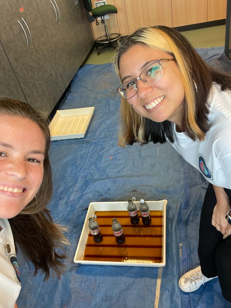
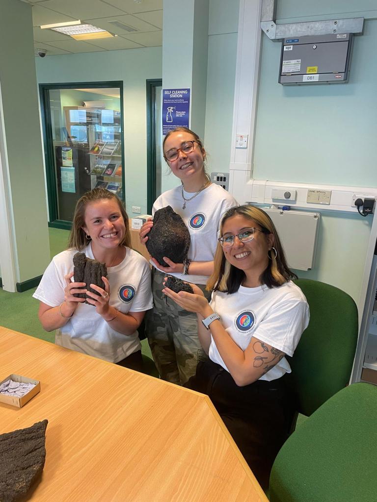
A group from the University of Bristol’s volcanology group represented COMET at the recent Girls into Geoscience careers day at the University of Plymouth. The group, consisting of MSc Volcanology students Alex Daniels, Anne-Marie Molina, Hannah Ellis, and PhD Student Ben Ireland, delivered a workshop showcasing a range of volcanological phenomena.
Anne-Marie and Alex had the following to say about the experience:
“We were at Plymouth University representing COMET for an event called “Girls into Geoscience”, where we talked about the different areas of volcanology to try and encourage these girls to pursue a career in geoscience! We wanted to pique their interest by showcasing volcanic rocks, drone imagery, and had a simulation of a volcanic eruption with a Coke and Mentos experiment.
We loved seeing the girls get involved with the interactive activities which they may not have access to in a classroom and loved their questions for us. It was really rewarding to see the girls understand volcanic processes through our experiment and get a sense of the intricacies which take place prior to a volcanic eruption in different settings around the world. This was an amazing opportunity to speak to so many girls with different backgrounds that came together with an interest in geoscience. It felt great to be able to inspire some of them with our own stories and hopefully they’ll pursue a career in geoscience!
We hope to be back representing COMET at this great event next year!”
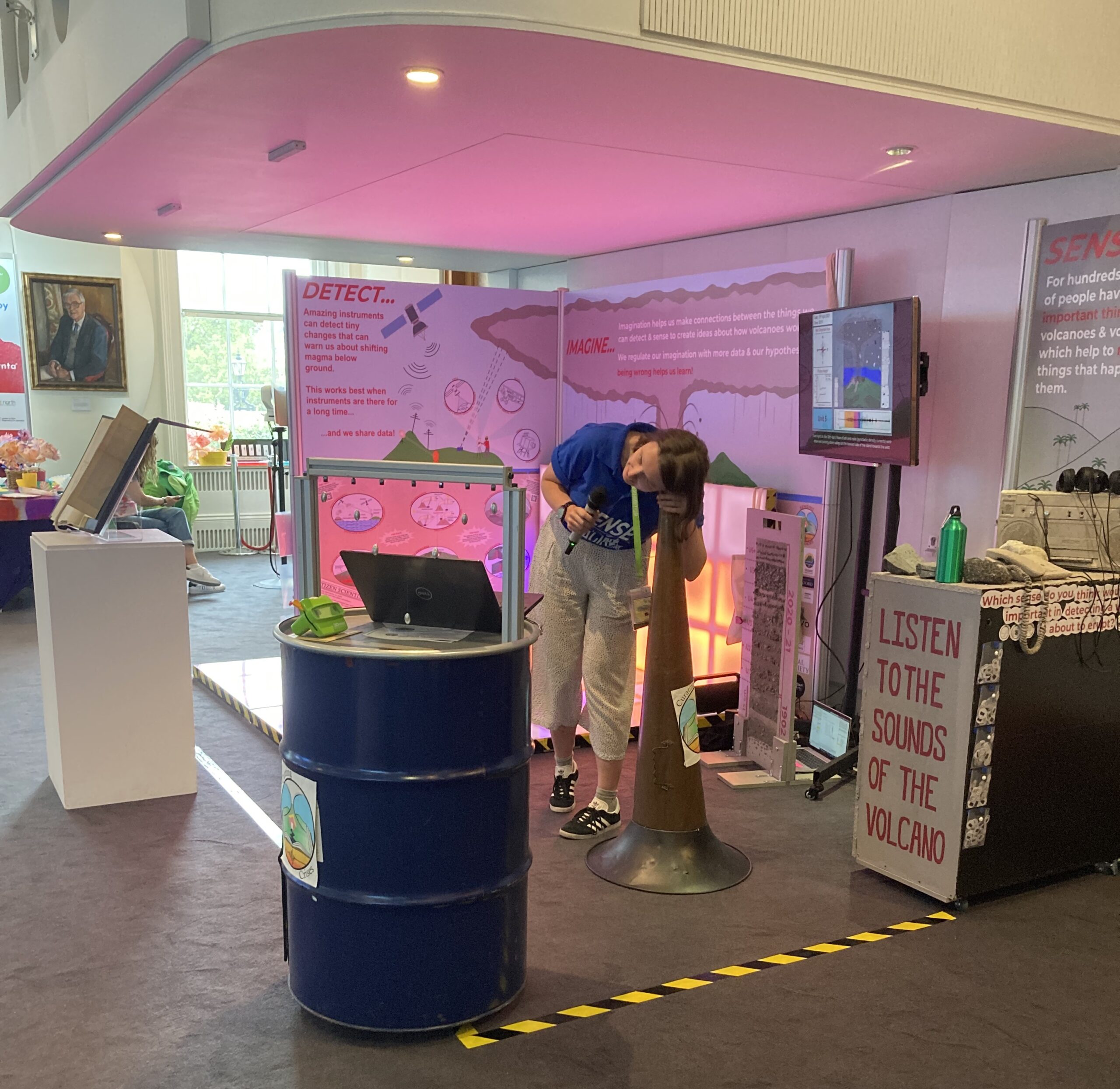
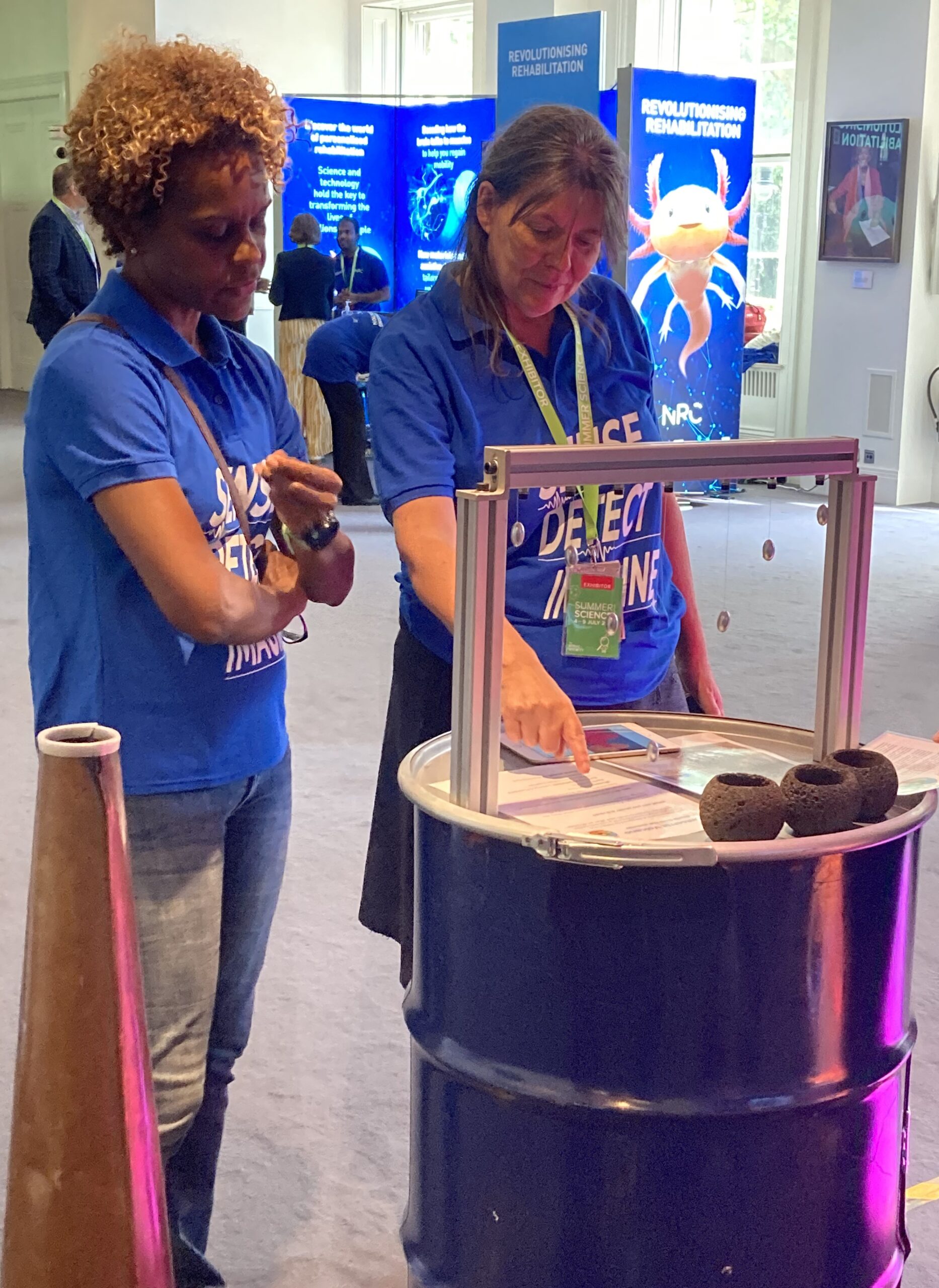
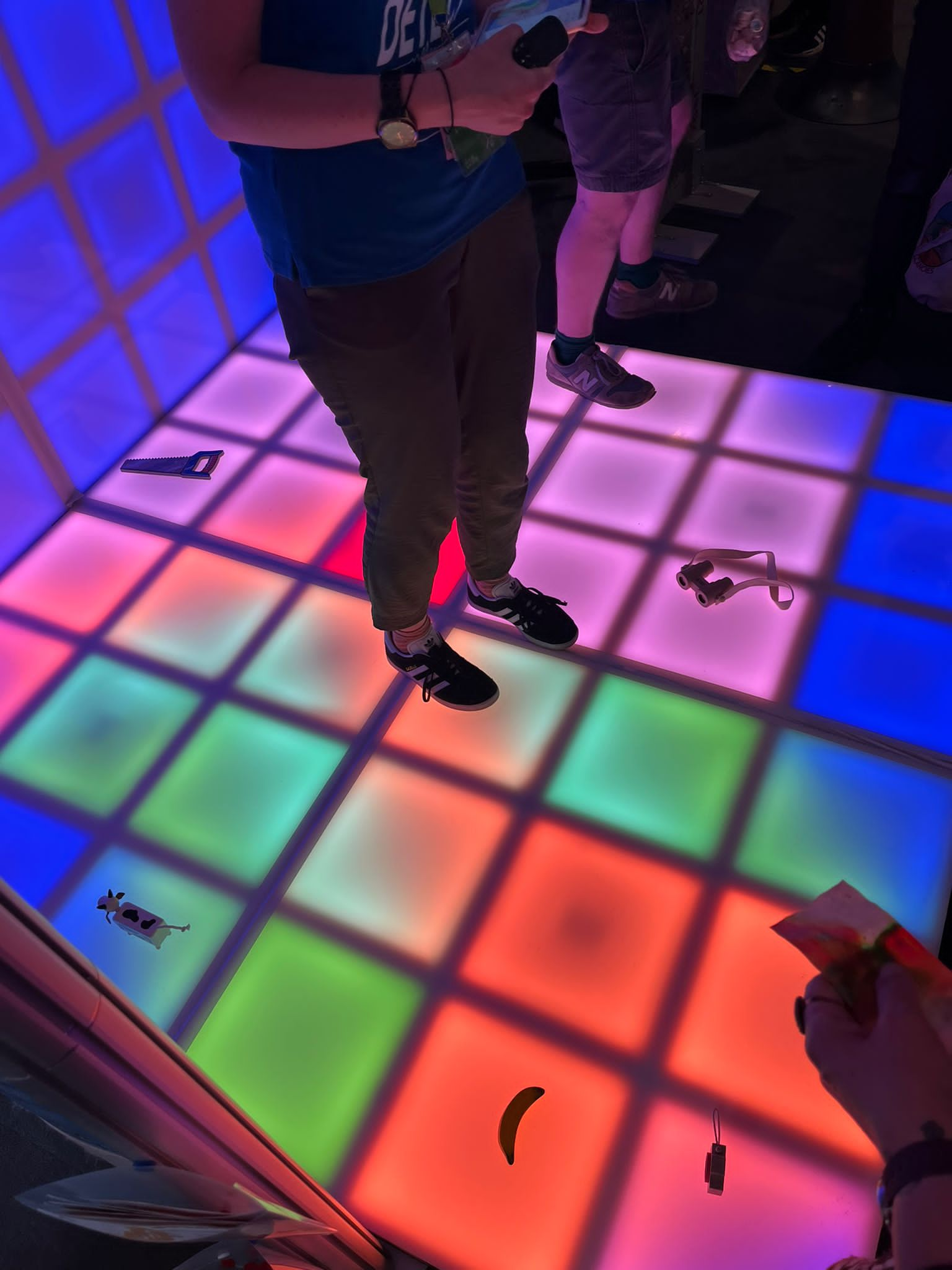
From July 4 – 9 this year, a team from the University of Oxford, University of East Anglia and the University of the West Indies, Seismic Research Centre and Montserrat Volcano Observatory ran a multi-sensory installation as one of nine showcase exhibits at the Royal Society’s summer exhibition. Over six days, thirty volunteers helped to run the installation, manage the enthusiastic crowds of children and adults, and showcase aspects of volcanic and geophysical research.
The exhibit was designed around the ‘Curating Crises’ project [https://curatingcrises.omeka.net] funded by AHRC and NERC, which is exploring historical unrest at Caribbean volcanoes using data sources from archives – including the National Archives, the Royal Society, the British Geological Survey and the Montserrat Public Library.
The tag line for the exhibit was ‘sense, detect, imagine’. The idea was to explore how people living near a volcano might sense unrest; and how the detection of unrest feeds into the imagining, or interpretation, of what is happening underground, and what might happen next. To create sensory elements of the installation we had objects including an early 1900’s gramophone trumpet, with the sounds of bubbling geysers; an ash-covered cord telephone (from the 1990’s) with recorded eye-witness accounts of activity on Montserrat, and some tactile pots carved from scoria, impregnated with a mysterious ‘volcano scent’ that had been created for the exhibition. The highlight of the exhibit was the imaginarium – a ‘light up’ floor, controlled by a raspberry Pi. We ran this in two modes – one to represent the seismicity and movement of magma beneath La Soufrière, St Vincent during the 2021 eruption; and the second to run an interactive game on uncertainty and unrest, where the floor transformed into a map view of an island, which then turns out be a volcano.
The exhibit was busy for the whole of the exhibition, with over 4000 visitors to the building over the final weekend alone. Those who dropped by included Janice Panton, the Government of Montserrat representative; Turner-prize winning artist Veronica Ryan, and Cecil Browne, a Vincentian author. The exhibit is portable (with a van!) and will have another outing at the Oxford Festival of Science and Ideas in October.
Thank you to all of our volunteers, funders, and to the artists and creatives – Output Arts, Ωmega ingredients and Lizzie Ostrom – who helped to turn a 2-page vision statement into a physical exhibit in a little over six months!
https://curatingcrises.omeka.net/exhibits/show/sensing-royal-society/sensing-volcanoes
Written by Professor David Pyle, University of Oxford

COMET scientist, Dr Susanna Ebmeier has been recognised at the European Space Agency (ESA)-European Geosciences Union (EGU) excellence awards.
The awards celebrate the innovative use of Earth observation data.
Dr Ebmeier, from the University of Leeds, won the individual award for her work using satellite images to further the scientific understanding of volcanic processes.
Satellite technology means researchers can take measurements that show how the Earth’s surface is moving in volcanic areas with a precision of a few millimetres.
That information means that Dr Ebmeier and her colleagues are able to see how molten rock is moving beneath the Earth’s surface, as well as learn about the growth and stability of volcanoes themselves.
The prize winners, from across Europe, have been celebrated at the EGU’s General Assembly which took place in Vienna on 25 April.
Congratulations to Susi from all your COMET colleagues!
A personal view from COMET* director, Prof Tim Wright
14 February 2023
We have all been shocked and horrified by the pictures coming from Türkiye and Syria over the past week following the two large earthquakes that happened on 6 February. COMET aims to generate and freely distribute robust scientific satellite deformation data sets following all moderate-large earthquakes on land. These can assist the humanitarian and scientific response.
Here I want to briefly explain COMET’s approach to responding to an event like this from my perspective not just as COMET director, but also as a scientist who has been involved in responding to many earthquakes using satellite deformation data and who has been working on active faulting in Türkiye for my entire career.
Deformation data from satellites are now a fundamental data set for understanding what happened in an earthquake, complementing the information that is available from seismology and from field studies. Deformation data shows, very precisely, which faults moved in an earthquake and by how much. Earthquakes are not point sources – they involve slip on faults. As earthquakes get larger, they involve larger/longer faults with increasing amounts of slip. Understanding how much and where slip occurred on a fault helps us understand the amount of shaking that is likely to have been experienced in different locations – distance to the fault is a primary control on the intensity of shaking.
In COMET, we have been developing a service to automatically produce ground movement data sets from radar satellites following all earthquakes bigger than Magnitude 5.5 that are likely to impact the land surface, and are now a trusted source for these data sets. This is possible because the Sentinel-1 satellites, part of the European Commission’s Copernicus programme, have a systematic acquisition strategy over tectonic and volcanic areas, something that COMET worked with the European Space Agency to help define. We produce results from satellite data as fast as possible following the satellite acquisition, make them available to the public via a dedicated portal, and typically let people know about them using the @NERC_COMET and @COMET_database accounts on twitter.
In the case of the Türkiye earthquakes, the data sets that we produced in COMET, which was also analysed by other international groups, show that the fault that ruptured in the initial Magnitude 7.8 earthquake was a 300 km long section of the East Anatolian Fault, and the fault that ruptured in the second large earthquake, a magnitude 7.5, was over 100 km long and occurred along a different branch of the same fault system. In UK terms, the length of the first fault is about the same as the distance from Bristol to Hull; and is close to the distance from London to Paris. This great extent is one of the reasons why the devastation has been so widespread and horrendous. Both earthquakes occurred on mapped faults and in areas where national maps of seismic hazard required the strictest building codes.
We believe it is important to analyse satellite data as quickly as possible and to be open and transparent with the results, sharing them with the wider community and allowing people to use them in whatever way they wish. For most earthquakes, we now have data within a few days of the event, and we post results within a few hours of the satellite data acquisition, whether there is any media interest in an event or not. We would like to be able to do this within a few hours of every event, and with new satellite systems from the Europe, the US/India, Japan, Canada, China, and others coming on stream, there is good prospect of being able to provide results within a day of most events in the second half of this decade.
However, even if the results are not yet always available within the 72-hour window required for initial search and rescue efforts, the analysis of satellite deformation data can still be useful. Various groups around the world are using these types of data (provided by COMET or processed by other groups) to build models of the event – these can in turn be used to help understand how an earthquake influences the activity on nearby faults. More directly, the data, and information derived from it such as the location of individual fault ruptures, can help responders understand the potential impact on key infrastructure such as bridges and roads, which are vital for the relief effort but might have been impacted by the surface rupture, or other slope failures resulting from the earthquake. The data also help guide field geologists to sites in the field where they can study the earthquake fault rupture up close – such features can degrade very quickly in poor weather conditions; documenting them is important for understanding what palaeoseismologists see when they are investigating records of ancient earthquake ruptures and for understanding the detail of what happened in the causative earthquake. In turn, detailed surface rupture mapping can help to add constraints to models of the earthquake based on geodetic data. In the longer-term, forensically understanding every earthquake helps us prepare for future events in different regions.
As well as providing data sets, COMET scientists, including myself, often discuss the meaning of these data sets with colleagues in open fora like twitter, and respond to queries from colleagues and the media. Leading on from comments by American seismologist and science communicator Dr Lucy Jones, my view also is that this information sharing is vital so that scientists involved directly in the response, or those involved in communication to the public, have access to the latest data and can understand what happened during an event. Often this understanding evolves quite quickly during the hours and days that follow the earthquake. Having reliable information communicated directly in platforms like twitter, and indirectly via the media, is vital for combatting misinformation and conspiracy theories that can unfortunately proliferate in the absence of reliable scientific comment. Twitter has become a key platform for many of those discussions.
Behind the scenes, we also are passing on information to local and international partners directly, so that they have the data they need to respond, and we are responding to queries to help people use the data. We are also providing data and information to help assist with the UK government’s emergency response via our partners in the British Geological Survey.
We are of course acutely conscious that our scientific responses to events like the recent earthquakes are happening in the context of humanitarian tragedies. If you are able, I encourage you to give generously to organisations such as the Disasters Emergency Committee in the UK, who are helping survivors in urgent need of aid and assistance.
*COMET is the UK Centre for the Observation and Modelling of Earthquakes, Volcanoes and Tectonics, a partnership between scientists in UK Universities and the British Geological Survey tasked with delivering National Capability science on behalf of the Natural Environment Research Council. Our focus is on using Earth Observation data alongside other data sets to help understand earthquake and volcanic processes and hazards.
Thanks to Wendy Bohon, Ruth Lawford-Rolfe, and Laura Gregory for providing input on early drafts of this text.
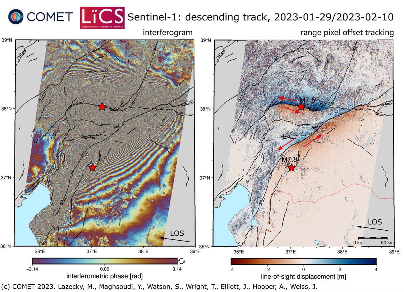
On 6 February, a 7.8-magnitude earthquake struck the East Anatolian Fault affecting large areas of Southern Türkiye and Northern Syria. This was followed by a 7.5-magnitude event approximately 9 hours later, around 60 miles to the north. To date more than 37,000 people are confirmed to have died, large numbers of people are affected across the region and the damage to buildings and infrastructure is significant.
Images from ESA’s Sentinel-1A satellite captured on 9/10 February clearly showed the physical effects of the earthquake on the ground, including deformation of up to 6 metres along a 300km section of the fault, and the second event causing a second ~125km rupture. Many population centres sit close to these zones, explaining the significant human impact of the event.
By combining Sentinel-1A imagery from before and after the earthquake, COMET scientists have been able to measure surface deformation that is clearly visible in InSAR and pixel offset tracking data sets shown below:
In addition to the results from the satellite radar data, we have also used the pre- and post-event optical images from Sentinel-2 to estimate ground movement in the earthquakes also using pixel tracking:
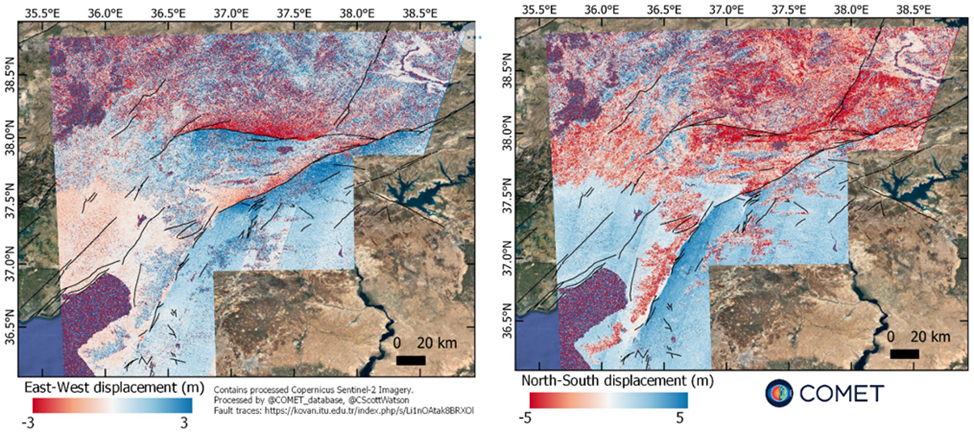
The processing outputs from Sentinel-1A data are available for download at our LiCSAR system event page. The results from Sentinel-2 are available here.
The images above contain modified Copernicus Sentinel-1 and Sentinel-2 data analysed by the Centre for the Observation and Modelling of Earthquakes, Volcanoes and Tectonics (COMET). Data processing uses JASMIN, the UK’s collaborative data analysis environment (http://jasmin.ac.uk).
For more information on why and how COMET responds to earthquake events read this article by our Director – Professor Tim Wright.
COMET – 14 February 2023
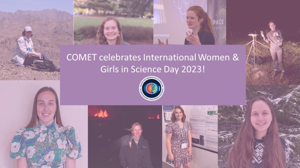
This year, COMET celebrates International Women & Girls in Science Day 2023 by promoting some of the high-quality science that women have achieved, as part of and in collaboration with members of COMET. We would also like to recognise and emphasise that women are still facing many barriers along their scientific career path. More information can be found on the UN website: https://www.un.org/en/observances/women-and-girls-in-science-day.