Observations of Deformation
| Volcano number: | 321010 |
|---|---|
| Region: | Canada and Western USA |
| Country: | United States |
| Geodetic measurements? | Yes |
| Deformation observation? | Yes |
| Measurement method(s): | GPS - campaign, EDM, Gravity |
| Duration of observation: | 1980 - 1934, 2004 - 2009 |
| Inferred cause(s) of deformation: | Magmatic |
| Characteristics of deformation: | In 1980-1984 the U.S Geological Survey established and remeasured a trilateration network at Hood, measuring slope distances with EDM. No significant changes in the measurements were observed (Chadwick et al. 1985). In 1975 Baker went through a period of unrest interpreted to be the emplacement of a magma body. Gravity stations were installed in response to this activity and were resurveyed in 2005 – 2006 revealing a major gravity increase (1800 ± 300 μGal) (Crider et al. 2008). GPS campaigns were carried out in 2004, 2006, 2007, and 2009, with additional marks added to the original EDM network. These measurements suggest that the volcano had subsided at a rate of <2 mm/yr in the 25 years between surveys. Models of this period predict a total volume change of −11 × 106 m3, located 1500 m east–northeast of the summit, at a depth of ∼5.8 km (Hodge and Crider, 2010). Subsidence is thought to occur due to densification and devolatilization of the magma body intruded in the 1970s. |
| Reference(s): | Chadwick, W. W., Iwatsubo, E. Y., Swanson, D. A., and Ewert, J. W. (1985) Measurements of Slope Distances and Vertical Angles at Mount Baker and Mount Rainier, Washington, Mount Hood and Crater Lake, Oregon, and Mount Shasta and Lassen Peak, California, 1980-1984, US Department of the Interior, Geological Survey, Open File Report 85-205. |
| Crider, J. G., Hill Johnsen, K., Williams‐Jones, G. (2008) Thirty‐year gravity change at Mount Baker Volcano, Washington, USA: Extracting the signal from under the ice. Geophysical Research Letters, 35(20). | |
| Hodge, B. E., Crider, J. G. (2010) Investigating mechanisms of edifice deflation, 1981–2007, at Mount Baker volcano, Washington, United States. Journal of Geophysical Research, 115(B4). | |
| U.S. Geological Survey Cascade Volcano Observatory (CVO) http://volcanoes.usgs.gov/volcanoes/baker/baker_monitoring_114.html | |
| Location: | 48.777, -121.813 |
| REST API endpoint (JSON): | https://comet.nerc.ac.uk/wp-json/volcanodb/v1/volcano/466 |
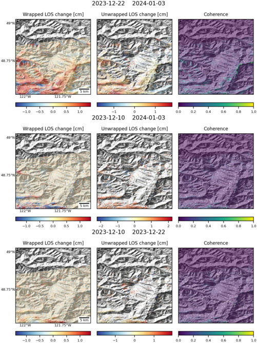
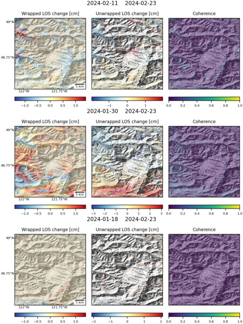
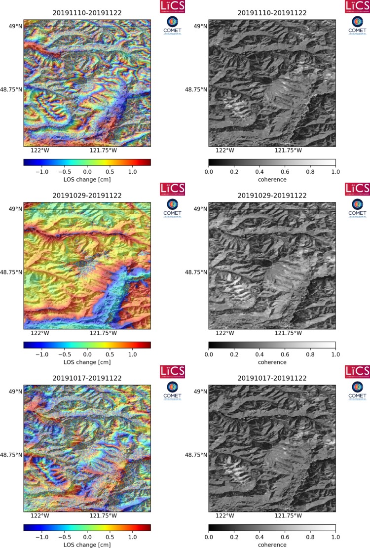
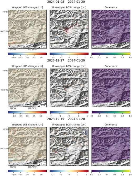
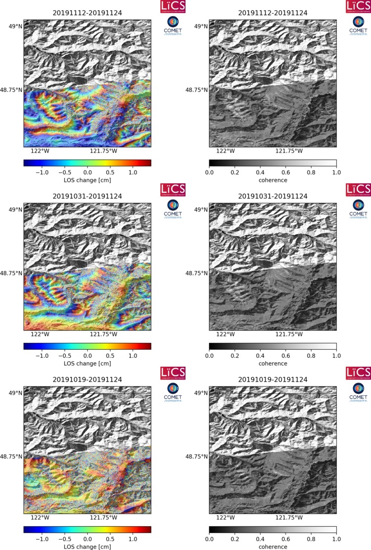
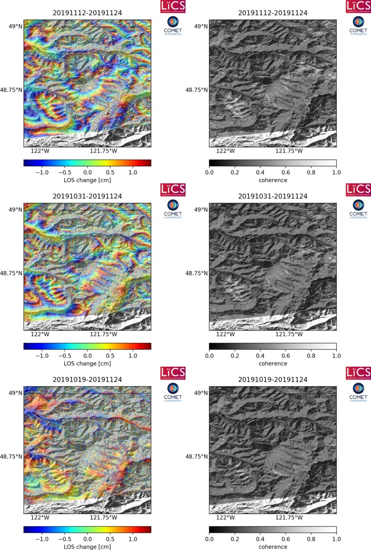
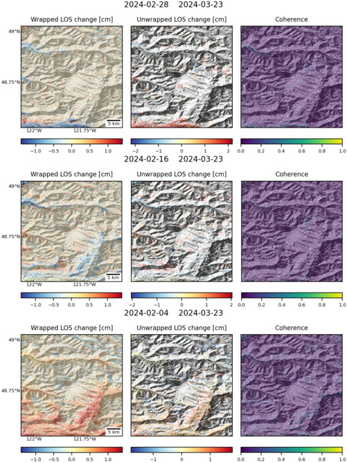
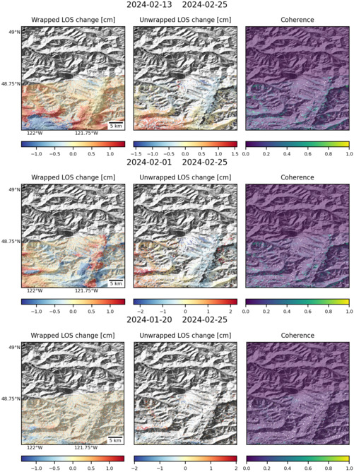
Latest Sentinel-1 Data
Size: 501px x 669px (173.23 KB)
Size: 501px x 669px (178.37 KB)
Size: 750px x 1110px (287.69 KB)
Size: 501px x 668px (173.64 KB)
Size: 750px x 1110px (294.69 KB)

Size: 501px x 669px (171.76 KB)
Size: 750px x 1110px (294.89 KB)
Size: 501px x 668px (180.02 KB)
Size: 501px x 668px (165.56 KB)