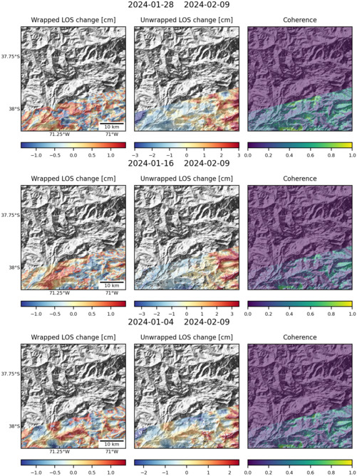
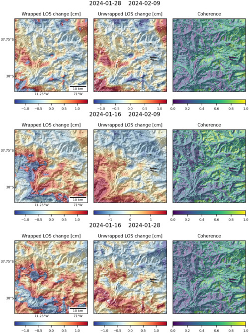
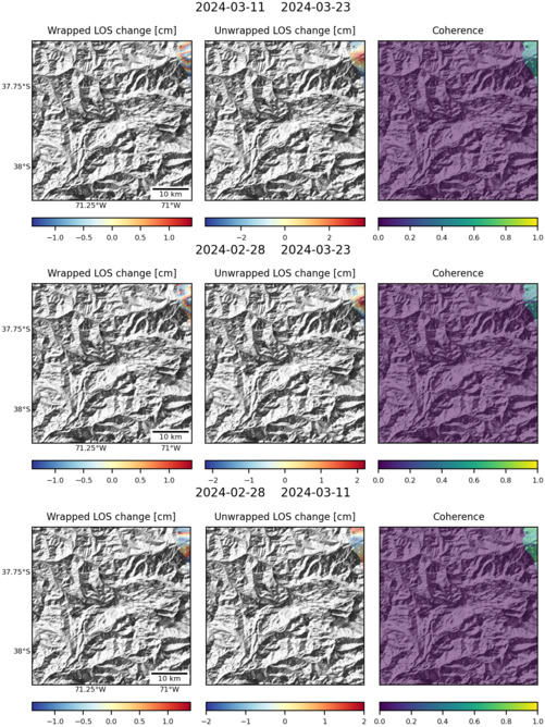
Observations of Deformation
| Volcano number: | 357090 |
|---|---|
| Region: | South America |
| Country: | Chile - Argentina |
| Geodetic measurements? | Yes |
| Deformation observation? | Yes |
| Measurement method(s): | InSAR |
| Duration of observation: | Late 2012 (ref 1)and 2002 to 2007 (ref 2), December 2002 and April 2006 (ref 3) |
| Inferred cause(s) of deformation: | Magmatic |
| Characteristics of deformation: | Copahue is a southern Andes volcano that has been inflating since early 2012, with intermittent summit eruptive activity since late 2012. We have an extensive InSAR time series from RADARSAT-2 and COSMO-SkyMed data, although both are from descending tracks. Preliminary modeling suggests a very irregular magma body that extends from the volcanic edifice to less than 5 km depth and located slightly north of the summit at shallow depths but to the ENE at greater depths. Ref 1 |
| Reference(s): | Lundgren, P., Camacho, A., Poland, M. P., Miklius, A., Samsonov, S. V., & Milillo, P. (2013, December). Imaging irregular magma reservoirs with InSAR and GPS observations: Application to Kilauea and Copahue volcanoes. In AGU Fall Meeting Abstracts. |
| Velez, M. L., Euillades, P., Caselli, A., Blanco, M., & Díaz, J. M. (2011). Deformation of Copahue volcano: inversion of InSAR data using a genetic algorithm. Journal of Volcanology and Geothermal Research, 202(1), 117-126. | |
| Fournier, T. J., Pritchard, M. E., & Riddick, S. N. (2010). Duration, magnitude, and frequency of subaerial volcano deformation events: New results from Latin America using InSAR and a global synthesis. Geochemistry, Geophysics, Geosystems, 11(1). | |
| Location: | -37.856, -71.183 |
| REST API endpoint (JSON): | https://comet.nerc.ac.uk/wp-json/volcanodb/v1/volcano/4327 |
Latest Sentinel-1 Data
Size: 501px x 669px (167.13 KB)
Size: 501px x 669px (182.19 KB)
Size: 501px x 668px (152.81 KB)