
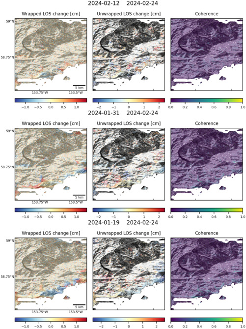
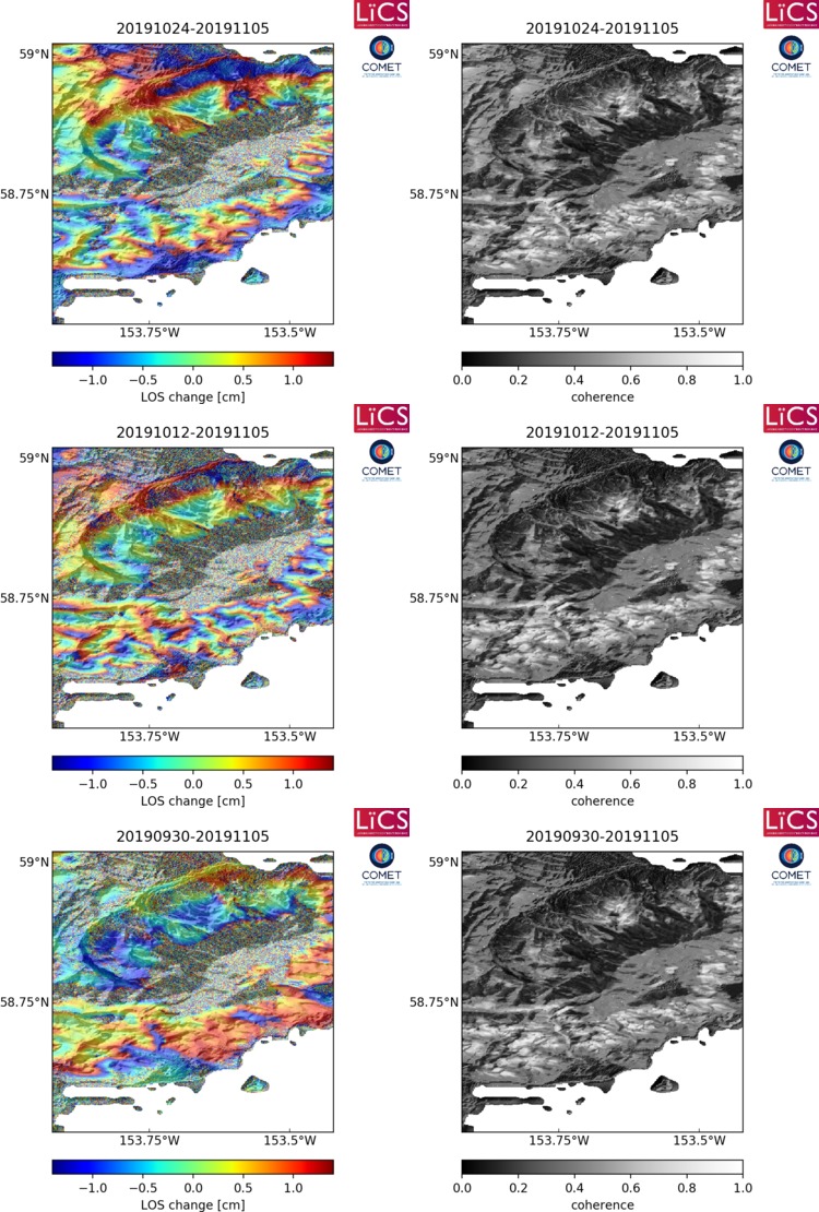
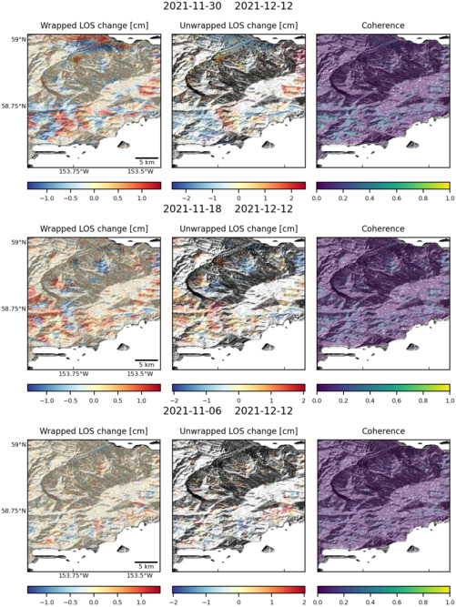
Observations of Deformation
| Volcano number: | 312260 |
|---|---|
| Region: | Alaska |
| Country: | United States |
| Geodetic measurements? | Yes |
| Deformation observation? | Yes |
| Measurement method(s): | InSAR |
| Duration of observation: | 2003 - 2010 |
| Inferred cause(s) of deformation: | Magmatic, isostatic rebound |
| Characteristics of deformation: | Deformation observed at Fourpeaked covers both the Douglas and Fourpeaked areas. InSAR measurements show broad inflation of this region between 2003–2010, with deformation mostly vertical. This deformation is modelled by a Mogi source of poorly constrained depth (5 – 10 km). Fixing the depth to that of local seismicity (7 km) yields an average rate of volume change of ~0.004 km³/year. Deformation is attributed to magmatic intrusion (possibly episodic), or isostatic rebound as the ice cap thins and recedes. |
| Reference(s): | Lu, Z., and Dzurisin, D., 2014, InSAR imaging of Aleutian volcanoes: Chichester, UK, Springer-Praxis, 390 p. |
| U.S. Geological Survey Alaska Volcano Observatory (AVO) website http://www.avo.alaska.edu/volcanoes/volcinfo.php?volcname=Fourpeaked | |
| Location: | 58.77, -153.672 |
| REST API endpoint (JSON): | https://comet.nerc.ac.uk/wp-json/volcanodb/v1/volcano/732 |
Latest Sentinel-1 Data
Size: 501px x 669px (161.33 KB)
Size: 750px x 1110px (254.45 KB)
Size: 501px x 667px (162.01 KB)