Observations of Deformation
| Volcano number: | 221150 |
|---|---|
| Region: | Africa and Red Sea |
| Country: | Ethiopia |
| Geodetic measurements? | Yes |
| Deformation observation? | No |
| Measurement method(s): | InSAR |
| Duration of observation: | 2005-2010 |
| Characteristics of deformation: | Pagli, et al. (2014), for the purposes of investigating regional velocity fields, has looked at Envisat InSAR data covering this volcano. They report no deformation at this rhyolitic stratovolcano. |
| Reference(s): | Pagli, C. et al., 2014. Current plate boundary deformation of the Afar rift from a 3-D velocity field inversion of InSAR and GPS. Journal of Geophysical Research: Solid Earth, 119(11), pp.8562-8575. |
| NASA Landsat image, 1999. | |
| Siebert, L., and T. Simkin (2002), Volcanoes of the World: An Illustrated Catalogue of Holocene Volcanoes and Their Eruptions, Global Volcanism Program Digital Inf. Ser., GVP‐3, Smithsonian Inst., Washington, D. C. [Available at http://www.volcano.si.edu/world/.] | |
| Location: | 11.08, 41.27 |
| REST API endpoint (JSON): | https://comet.nerc.ac.uk/wp-json/volcanodb/v1/volcano/495 |
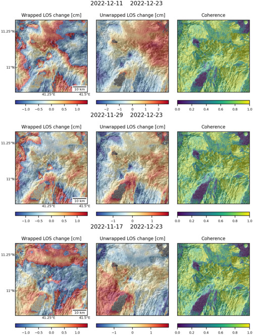
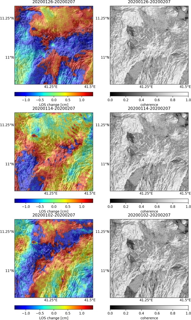
Latest Sentinel-1 Data
Size: 501px x 663px (172.63 KB)
Size: 628px x 1050px (263.67 KB)

Size: 501px x 663px (173.71 KB)