
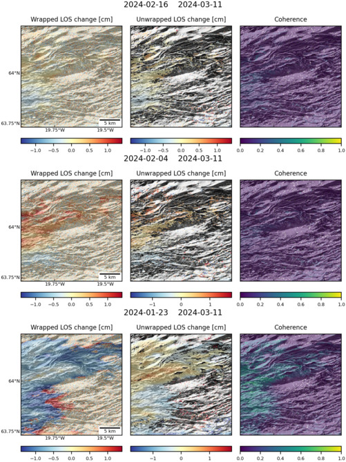
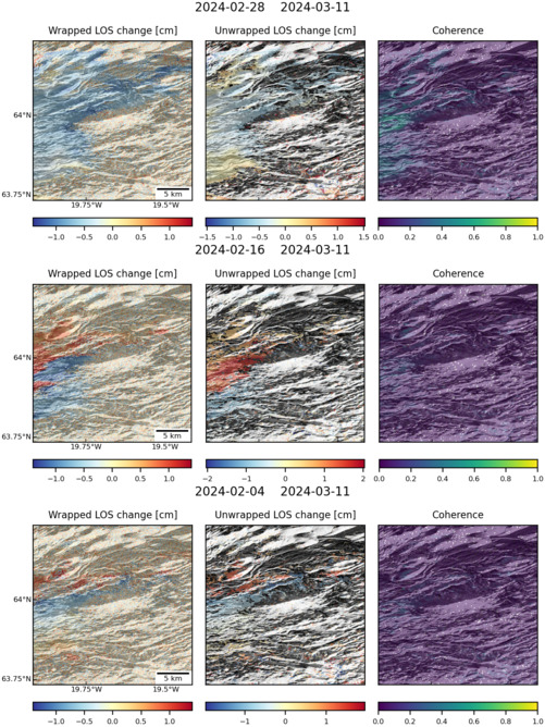
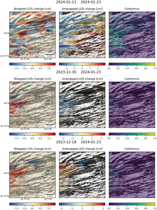
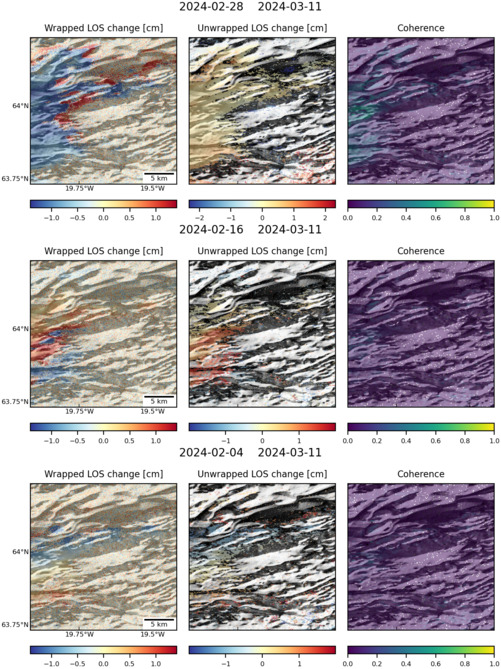
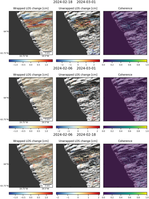
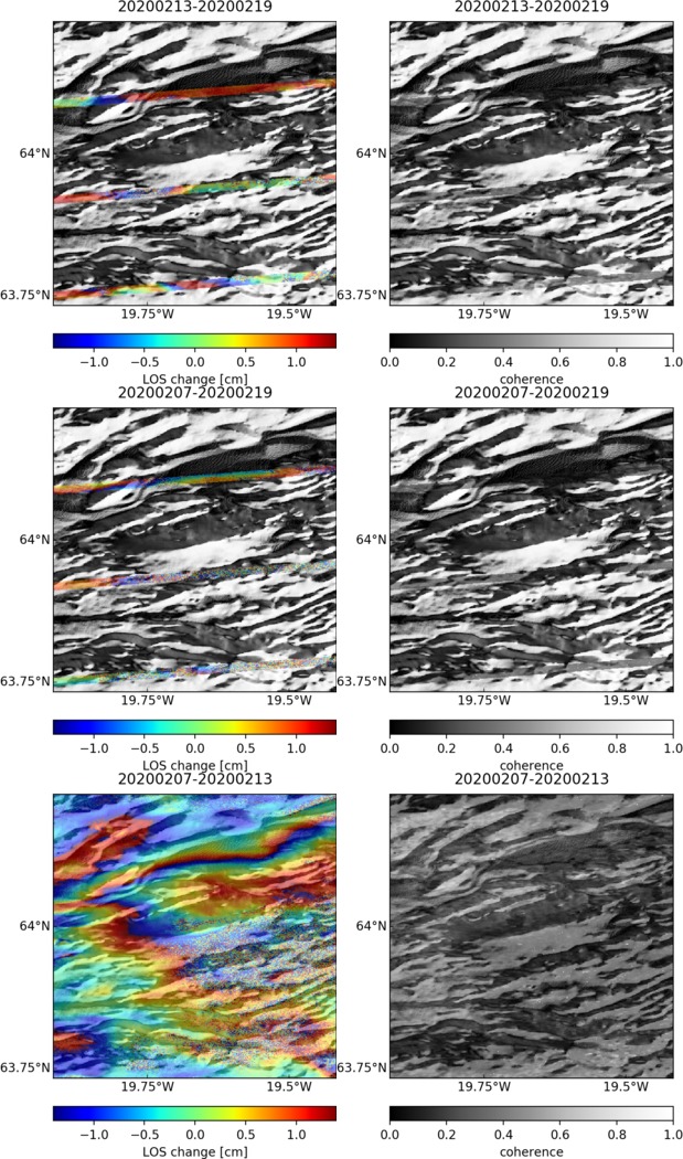
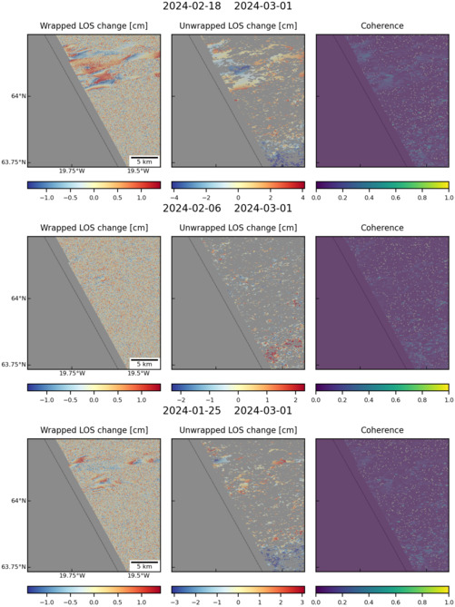
Observations of Deformation
| Volcano number: | 372070 |
|---|---|
| Region: | Iceland and Arctic Ocean |
| Country: | Iceland |
| Geodetic measurements? | Yes |
| Deformation observation? | Yes |
| Measurement method(s): | InSAR, GPS - continuous, GPS - campaign, Levelling, Strainmeter, Tiltmeter, EDM |
| Duration of observation: | Continuous |
| Inferred cause(s) of deformation: | Magmatic |
| Characteristics of deformation: | Sturkell et al. (2013) studied Hekla’s last eruption in 2000 using campaign GPS; an InSAR interferogram; dry tilt data, and borehole strain data. They found the presence of a dike that “causes surface fissuring extends no more than ~ 0.5 km in depth, and the reservoir depth is ~ 10 km. These are connected by a conduit of small lateral extent. Data for previous eruptions are consistent with this model”. |
| Reference(s): | Sturkell, E., K Ágústsson, A. T. Linde, S. I. Sacks, P. Einarsson, F. Sigmundsson, H. Geirsson, R. Pedersen, Peter C. LaFemina, H. Ólafsson, New insights into volcanic activity from strain and other deformation data for the Hekla 2000 eruption, JVGR, http://dx.doi.org/10.1016/j.jvolgeores.2013.02.001 |
| Smithsonian Institution Global Volcanism Program http://www.volcano.si.edu/volcano.cfm?vn=372070 | |
| Location: | 63.98, -19.7 |
| REST API endpoint (JSON): | https://comet.nerc.ac.uk/wp-json/volcanodb/v1/volcano/3038 |
Latest Sentinel-1 Data
Size: 501px x 669px (175.99 KB)
Size: 501px x 668px (177.03 KB)
Size: 501px x 669px (175.01 KB)
Size: 501px x 669px (172.17 KB)
Size: 501px x 669px (125.86 KB)
Size: 619px x 1050px (237.86 KB)
Size: 501px x 669px (103.62 KB)
Size: 501px x 660px (52.03 KB)

Size: 501px x 669px (180.07 KB)