
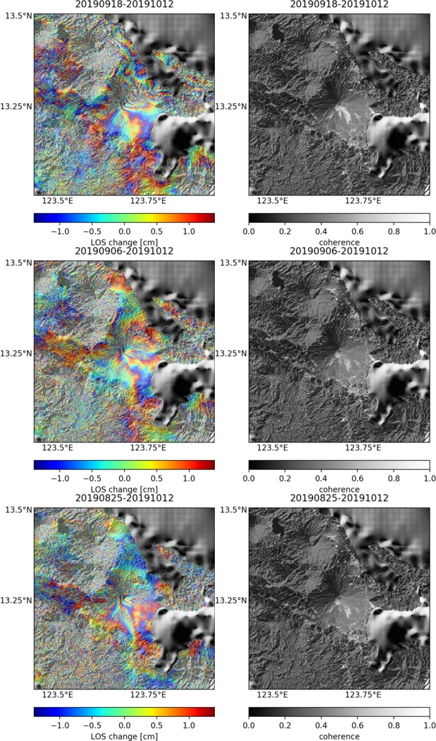
Observations of Deformation
| Volcano number: | 273030 |
|---|---|
| Region: | Philippines and SE Asia |
| Country: | Philippines |
| Geodetic measurements? | Yes |
| Deformation observation? | Yes |
| Measurement method(s): | InSAR, GPS - campaign, GPS - campaigns, InSAR |
| Duration of observation: | 1992-1996 (GPS campaigns), 2007-2011 (InSAR) |
| Inferred cause(s) of deformation: | Surface deposits, Subsidence of lava flows |
| Characteristics of deformation: | ALOS InSAR time series survey (2007-2011) reveals subsidence at a rate of 3.5 cm/yr over lava flows emplaced during 2006 on the SE flank (Morales et al., 2015). |
| Reference(s): | Morales Rivera, A.M., Amelung, F., Eco, R. (2015). Volcano deformation and modeling on active volcanoes in the Philippines from ALOS InSAR time series. Proceedings of the Fringe 2015 Workshop, ESA SP-731 (CD-ROM), ESA Publications Division, European Space Agency |
| Peter Vajda, Ilya Prutkin, Robert Tenzer, Gerhard Jentzsch (2012). Inversion of temporal gravity changes by the method of local corrections: A case study from Mayon volcano, Philippines. Journal of Volcanology and Geothermal Research, Volumes 241–242, Pages 13-20, ISSN 0377-0273, http://dx.doi.org/10.1016/j.jvolgeores.2012.06.020. | |
| Location: | 13.257, 123.685 |
| REST API endpoint (JSON): | https://comet.nerc.ac.uk/wp-json/volcanodb/v1/volcano/3380 |
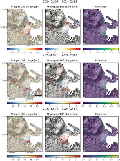
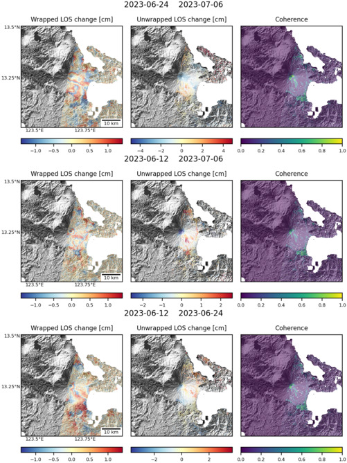
Latest Sentinel-1 Data
Size: 619px x 1050px (267.60 KB)

Size: 501px x 669px (162.74 KB)
Size: 501px x 669px (163.01 KB)
Size: 501px x 669px (147.98 KB)