Observations of Deformation
| Volcano number: | 263250 |
|---|---|
| Region: | Indonesia |
| Country: | Indonesia |
| Geodetic measurements? | Yes |
| Deformation observation? | Yes |
| Measurement method(s): | InSAR, EDM |
| Duration of observation: | 2013 to 2013 |
| Inferred cause(s) of deformation: | Magmatic |
| Characteristics of deformation: | The explosion at Merapi on 18 Nov 2013, has broken the dome into two main parts. Walter et al. (2015) did not observe any edifice-wide deformation before the eruption (8 to 30 Nov 2013) – fringes are confined and appear only in the very steep uppermost proportion of the amphitheatre. They believe that they are related to a very shallow geologic process, which may explain why no precursors had been recorded by existing networks. Whether this subsidence is associated with magmatic processes, cooling of a conduit, or related to other mass movements in the upper edifice region cannot be ascertained from this data alone. However, prior to the 2013 eruption of Mount Merapi, Saepuloh et al. (2013) observed the subsidence of Merapi, followed by uplift from 2007-2010, which subsequently erupted in 2010. Saepuloh et al. (2013) suggest that Merapi has inter-eruptive deformation cycles, which are also seen in thermal data from ASTER and gas emissions. These cycles are interpreted as the result of the successive movement of individual magma batches migrating upward from deeper to shallower storage systems located along a NE dipping conduit. In view of magma migration prior to eruptions, these cycles may also serve as a precursory signal for large eruptions at Merapi, such as the one that took place in early November 2010. |
| Reference(s): | Walter, T. R., Subandriyo, J., Kirbani, S., Bathke, H., Suryanto, W., Aisyah, N., ... & Dahm, T. (2015). Volcano-tectonic control of Merapi's lava dome splitting: The November 2013 fracture observed from high resolution TerraSAR-X data. Tectonophysics, 639, 23-33. |
| Saepuloh, A., Urai, M., Aisyah, N., Widiwijayanti, C., & Jousset, P. (2013). Interpretation of ground surface changes prior to the 2010 large eruption of Merapi volcano using ALOS/PALSAR, ASTER TIR and gas emission data. Journal of Volcanology and Geothermal Research, 261, 130-143. | |
| Location: | -7.54, 110.446 |
| REST API endpoint (JSON): | https://comet.nerc.ac.uk/wp-json/volcanodb/v1/volcano/5886 |
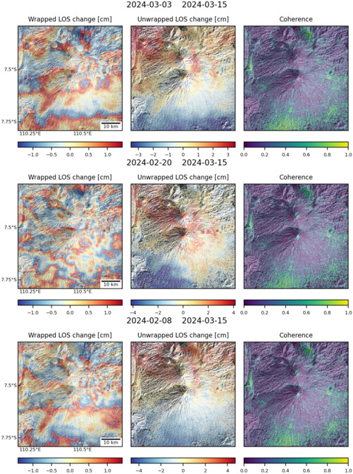
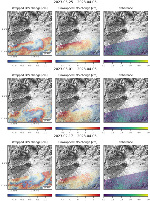
Latest Sentinel-1 Data

Size: 501px x 672px (186.74 KB)

Size: 501px x 672px (158.52 KB)
