
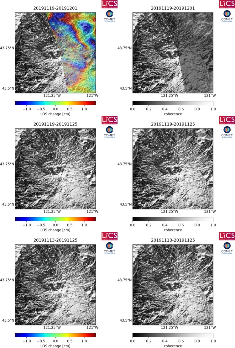
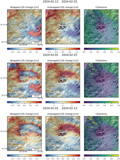
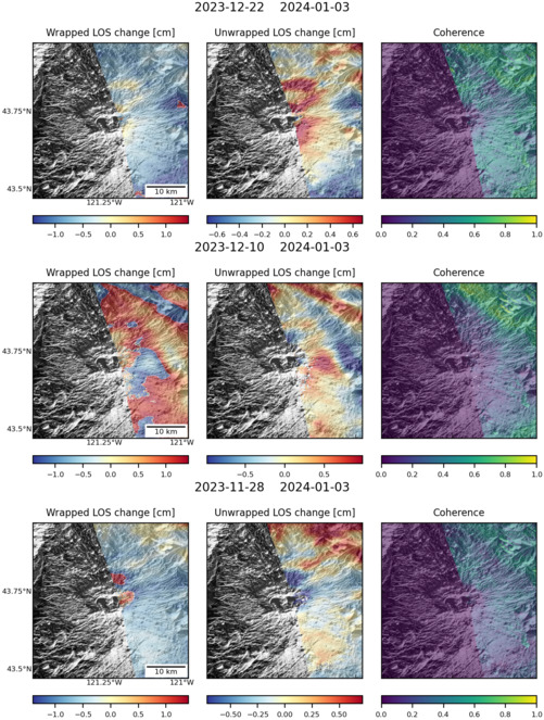
Observations of Deformation
| Volcano number: | 322110 |
|---|---|
| Region: | Canada and Western USA |
| Country: | United States |
| Geodetic measurements? | Yes |
| Deformation observation? | Yes |
| Measurement method(s): | GPS - continuous, GPS - campaign, Levelling |
| Duration of observation: | 1931, 1985, 1986, 1994, 2002 - 2009, 2011 - present |
| Inferred cause(s) of deformation: | Uncertain |
| Characteristics of deformation: | Newberry was first surveyed using levelling in 1931 and again by the U.S. Geological Survey Cascades Volcano Observatory in 1985, 1986 and 1994. The 1931 survey was less precise than more recent surveys and consequently the results are uncertain. Comparisons between 1931 – 1994 indicated that the summit area of the volcano had uplifted ~10 cm . However, smaller surveys across the caldera floor in 1985 and 1986 showed that no uplift or subsidence occurred between 1985-1994. The possible uplift is modelled as the intrusion of ~0.06 km³ of magma at a depth of ~10 km beneath the volcano summit (Dzurisin, 1999). |
| Reference(s): | Dzurisin, D. (1999). Results of repeated leveling surveys at Newberry Volcano, Oregon, and near Lassen Peak Volcano, California. Bulletin of Volcanology , 61, pp. 83-91. doi:10.1007/s004450050264 |
| USGS Cascades Volcano Observatory (CVO) website http://volcanoes.usgs.gov/volcanoes/newberry/newberry_monitoring_88.html | |
| Location: | 43.722, -121.229 |
| REST API endpoint (JSON): | https://comet.nerc.ac.uk/wp-json/volcanodb/v1/volcano/5180 |
Latest Sentinel-1 Data
Size: 750px x 1110px (306.78 KB)
Size: 501px x 663px (159.46 KB)
Size: 501px x 663px (154.36 KB)

Size: 501px x 659px (147.37 KB)