
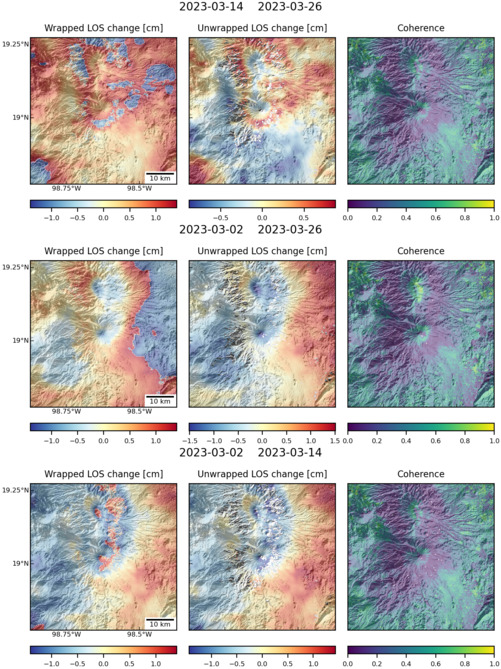
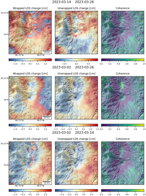
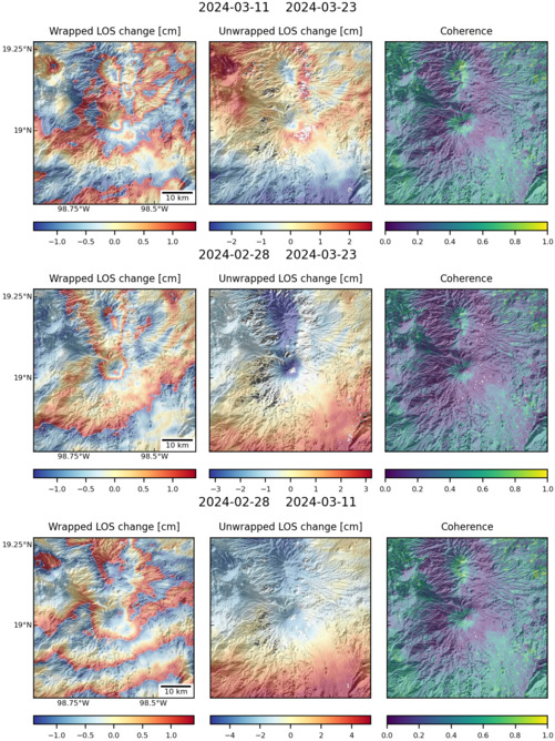
Observations of Deformation
| Volcano number: | 341090 |
|---|---|
| Region: | Mexico and Central America |
| Country: | Mexico |
| Geodetic measurements? | Yes |
| Deformation observation? | No |
| Measurement method(s): | InSAR, GPS - continuous, Tiltmeter, EDM |
| Duration of observation: | 1994-present (tilt), 1996-present (GPS), 1996-present (EDM), 2002-2006 (Envisat InSAR), 2007-2010 (ALOS InSAR) |
| Characteristics of deformation: | Volcán Popocatépetl has been erupting semi-continuously since 1994. During this period CENAPRED (Centro Nacional de Prevención de Desastres) has operated a deformation monitoring network consisting of 4 tiltmeters, 7 GPS stations and periodic EDM measurements. |
| Reference(s): | E. Cabral-Cano, F. Correa-Mora, C. Meertens Deformation of Popocatépetl volcano using GPS: regional geodynamic context and constraints on its magma chamber J. Volcanol. Geotherm. Res., 170 (2008), pp. 24–34 |
| V. Pinel, A. Hooper, S. De la Cruz-Reyna, G. Reyes-Davila, M.P. Doin The challenging retrieval of displacement field from InSAR data for andesitic stratovolvanoes: case study of Popocatepetl and Colima Volcano, Mexico Journal of Volcanology and Geothermal Research, 200 (1–2) (2011), pp. 49–61 | |
| Chaussard, E., F. Amelung, and Y. Aoki (2013), Characterization of open and closed volcanic systems in Indonesia and Mexico using InSAR time series, J. Geophys. Res. Solid Earth, 118, 3957–3969, doi:10.1002/jgrb.50288. | |
| Location: | 19.023, -98.622 |
| REST API endpoint (JSON): | https://comet.nerc.ac.uk/wp-json/volcanodb/v1/volcano/560 |
Latest Sentinel-1 Data
Size: 501px x 669px (166.72 KB)
Size: 501px x 669px (166.57 KB)
Size: 501px x 668px (168.57 KB)