
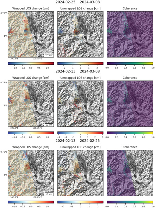
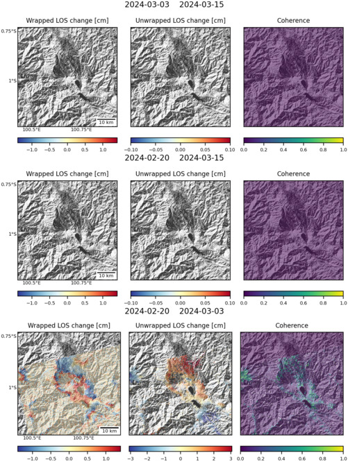
Observations of Deformation
| Volcano number: | 261160 |
|---|---|
| Region: | Indonesia |
| Country: | Sumatra |
| Geodetic measurements? | Yes |
| Deformation observation? | Yes |
| Measurement method(s): | InSAR, GPS - campaign |
| Duration of observation: | 2007-2009 |
| Inferred cause(s) of deformation: | Faulting/tectonics, Uncertain |
| Characteristics of deformation: | Two geodetic studies with very similar time frames (early 2007-2009) have been performed concerning Talang, though only one was centred on this volcano. A campaign GPS survey performed by Kriswati et al showed a very slight inflation on the edifice’s southern slope, which the authors attribute to an accumulation of tectonic stress associated with faulting; a series of right-reverse fault shear zones cut through the top of the volcano. |
| Reference(s): | Kriswati, E. et al, 2012. Preliminary Study of Interaction System Between Talang Volcanic Activity and Regional Tectonic of West Sumatera. American Geophysical Union, Fall Meeting 2012, abstract #T43A-2645 |
| Chaussard, E., S. Hong, and E. Amelung (2009), Monitoring the Sumatra volcanic arc with InSAR, Eos Trans AGU, 90(52), Fall Meet. Suppl., Abstract G41A-0703. | |
| Location: | -0.978, 100.679 |
| REST API endpoint (JSON): | https://comet.nerc.ac.uk/wp-json/volcanodb/v1/volcano/3609 |
Latest Sentinel-1 Data
Size: 501px x 672px (171.98 KB)
Size: 501px x 666px (162.97 KB)

Size: 501px x 672px (182.10 KB)