
Observations of Deformation
| Volcano number: | 372050 |
|---|---|
| Region: | Iceland and Arctic Ocean |
| Country: | Iceland |
| Geodetic measurements? | Yes |
| Deformation observation? | Yes |
| Measurement method(s): | InSAR, Tiltmeter |
| Duration of observation: | Continuous |
| Inferred cause(s) of deformation: | Faulting/tectonics |
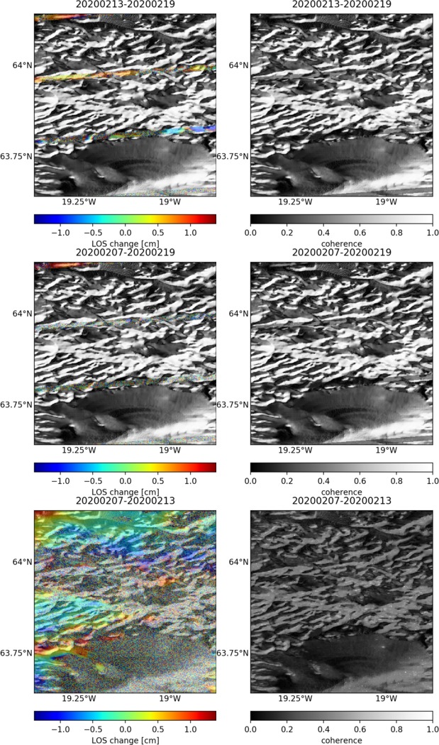
| Characteristics of deformation: | Scheiber-Enslin et al. (2011) present GPS derived horizontal velocity field in southern Iceland covering the period 1994–2006, new InSAR analyses for the periods 1993–2000 and 2003–2007. |
| Reference(s): | Scheiber-Enslin, S. E., LaFemina, P. C., Sturkell, E., Hooper, A. J., & Webb, S. J. (2011). Geodetic investigation of plate spreading along a propagating ridge: the Eastern Volcanic Zone, Iceland. Geophysical Journal International, 187(3), 1175-1194. |
| Smithsonian Institution Global Volcanism Program http://www.volcano.si.edu/volcano.cfm?vn=372050 | |
| Location: | 63.92, -19.17 |
| REST API endpoint (JSON): | https://comet.nerc.ac.uk/wp-json/volcanodb/v1/volcano/3033 |
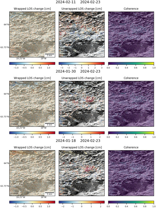
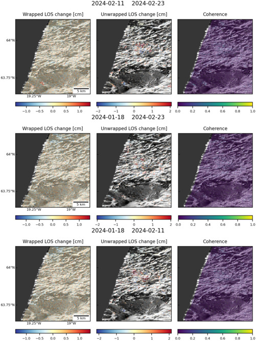
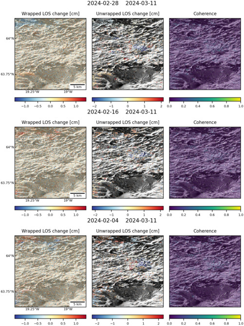
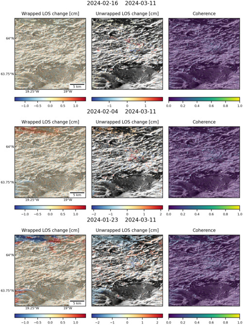
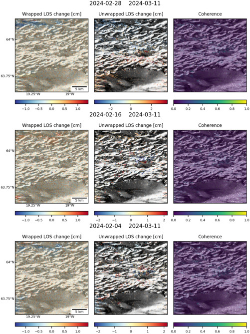
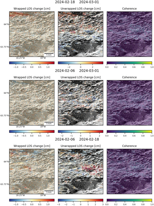
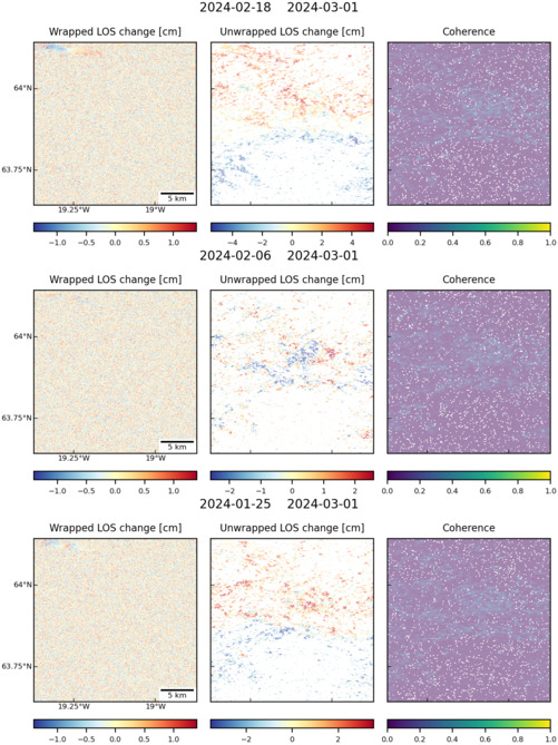
Latest Sentinel-1 Data
Size: 619px x 1050px (240.91 KB)
Size: 501px x 669px (179.86 KB)
Size: 501px x 668px (144.54 KB)
Size: 501px x 669px (177.28 KB)
Size: 501px x 669px (177.99 KB)
Size: 501px x 669px (170.39 KB)
Size: 501px x 660px (52.20 KB)
Size: 501px x 669px (181.83 KB)
Size: 501px x 669px (148.40 KB)

Size: 501px x 669px (171.50 KB)