Velocity over Tibet

Use the link below to visualize velocity and strain-rate fields across the Tibetan Plateau:

Deformation, Strains, and Velocities for the Tibetan Plateau

For accessing all the processed datasets over Tibetan Plateau, look at the following CEDA archive link:

Processed datasets over Tibetan Plateau

For more information on these results, see the article in Science:

T. J. Wright et al. ,High-resolution geodetic velocities reveal role of weak faults in deformation of Tibetan Plateau.Science391,499-503(2026).DOI:10.1126/science.adi3552 


Velocity time series app

Use the app below to interactively inspect the displacement time series for an area in Turkey. Data were generated using LiCSBAS, which is described below. Data citation: Weiss, J. et al. (2020). High-resolution surface velocities and strain for Anatolia from Sentinel-1 InSAR and GNSS data. doi:10.31223/osf.io/8xa7j.

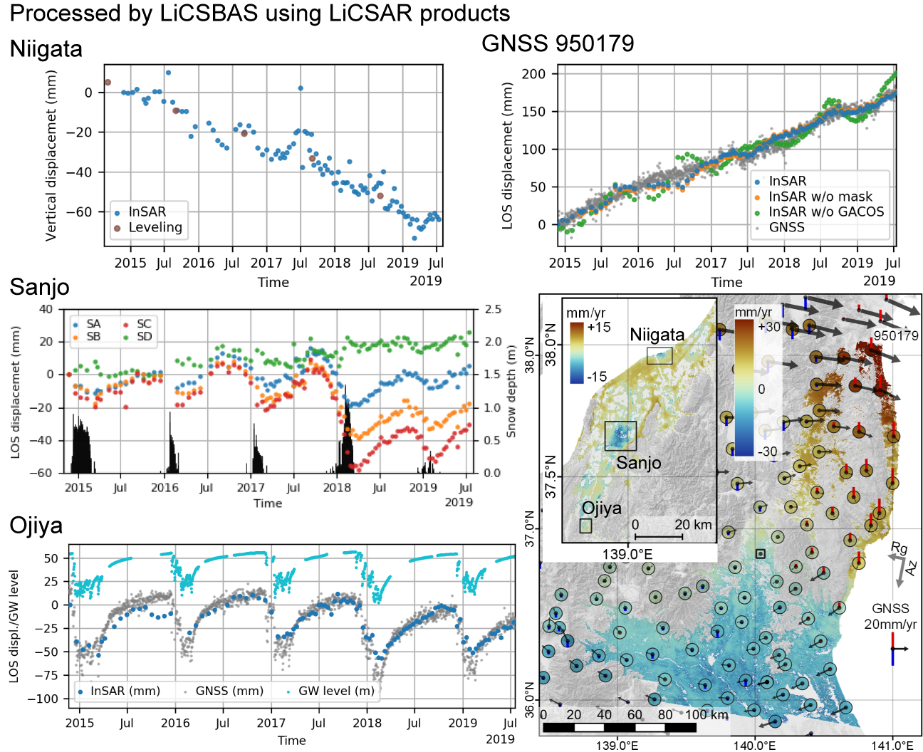
Deriving velocities and time series using LiCSBAS

LiCSBAS is an open-source SAR interferometry (InSAR) time series analysis package that integrates with LiCSAR data to produce displacement time series and velocities. The outputs can be explored in an interactive time series viewer (see the example below) or exported for further analysis.
 
Visit the LiCSBAS GitHub page for a quick start guide and read the LiCSBAS paper here.
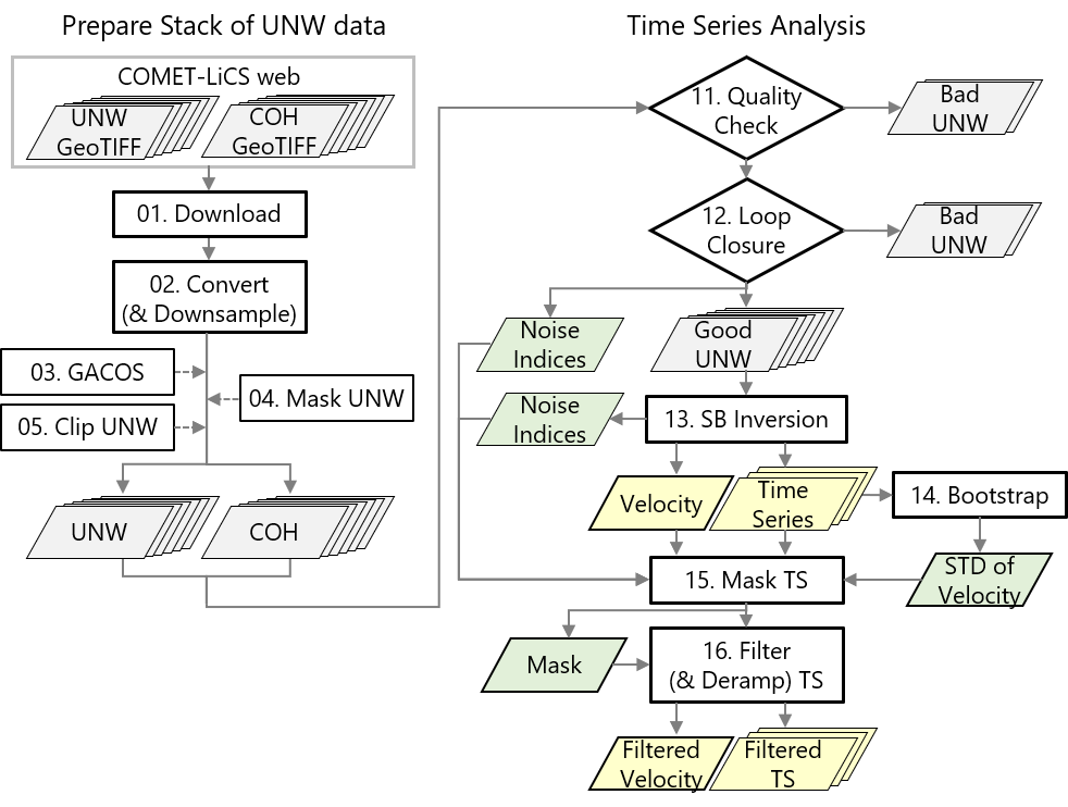
 
LiCSBAS outputs graphical abstract
 
 LiCSBAS workflow
 

LiCSBAS workflow

References

  1. Morishita, Y.; Lazecky, M.; Wright, T.J.; Weiss, J.R.; Elliott, J.R.; Hooper, A. LiCSBAS: An Open-Source InSAR Time Series Analysis Package Integrated with the LiCSAR Automated Sentinel-1 InSAR Processor. Remote Sens. 2020, 12, 424.
 

Contact Us

COMET
School of Earth and Environment
The University of Leeds
Leeds
LS2 9JT
Email Contacts:
LiCSAR inquiries:  [email protected]
General COMET inquiries: [email protected]