
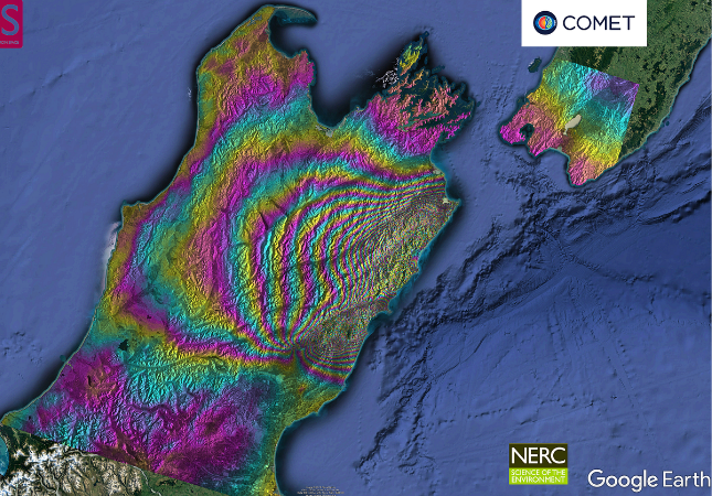
The first Sentinel-1 interferogram (12 day 20161103-20161115) covering the Mw 7.8 New Zealand earthquake is available to download for viewing as a kmz in GoogleEarth from here. Note that the fringes are wrapped to 2.8 cm displacement in the line-of-sight. The regions around where the fault projects to the surface are incoherent so it is hard to see exactly where they are. Note also there are some other artefacts (straight line discontinuities) which will not be fault offsets. Data thanks to ESA EU-Copernicus.
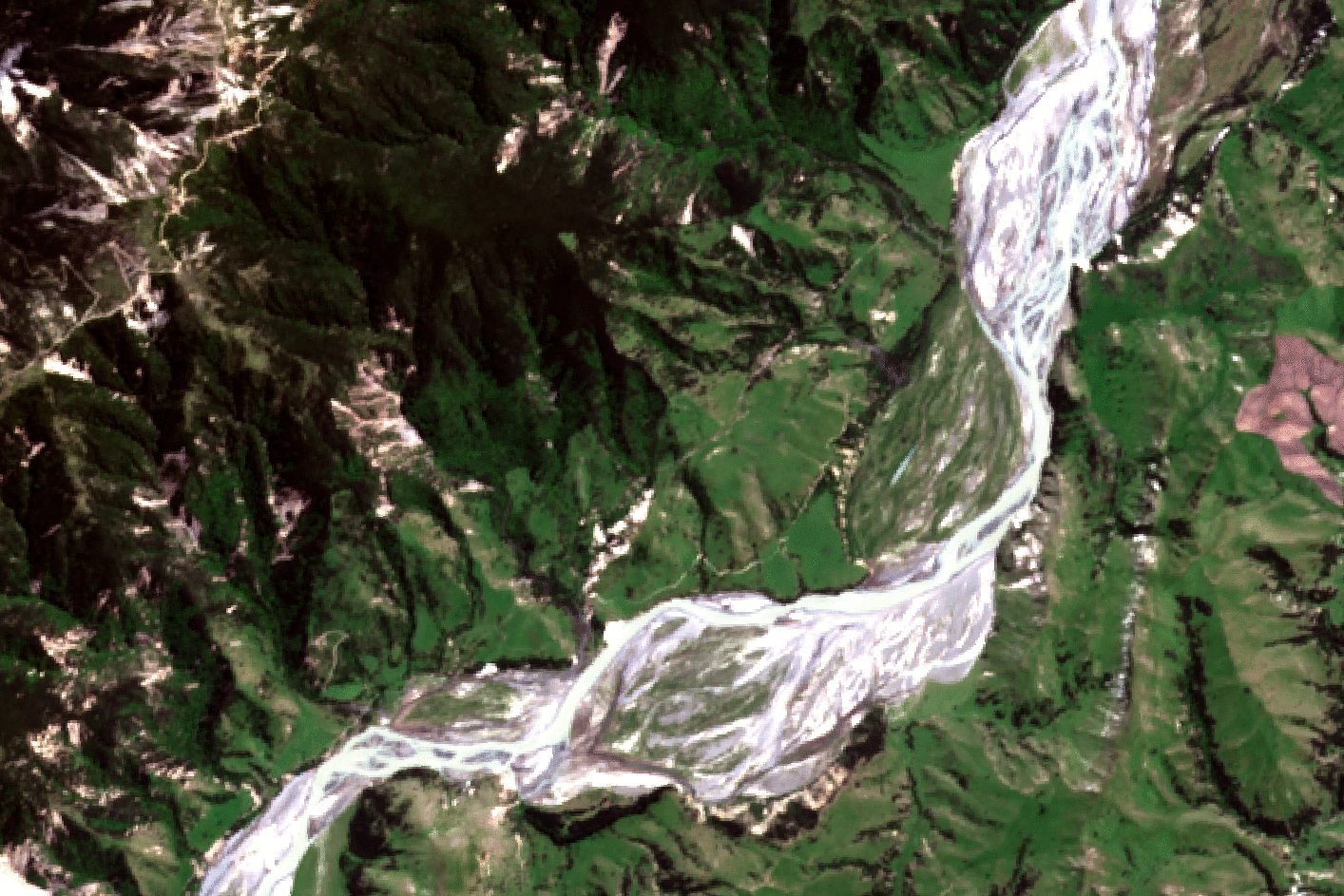
Image correlation results from Sentinel-2A data confirm right lateral displacements of ~10m along the length of the Kekerengu Fault. Smaller left lateral displacements of 3-5m are visible along the Papatea Fault near the Clarence river.
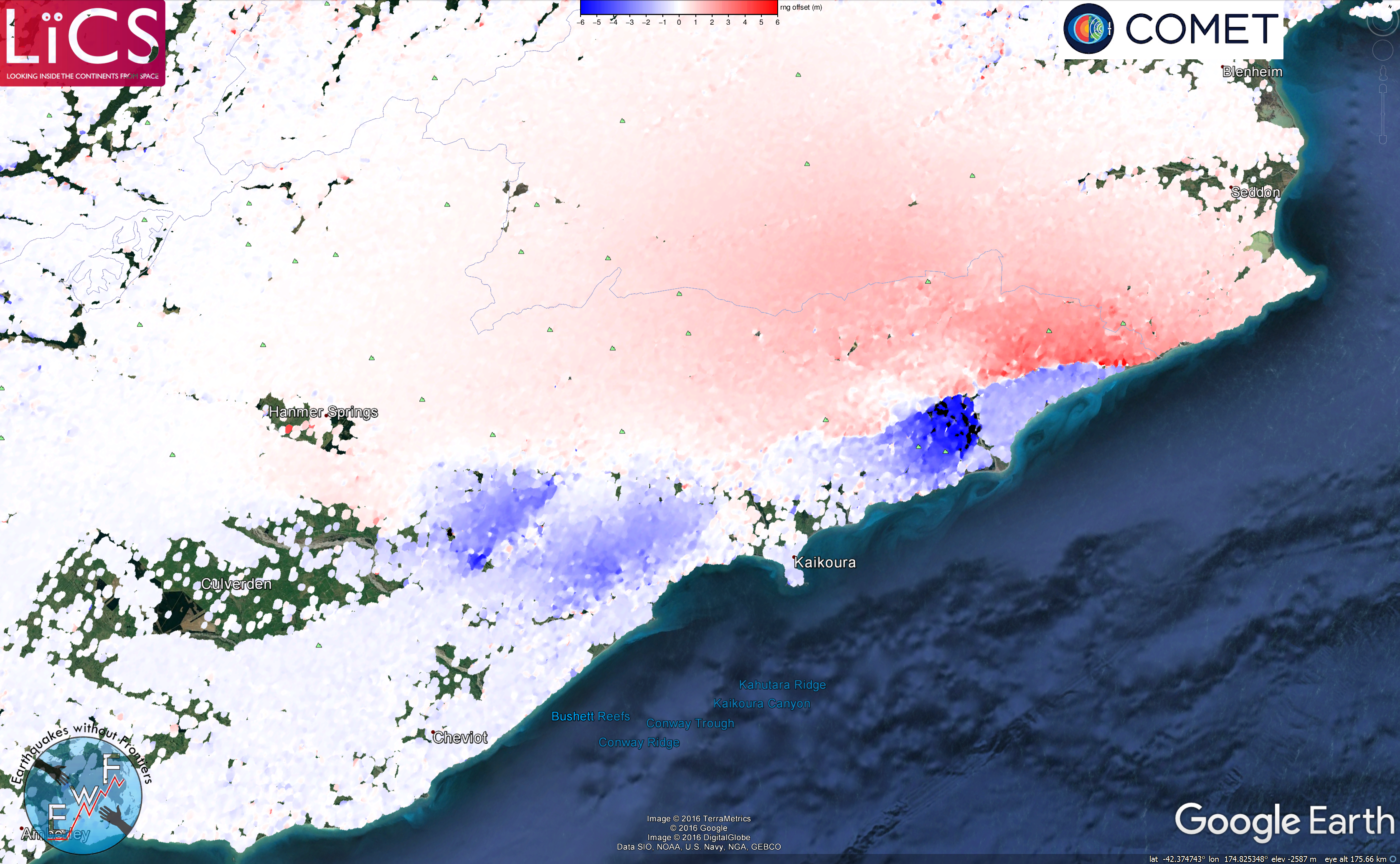
The range offsets (which are not susceptible to unwrapping errors unlike the above phase measurements) are available to download here.
ALOS-2 Interferograms
Also available for download as kmz files are wrapped displacement maps using ALOS-2 SAR data:
Coseismic Frame 194, 195 and 196.
For a more detailed study of this earthquake, see:
Hamling, Ian J.; Hreinsdóttir, Sigrún; Clark, Kate; Elliott, John; Liang, Cunren; Fielding, Eric; Litchfield, Nicola; Villamor, Pilar; Wallace, Laura; Wright, Tim J.; D’Anastasio, Elisabetta; Bannister, Stephen; Burbidge, David; Denys, Paul; Gentle, Paula; Howarth, Jamie; Mueller, Christof; Palmer, Neville; Pearson, Chris; Power, William; Barnes, Philip; Barrell, David J. A.; Dissen, Russ Van; Langridge, Robert; Little, Tim; Nicol, Andrew; Pettinga, Jarg; Rowland, Julie; Stirling, Mark, Complex multifault rupture during the 2016 Mw 7.8 Kaikōura earthquake, New Zealand, Science, vol. 356, no. 6334, (2017)
