This dataset contains a 100 km long section of the East Helanshan Fault on the western side of the Yinchuan Graben in northern China. This fault was the site of the devastating 1739 Yinchuan earthquake.
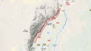
Collection Overview: This dataset contains a 100 km long section of the East Helanshan Fault on the western side of the Yinchuan Graben in northern China. This fault was the site of the devastating 1739 Yinchuan earthquake. Surface fault scarps are visible in the point cloud for much of the fault length. The point cloud data were constructed via photogrammetric methods from data acquired by Airbus Defence and Space (Pleiades 1A) and funded by the Natural Environment Research Council (NERC), UK. For further details see: Middleton, T. A., R. T. Walker, B. Parsons, Q. Lei, Y. Zhou, and Z. Ren (2016), A major, intraplate, normal-faulting earthquake: The 1739 Yinchuan event in northern China, J. Geophys. Res. Solid Earth, 121, 293-320, doi: 10.1002/2015JB012355.
Dataset Acknowledgement: Point cloud constructed from data acquired by Airbus Defence and Space (Pleiades 1A) and funded by the Natural Environment Research Council (NERC), UK. See: Middleton, T. A., R. T. Walker, B. Parsons, Q. Lei, Y. Zhou, and Z. Ren (2016), A major, Intraplate, normal-faulting earthquake: The 1739 Yinchuan event in northern China, J. Geophys. Res. Solid Earth, 121, 293-320, doi: 10.1002/2015JB012355.
Dataset Citation: East Helanshan Fault, northern China. Distributed by OpenTopography. https://doi.org/10.5069/G9QJ7F8K . Accessed: 2025-05-24
Use License: Not Provided
Dataset Keywords: East Helanshan Fault, Yinchuan basin, Yinchuan Graben, China, intraplate fault, lidar
Survey Date: 04/23/2014 – 07/25/2014
Publication Date: 07/04/2016


The 2024/2025 COMET Annual Report is now available to view online
Click here to read previous annual reports, from 2014-present.