
A high-resolution map of the Tibetan Plateau reveals that major faults are far weaker than expected, pointing to slow, continent-wide flow rather than rigid block motion.
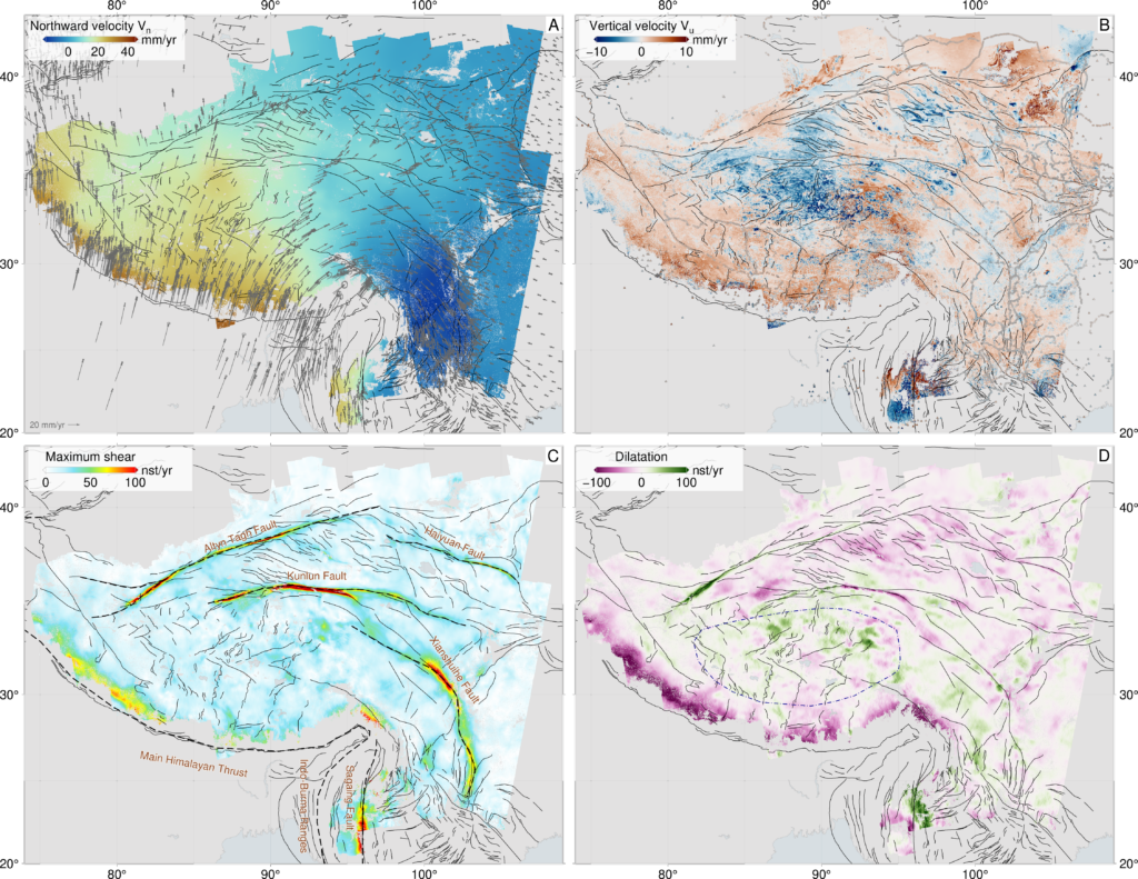
Scientists have created the most detailed map ever produced of how the largest region of active continental movement on Earth, the Tibetan Plateau, is stretching, squeezing, and shifting in unexpected ways.
The results, published in Science, overturn longstanding ideas about how continents deform, and reveal that the interior of Asia is best explained as a flowing material, guided by weak faults.
This analysis draws on tens of thousands of satellite images and one of the most extensive geodetic datasets ever assembled. Using more than 44,000 radar images from the European Space Agency’s Sentinel-1 satellite, over 340,000 maps showing ground movement (interferograms), and 14,000+ Global Navigation Satellite System (GNSS) measurements, the research team produced an unprecedented, millimetre per year scale velocity map of the entire plateau. This is the highest resolution view to date of how the collision between India and Eurasia, one of the most powerful tectonic events on the planet, is reshaping Asia.
“This is the clearest picture yet of how a continent deforms under extraordinary forces,” said lead author Tim Wright (University of Leeds / COMET). “By mapping motion across the whole region in incredible detail, we can finally see how the Tibetan Plateau is actually moving, and the story it tells is very different from what the old models predicted.”
Weak faults, flowing continents
Conventional models often treat Tibet as a mosaic of strong, rigid blocks separated by major faults that slip horizontally past each other. But when the team compared their high-resolution movement map with dynamic models of continental flow, they found a striking mismatch: the observations can only be explained if the major fault systems, including the Kunlun Fault system, which failed in very large earthquakes in 1997 and 2001, are weak, offering little resistance to deformation.
“The data show that continents don’t behave like a mosaic of stiff plates. They flow, but their flow is enabled by major faults, which act as weak zones,” said co-author Greg Houseman (China University of Geosciences Beijing and University of Leeds). “This helps explain why the extension in southern and central Tibetan plateau is so widespread.”
Why central Tibet is stretching apart
One of the most surprising findings is a clear explanation for Tibet’s widespread east–west extension, particularly in the plateau’s interior. The new models show that to match the observations the Kunlun Fault must be extremely weak, allowing the northern edge of central Tibet to slide freely relative to the region north of it. This weak boundary enables the plateau interior to collapse and stretch east–west, releasing gravitational potential energy accumulated by the immense thickness of the crust.
“The weakness of the Kunlun Fault is the key that unlocks what’s happening in central Tibet,” said coauthor Jin Fang (University of Leeds / COMET). “It allows the interior of the plateau to essentially flow eastwards, helping to explain the region’s widespread extension, something that has puzzled geologists for decades.”
A new framework for understanding continental interiors
The study’s findings reshape scientific understanding of how continental interiors respond to largescale tectonic forces. By demonstrating that weak faults and viscous-like flow dominate deformation across the Tibetan Plateau, the work provides a more physically realistic foundation for future research on mountain building, continental dynamics, and long-term seismic hazard across Asia.
“This is a fundamentally new way of looking at how continents work,” said Wright. “And with next generation satellites and global coverage, this approach could soon give us similarly detailed maps for deforming regions all around the world.”
Around three quarters of the world’s deadliest earthquakes occur in continental interiors. The new tools and maps produced by the research team are already being used to improve seismic hazard models used to help countries and communities prepare for earthquakes.
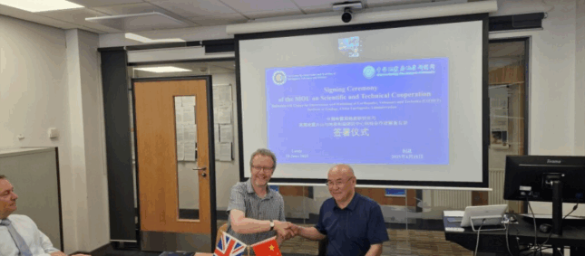
This research, led by Tim Wright (University of Leeds/COMET), is a collaboration between the UK Centre for Observation and Modelling of Earthquakes, Volcanoes and Tectonics (COMET) across the universities of Leeds, Edinburgh, Exeter, and Oxford, and the China University of Geosciences (Beijing, China), Monash University (Australia), GNS Science (New Zealand), Columbia University (New York, USA) and South China Agricultural University (Guangzhou, China).
The research was funded primarily by the UK Natural Environment Research Council (NERC), with additional support from the Royal Society and the National Natural Science Foundation of China.
The UK Centre for Observation and Modelling of Earthquakes, Volcanoes and Tectonics (COMET) is a trusted centre of excellence in volcanic and earthquake science, combining expertise in observations and hazard modelling to deliver accessible data and advice for global risk reduction and resilience. COMET brings together world-leading scientists across 16 UK universities, the British Geological Survey (BGS), and external partners.

The 2024/2025 COMET Annual Report is now available to view online
Click here to read previous annual reports, from 2014-present.