Observations of Deformation
| Volcano number: | 373030 |
|---|---|
| Region: | Iceland and Arctic Ocean |
| Country: | Iceland |
| Geodetic measurements? | Yes |
| Deformation observation? | Yes |
| Measurement method(s): | InSAR, GPS - continuous, GPS - campaign, Levelling, Strainmeter, Tiltmeter, EDM |
| Duration of observation: | Continuous |
| Inferred cause(s) of deformation: | Magmatic |
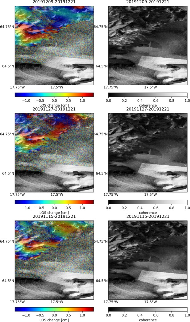
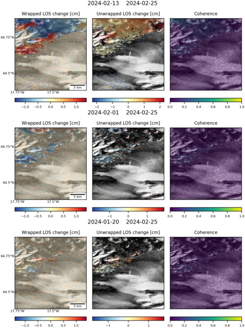
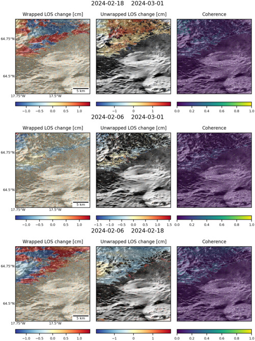
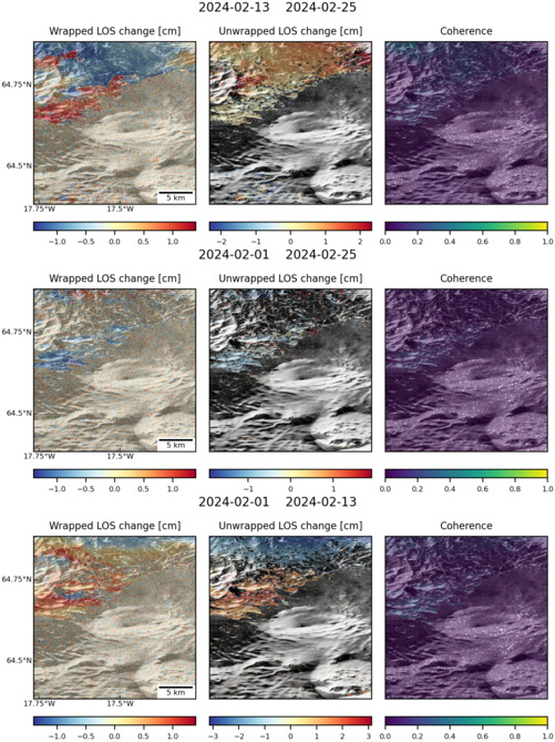
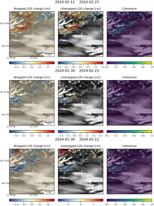
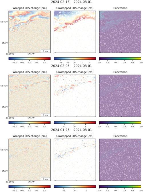
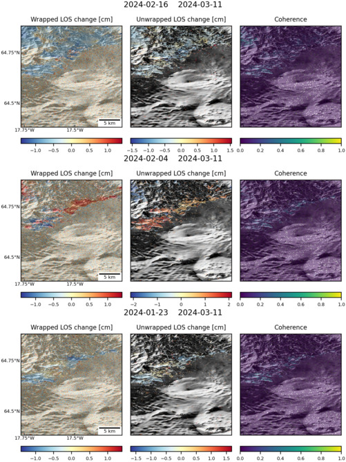
| Characteristics of deformation: | The most recent activity at Bardarbunga occurred in 2014 with the injection of a 45-km-long regional dike was emplaced over a period of 2 weeks in August 2014. Gudmundsson et al. (2014) show that the dike initiated close to the Bardarbunga Volcano but gradually extended to the northeast until it crossed the boundary between the East Volcanic Zone (EVZ) and the North Volcanic Zone (NVZ). The eruption was heavily monitored using InSAR analysis, in conjunction with GPS measurements and earthquake seismicity, has been instrumental in the continued monitoring of Bárðarbunga volcanic system since the onset of unrest. |
| Reference(s): | Smithsonian Institution Global Volcanism Program http://www.volcano.si.edu/volcano.cfm?vn=372030 |
| Parks, M., Dumont, S., Drouin, V., Sigmundsson, F., Spaans, K., Hooper, A., ... & Sturkell, E. (2015, April). PS-InSAR measurements at the most active volcanoes in Iceland: role of the GEO supersite initiative in deformation monitoring at Bárðarbunga, Askja, Hekla, Katla and Eyjafjallajökull volcanoes. In EGU General Assembly Conference Abstracts (Vol. 17, p. 12290). | |
| Gudmundsson, A., Lecoeur, N., Mohajeri, N., & Thordarson, T. (2014). Dike emplacement at Bardarbunga, Iceland, induces unusual stress changes, caldera deformation, and earthquakes. Bulletin of Volcanology, 76(10), 1-7. | |
| Location: | 64.42, -17.33 |
| REST API endpoint (JSON): | https://comet.nerc.ac.uk/wp-json/volcanodb/v1/volcano/3045 |
Latest Sentinel-1 Data
Size: 619px x 1050px (222.07 KB)
Size: 501px x 669px (150.83 KB)
Size: 501px x 669px (162.64 KB)
Size: 501px x 669px (163.25 KB)
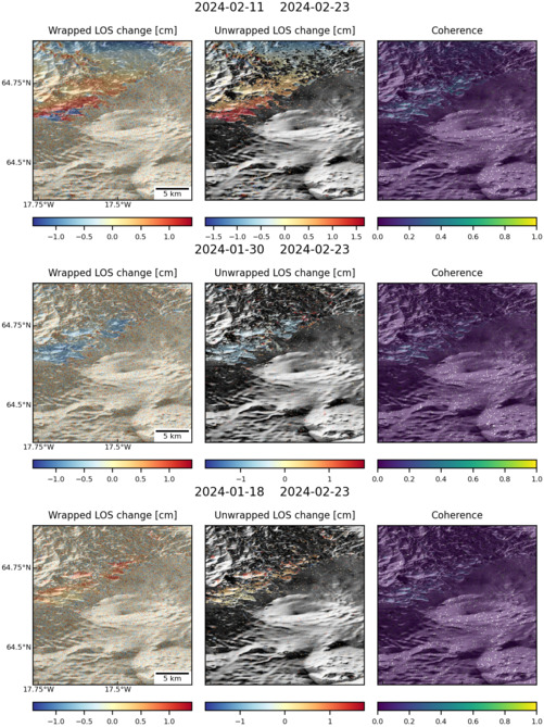
Size: 501px x 669px (161.49 KB)
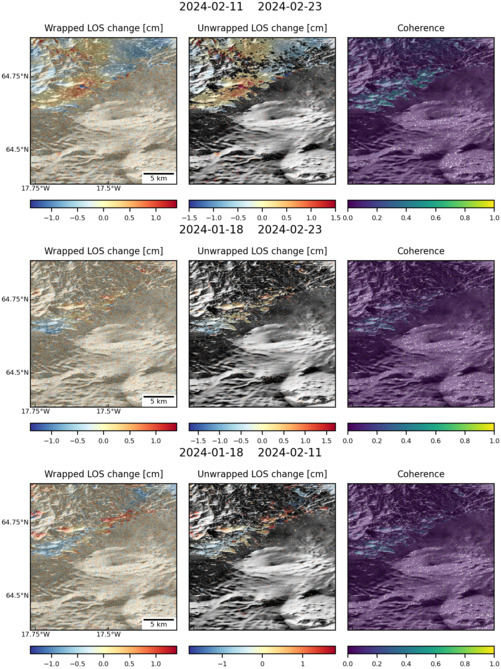
Size: 501px x 669px (162.84 KB)
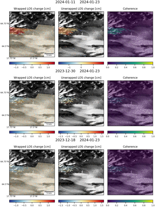
Size: 501px x 669px (138.71 KB)
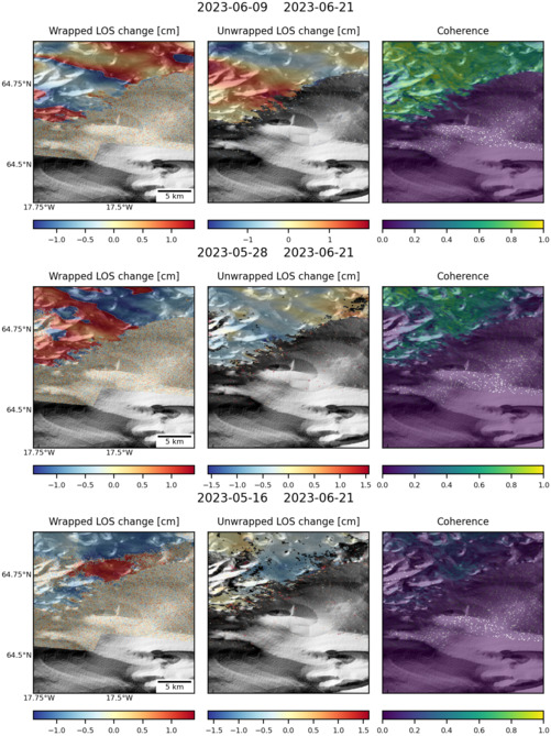
Size: 501px x 669px (138.04 KB)
Size: 501px x 669px (151.11 KB)
Size: 501px x 669px (135.66 KB)
Size: 501px x 669px (162.54 KB)
