Observations of Deformation
| Volcano number: | 300250 |
|---|---|
| Region: | Kamchatka and Mainland Asia |
| Country: | Russia |
| Geodetic measurements? | Yes |
| Deformation observation? | Yes |
| Measurement method(s): | InSAR, GPS - continuous, GPS - campaign |
| Duration of observation: | 1992 to 2003; 2005 to 2010 |
| Inferred cause(s) of deformation: | Magmatic |
| Characteristics of deformation: | Grapenthin et al. (2012) investigate deformation related to ongoing activity and installed a GPS network of 8 continuous and 6 campaign stations around Bezymianny. During the 2005–2010, the authors show: “(1) rapid and continuous network-wide subsidence between 8 and 12 mm/yr”, which appears to affect GPS stations more than 40 km away, which show 4–5 mm/yr of subsidence, “and (2) only the summit station BZ09 shows slight deviations from the average motion in the north component at times of eruptions”. The authors model the deformation by “a deep sill at about 30 km under Kluchevskoy that constantly discharges material.” The sill is constrained by deep seismicity which suggests 9.5 km width, 12.7 km length, and a 13° dip-angle to the south-east.” The authors infer a closing rate of 0.22 m/yr, which implies a volume loss of 0.027 km3/yr (0.16 m/yr and 0.019 km3/yr considering surface loading)”. Eruption related deformation is likely due to “a very shallow reservoir, likely within Bezymianny’s edifice at a depth between 0.25 km and 1.5 km with a volume change of 1–4 × 10− 4 km3. Much of the material erupted at Bezymianny may be sourced from deeper mid-crustal reservoirs with co-eruptive volume changes at or below the detection limit of the GPS network”
|
| Reference(s): | Smithsonian Institution Global Volcanism Program http://www.volcano.si.edu/volcano.cfm?vn=300250 |
| Pritchard, M. E., & Simons, M. (2004). Surveying volcanic arcs with satellite radar interferometry: The central Andes, Kamchatka, and beyond. GSA Today, 14(8), 4-11. GSA Data Repository Item 2004139. Tables DR1 and DR2 and Figures DR1–DR3, is available on request from Documents Secretary, GSA, P.O. Box 9140, Boulder, CO 80301-9140, USA, editing@geosociety.org, or at www.geosociety.org/pubs/ft2004.htm | |
| Grapenthin, R., J. T. Freymueller, S. S. Serovetnikov (2012) Surface deformation of Bezymianny volcano, Kamchatka, recorded by GPS: The eruptions from 2005-2010 and long-term, long-wavelength subsidence, J. Volc. Geotherm. Res., doi:10.1016/j.volgeores.2012.11.012 | |
| Location: | 55.972, 160.595 |
| REST API endpoint (JSON): | https://comet.nerc.ac.uk/wp-json/volcanodb/v1/volcano/5361 |
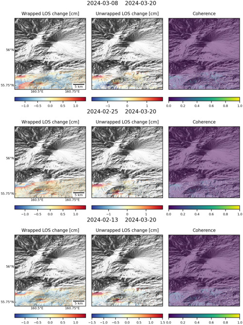
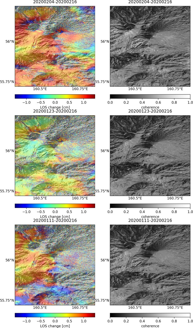
Latest Sentinel-1 Data
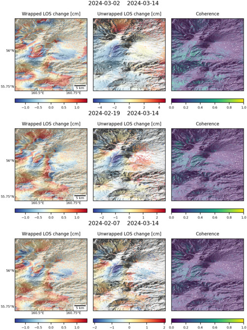
Size: 501px x 669px (175.01 KB)

Size: 501px x 669px (168.88 KB)
Size: 501px x 669px (146.19 KB)
Size: 619px x 1050px (257.88 KB)