Observations of Deformation
| Volcano number: | 312020 |
|---|---|
| Region: | Alaska |
| Country: | United States |
| Geodetic measurements? | Yes |
| Deformation observation? | Yes |
| Measurement method(s): | InSAR |
| Duration of observation: | 2003 - 2009 |
| Inferred cause(s) of deformation: | Hydrothermal, Magmatic, Uncertain |
| Characteristics of deformation: | Interferograms reveal subsidence within Emmons Lake caldera extending NE to Mount Hague. Maximum subsidence is measured to be ~8 mm/yr. Deformation is modelled using a sill source to replicate the elongte shape of the deformation field. The best fitting sill is ~4 km x ~1 km, striking NE and located at 7 km depth. Subsidence is attributed to cooling and volume loss from a magma body and/or depressurisation of the hydrothermal system. |
| Reference(s): | Lu, Z., and Dzurisin, D., 2014, InSAR imaging of Aleutian volcanoes: Chichester, UK, Springer-Praxis, 390 p. |
| U.S. Geological Survey Alaska Volcano Observatory (AVO) website http://www.avo.alaska.edu/volcanoes/volcinfo.php?volcname=Emmons+Lake+Volcanic+Center | |
| Location: | 55.341, -162.073 |
| REST API endpoint (JSON): | https://comet.nerc.ac.uk/wp-json/volcanodb/v1/volcano/871 |
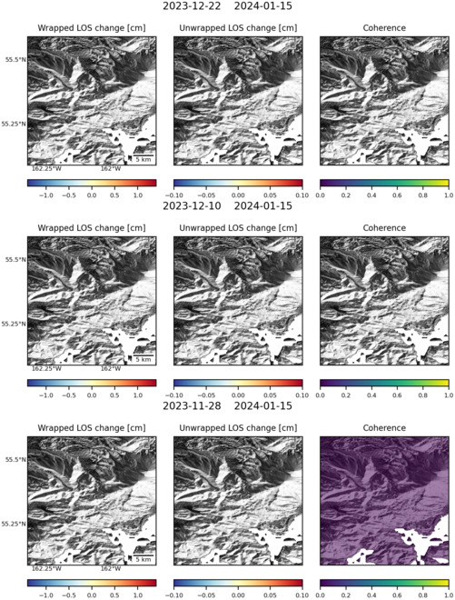
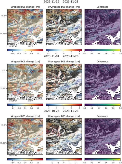
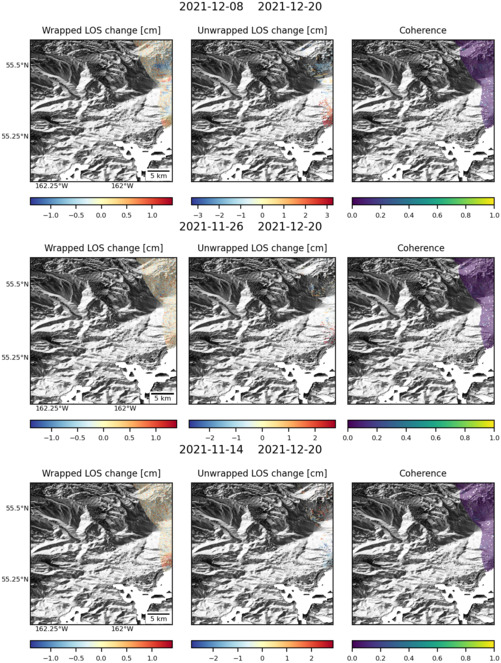
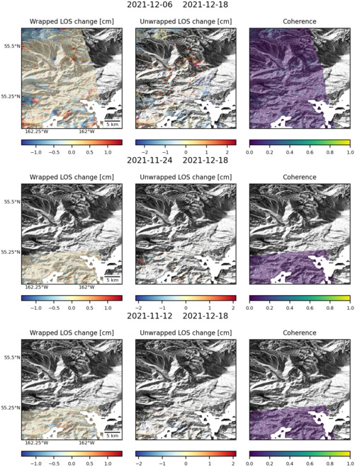
Latest Sentinel-1 Data
Size: 501px x 660px (143.60 KB)
Size: 501px x 669px (179.60 KB)
Size: 501px x 663px (151.23 KB)
Size: 501px x 660px (156.07 KB)