
Observations of Deformation
| Volcano number: | 231040 |
|---|---|
| Region: | Middle East and Indian Ocean |
| Country: | Saudi Arabia |
| Geodetic measurements? | Yes |
| Deformation observation? | Yes |
| Measurement method(s): | InSAR |
| Inferred cause(s) of deformation: | Magmatic |
| Characteristics of deformation: | Harrat Lunayyir was considered seismically quiet until April and June 2009 when a swarm of more than 30,000 earthquakes struck one of the lava fields in the province. Pallister et al. (2010) present geologic, geodetic and seismic data to show that the earthquake swarm resulted from magmatic dyke intrusion. They “document a surface fault rupture that is 8 km long with 91 cm of offset. Surface deformation is best modelled by the shallow intrusion of a north-west trending dyke that is about 10 km long”. |
| Reference(s): | Pallister, J. S., McCausland, W. A., Jónsson, S., Lu, Z., Zahran, H. M., El Hadidy, S., ... & Moufti, M. R. (2010). Broad accommodation of rift-related extension recorded by dyke intrusion in Saudi Arabia. Nature Geoscience, 3(10), 705-712. |
| Smithsonian Institution Global Volcanism Program http://www.volcano.si.edu/volcano.cfm?vn=231040 | |
| Location: | 25.17, 37.75 |
| REST API endpoint (JSON): | https://comet.nerc.ac.uk/wp-json/volcanodb/v1/volcano/5282 |
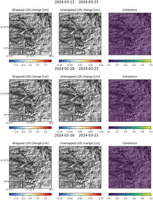
Latest Sentinel-1 Data
Size: 501px x 654px (142.04 KB)