Observations of Deformation
| Volcano number: | 241100 |
|---|---|
| Region: | New Zealand to Fiji |
| Country: | New Zealand |
| Geodetic measurements? | Yes |
| Deformation observation? | Yes |
| Measurement method(s): | InSAR, GPS - campaign, Levelling, EDM, trilateration |
| Duration of observation: | 1970 (trilateration) - present |
| Inferred cause(s) of deformation: | Hydrothermal, Magmatic, Uncertain |
| Characteristics of deformation: | Dvorak and Dzurisin (1997): Trilateration measurements across the summit crater of Ruapehu, New Zealand, showed that the summit extended only several tens of millimeters before steam explosions, even when measurements were made a few minutes before an explosion [Otway, 1979]. |
| Reference(s): | Dvorak, J. J., and D. Dzurisin (1997), Volcano geodesy: Dvorak, J. J., and D. Dzurisin (1997), Volcano geodesy: The search for magma reservoirs and the formation of eruptive vents, Rev. Geophys., 35, 343-384, doi:10.1029/97RG00070., Rev. Geophys., 35, 343-384, doi:10.1029/97RG00070 |
| Dvorak, J. J., and D. Dzurisin (1997), Volcano geodesy: The search for magma reservoirs and the formation of eruptive vents, Rev. Geophys., 35, 343-384, doi:10.1029/97RG00070 | |
| Location: | -39.28, 175.57 |
| REST API endpoint (JSON): | https://comet.nerc.ac.uk/wp-json/volcanodb/v1/volcano/3078 |
Latest Sentinel-1 Data

Size: 748px x 1110px (303.05 KB)
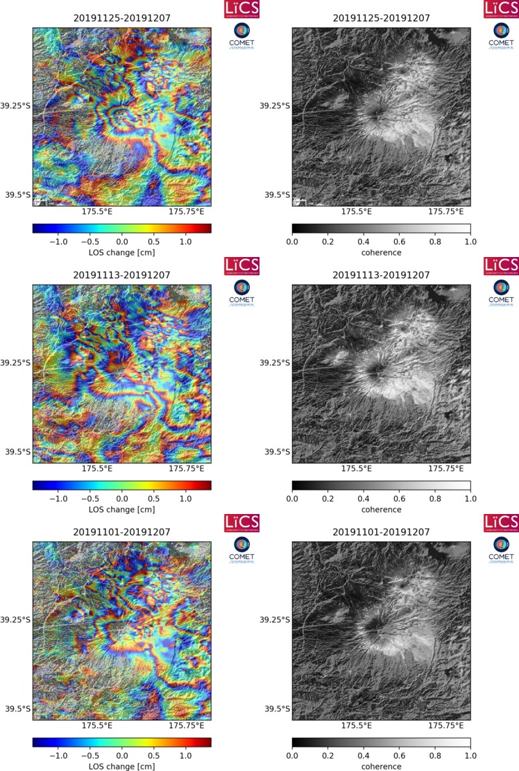
Size: 748px x 1110px (305.96 KB)

Size: 748px x 1110px (302.71 KB)