
Observations of Deformation
| Volcano number: | 221106 |
|---|---|
| Region: | Africa and Red Sea |
| Country: | Ethiopia |
| Geodetic measurements? | Yes |
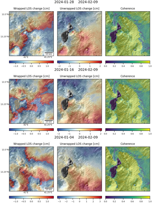
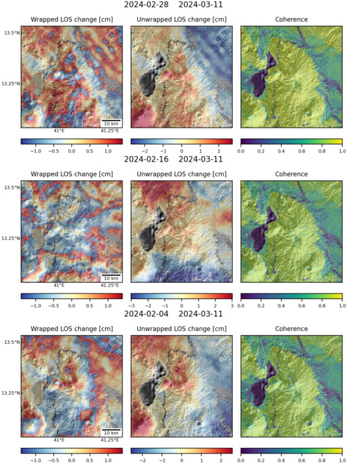
| Deformation observation? | No |
| Measurement method(s): | InSAR |
| Duration of observation: | 2005 - 2010 |
| Inferred cause(s) of deformation: | Magmatic |
| Characteristics of deformation: | Tat Ali is a Holocene shield volcano east of Lake Afrera. NNW-SSE-trending fissures cutting the volcano have fed basaltic lava flows, but not in recent times. Pagli et al. (2014), for the purposes of investigating regional velocity fields, have looked at Envisat InSAR data covering this volcano. They report no deformation between 2005 and 2010. |
| Reference(s): | Pagli, C. et al., 2014. Current plate boundary deformation of the Afar rift from a 3-D velocity field inversion of InSAR and GPS. Journal of Geophysical Research: Solid Earth, 119(11), pp. 8562-8575. |
| Nasa Landsat Image. 1999. | |
| Location: | 13.284, 41.063 |
| REST API endpoint (JSON): | https://comet.nerc.ac.uk/wp-json/volcanodb/v1/volcano/1384 |
Latest Sentinel-1 Data
Size: 501px x 669px (162.68 KB)
Size: 501px x 669px (177.17 KB)