COMET workshop on the modelling of magmatic processes

COMET workshop on the modelling of magmatic processes

Around 20 scientists gathered at the University of Leeds recently to share their knowledge and their views on how magmatic activity can be understood and reproduced by models of volcanic processes.

Fourteen COMET members, including scientists, research staff and students, were joined by experts in various fields of volcanology from other world-leading institutions such as the United States Geological Survey, the University of Geneva and the University of Liverpool.

At the workshop we discussed the numerous challenges we face when we try to experimentally replicate natural processes such as those occurring at volcanoes. The most important limitation is that we can exclusively witness and measure what happens at the surface of the volcanoes, and only indirectly infer what goes on beneath them.

There are many different techniques commonly used to take the pulse of the magmatic activity: we measure how the volcanic edifices deform, we record seismic waves coming from and travelling through the magmatic systems, we collect and analyse lava and ash samples during eruptions, we measure the concentration of gases emitted by volcanic vents etc.

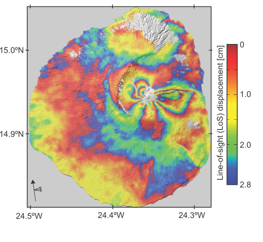
The rapid expansion and improvement of satellite Earth Observation (EO) techniques (such as radar interferometry to measure deformation, infrared atmospheric sounding to measure gas emissions etc.) offers further opportunities to study magmatic processes at a global scale.

Although each technique can shed light on one or more volcanic processes, the highest chance of truly understanding what controls the magmatic activity happens when all the measurements and information are analysed together.

The use of a multi-disciplinary approach was the key element of the COMET workshop and all participants agreed that future research in volcanology must move in this direction. Conceptual and numerical models of how magma is stored beneath the surface must be able to reconcile the observed deformation, the amount of gasses released in the atmosphere and the physical/chemical properties of the erupted products. Models of how magma reaches the surface during eruptions need to explain the seismic signature of magma ascent, be compatible with the mechanical properties of volcanic rocks, and consider magma as a multi-phase fluid containing gas, liquid and crystals.

During our workshop, we identified several potential research projects that will be developed in the coming months and that will imply the use of information from different disciplines of volcanology. For example, we aim to globally classify active volcanoes on the basis of their behaviours in terms of deformation and gas emissions. Much effort will also be put in understanding the characteristics of magma reservoirs, moving from conceptual models of simple liquid-filled cavities to complex, multi-phase, dynamic systems.

Finally, specific volcanoes where COMET scientists already have access to long records of geophysical, geochemical and petrological data (for example Soufriere Hills Volcano in Montserrat or Kilauea Volcano in Hawaii) will be used as natural laboratories. At these locations, we will test models that try to reproduce processes ranging from specific eruptive behaviours to long-term magma supply to the volcanoes.

For further information, contact Dr Marco Bagnardi [email protected]

Multiple techniques shed light on the August 2014 Murmuri, Iran earthquake sequence

COMET researchers have unravelled a complex seismic sequence using a combination of techniques, explaining not only the earthquake sequence itself but also the formation of the mountain range where it occurred.

On August 18 2014, an Mw 6.2 earthquake struck Murmuri, near Dehloran in the Zagros Mountains of South West Iran (Figure 1), and was followed by five aftershocks of Mw of at least 5.4.  The largest of these was a Mw 6.0 aftershock which took place 16 hours after the main event.

These were the first large seismic events in the region since important developments in satellite Earth Observation (EO) have allowed us to study earthquakes in unprecedented detail, providing the potential to combine  a range of satellite-based and seismological approaches.

The study team, which included COMET scientists from Cambridge and Oxford along with colleagues from Iran, Colorado, and Canada, saw this as an opportunity to shed light not only on the Murmuri earthquake but also on how the Zagros Mountains themselves are evolving.

Figure 1 below shows the distribution of earthquakes in the region along with the 2014 Murmuri event.

Figure 1: Earthquakes and topography of the Zagros Mountains. White circles show events of magnitude 5.0 and larger (Nissen et al., 2011). The red star shows the Murmuri mainshock.

The depth of the earthquake-generating thrust faults in the Zagros Mountains has been the subject of debate for some time.  Previous studies have disagreed on whether the faults break a thick sequence of sedimentary layers, or are confined to the underlying crystalline rocks.

Importantly, rather than using a single technique, the team combined satellite-based EO techniques with studies of the seismic waves generated by the earthquake and aftershocks.  The first step was to identify their locations, which was crucial to understanding the relationship between the ground motions detected by InSAR and the fault planes that caused the earthquakes.  They then used the results to generate models of the faults.

Modelling the seismic waves showed that all except one of the events were caused by thrust faults.  The smooth signals in the InSAR interferograms meanwhile showed that the faulting which led to the earthquake was buried deep under the surface.

Figure 2: Interferograms of the 18 August 2014 earthquake.  Each interferogram is labelled with the dates of the two SAR acquisitions in the format YYYYMMDD, and the background shading is the topography.

The next question was whether the earthquakes had been caused by a single or multiple faults.  The interferograms showed distinct lobes extending to the east and southeast of the main affected area, suggesting that the displacements on the surface were caused by two if not three separate faults.

COMET’s Alex Copley, from the Department of Earth Sciences at the University of Cambridge, explained: “ We found that a single-fault model couldn’t reproduce the deformation patterns shown by the interferograms, so we investigated by applying multiple-fault models instead.”

The team modelled the faults to establish characteristics including their direction, length and angle.  When they used the interferograms alone there were a wide range of different fault parameters that could produce models that matched the data, but by including the seismic data the team could narrow down these characteristics.

Dr Copley added: “The only way we managed to work out what actually happened was by using seismological techniques, and then using these results  to interpret the satellite measurements.”

The results showed that the 18 August 2014 event involved significant slip on two planes, which produced a complex displacement pattern in the InSAR, and that there were two separate events big enough to produce surface deformation signals, hence the two lobes on the interferograms.

It also became clear that most if not all of the faulting took place in the sedimentary layers rather than the igneous rocks below, at depths of 3-9km.  The faults were also found to be longer than they were deep, which is relatively unusual – most faults tend to be more or less equal in length and depth.  This could be because changes in the mechanical properties of the rocks below stop the faults from extending any deeper.

As well as explaining the events at Murmuri, the results throw light on the large scale tectonics of the Zagros Mountains, showing which combination of tectonic forces and material properties of the rocks can give rise to the shape and deformation pattern of the mountain range.

Dr Copley summarised: “If we had used seismology or satellite measurements alone we would have failed to learn much that was new about this earthquake sequence.  Instead, our approach allowed us to shed light not only on the formation of the Zagros, but also how similar fold-thrust belts form across the globe.”

The full paper is: Copley, A., Karasozen, E., Oveisi, B., Elliott, J.R., Samsonov, S., Nissen, E.  Seismogenic faulting of the sedimentary sequence and laterally-variable material properties in the Zagros Mountains (Iran) revealed by the August 2014 Murmuri (E. Dehloran) earthquake sequence, Geophysical Journal International, 2015 doi: 10.1093/gji/ggv365

Sentinel-1A’s TOPS explains the 2014-15 Fogo eruption

COMET researchers have used the European Space Agency’s Sentinel-1A satellite to shed light on the 2014-15 eruption at Fogo, the most active volcano in the Cape Verde archipelago.

Their paperpublished in Geophysical Research Letters, investigates the eruption using Sentinel-1A’s new radar acquisition mode, Terrain Observation by Progressive Scans (TOPS).

Fogo has erupted at least 26 times in the last 500 years, and this particular event lasted 81 days from November 2014 to February 2015.  It had devastating consequences for the island. Fast lava flows destroyed the villages of Portela and Bangaeria in early December 2014.

As the satellite had only been operating for a few weeks when the eruption began, this is the first study to use Sentinel-1A TOPS to investigate surface deformation associated with volcanic activity.

Lead author Dr Pablo J. González, from the University of Leeds, explained: “the study has given us a real insight into the inner workings of Fogo volcano.  It also shows the potential of Sentinel-1’s TOPS mode for monitoring volcanic activity in the future acheter du viagra.”

Up until recently, the volcano had mostly been monitored by a GPS network with limited spatial coverage.  In comparison, the wide area and high spatial resolution of Sentinel-1A’s satellite images allowed the team, which included researchers from Norway, The Netherlands and Canada, to monitor ground deformation across Fogo.

Using the TOPS data, they found that during the eruption the ground surface had changed in a “butterfly” shape, characteristic for a dike intrusion (where the magma intrudes into a fissure, shouldering aside other the existing layers of rock).

Sentinel-1A ascending interferogram spanning the onset of the2014-2015 Fogo eruption (3 – 27 November 2014). Each colour fringe represents ~3 cm of ground displacement.

Models created to reproduce the observed data then showed that first of all the magma moved rapidly from depths of more than ten kilometres below the volcano’s summit.  It then moved along the dike to feed the eruption at a fissure on the southwestern flank of the volcano’s summit cone, rather than from its top.

This was backed up by the satellite data showing a lack of deformation across the whole island during the eruption, which would have suggested that it was instead being fed by an inflating/deflating magma reservoir directly beneath.

The findings will now set the direction for further research aimed at understanding the pattern of eruptions on the island, as well as assessing the stability of the entire volcanic structure.

Dr Marco Bagnardi, COMET researcher, and also co-author in this paper, added: “Our results not only show the importance of near-real time ground deformation monitoring at Fogo, they also demonstrate the potential of Sentinel-1A’s TOPS mode for monitoring geohazards more widely.”

The full paper, The 2014-2015 eruption of Fogo volcano: geodetic modelling of Sentinel-1 TOPS interferometry, is available now in Geophysical Research Letters