Researchers from the University of Bristol’s COMET group shared new results on volcanic processes and monitoring at EGU 2026 in Vienna.
From May 3–8, members of the COMET group at the University of Bristol, led by Prof. Juliet Biggs (COMET co-director), attended the European Geosciences Union (EGU) General Assembly 2026 in Vienna, Austria. EGU is one of the largest geoscience conferences in the world, bringing together researchers across Earth, planetary, and environmental sciences. This year, our group contributed a wide range of talks, posters, and PICO presentations spanning volcanic deformation, dike intrusion processes, earthquake swarms, geodetic methods, remote sensing, and science communication.
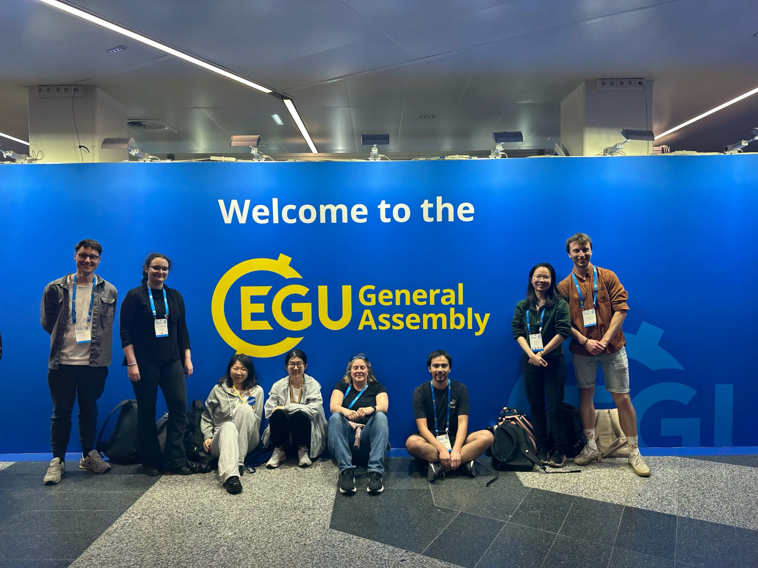
Bristol COMET group members at EGU 2026
It was a busy and exciting week, with presentations spread across many sessions and opportunities to discuss new research with collaborators and colleagues from around the world.
Monday: Modelling and Discussion across Disciplines
The week started with Prof. Juliet Biggs co-chairing the session GMPV10.12 Volcanic processes: tectonics, deformation, geodesy, unrest. The group enjoyed a fantastic series of talks throughout the session and had the opportunity to catch up with colleagues and collaborators from around the world.
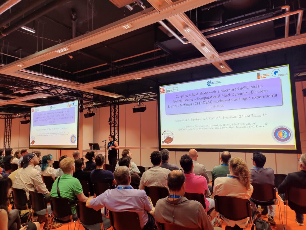
In the afternoon, Alexandra Morand presented her work during the PICO session GMPV12.1 Advances in computational modelling, data analysis, and visualisation. Her work, titled Coupling a fluid phase with a discretised solid phase: Benchmarking a Computational Fluid Dynamics–Discrete Element Methods (CFD-DEM) model with analogue experiments, explored a new numerical modelling framework that couples fluid flow with elastic and brittle deformation of surrounding rocks.
Alexandra presenting her work during the GMPV12.1 PICO session
Tuesday: Seismicity, Deformation, and Magma Transport in the Rift
Tuesday was one of the busiest days of the week, with multiple group members presenting across different sessions spanning seismology, rifting, and remote sensing.
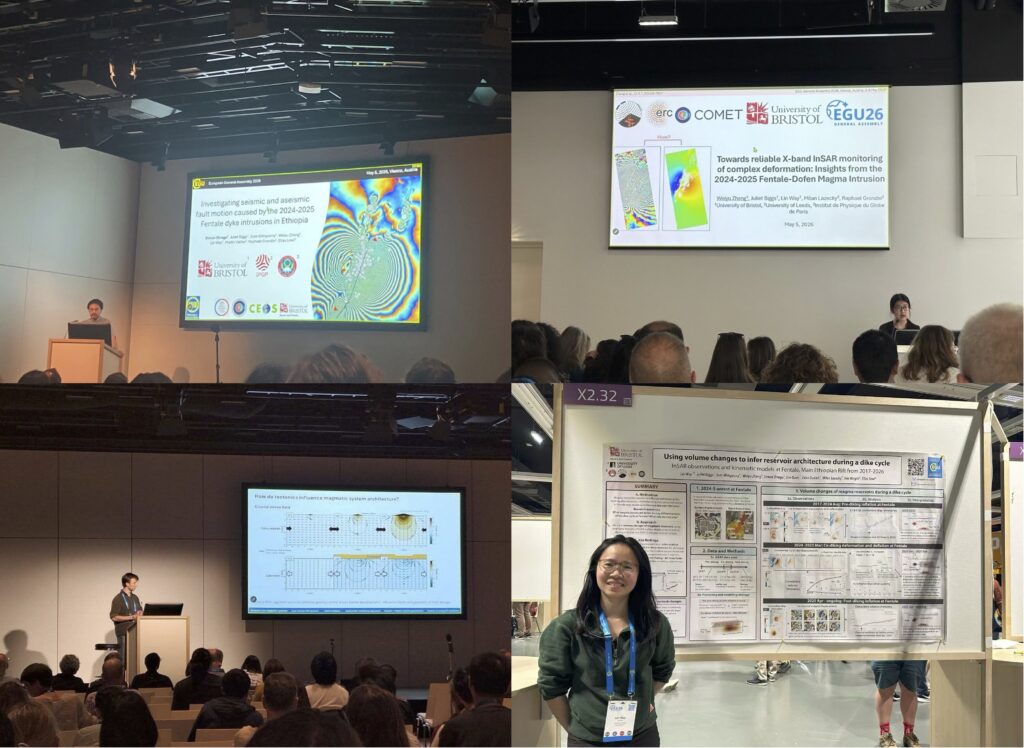
The day started early with Simon Orrego presenting in TS1.8 Seismic and aseismic fault deformation. His talk, Investigating seismic and aseismic fault motion caused by the 2024–2025 Fentale dyke intrusions in Ethiopia, provides new constraints on fault mechanics and the interaction with magmatic processes in rifting environments.
Later in the afternoon, Weiyu Zheng presented in the session GI6.1 Remote sensing for environmental monitoring. The talk, Towards reliable X-band InSAR monitoring of complex deformation: Insights from the 2024-2025 Fentale-Dofen Magma Intrusion, focused on improving InSAR unwrapping results for complex volcanic deformation, particularly during dike intrusion events.
Immediately afterwards, Ben Ireland presented in TS2.1 Rift evolution: from continental inception to seafloor spreading. The talk, Along-rift variations in magma system geometry observed using Sentinel-1 InSAR data from the East African Rift System, highlighting that magma systems along the East African Rift evolve from horizontally to vertically dominated geometries, indicating structural differences in magmatic system architecture.
The day concluded with Lin Way presenting her poster in GMPV10.12 Volcanic processes: tectonics, deformation, geodesy, unrest. Her presentation, Reservoir connectivity in a continental rift: Insights from geodetic observations during the 2024-2025 dike intrusions at Fentale, Main Ethiopian Rift, showed that tracking the evolving volume ratio between dike intrusion and magma reservoir deflation provides new insights into changes to the magmatic system.
Tuesday presentations from Simon, Weiyu, Ben and Lin
Wednesday: Science into Policy
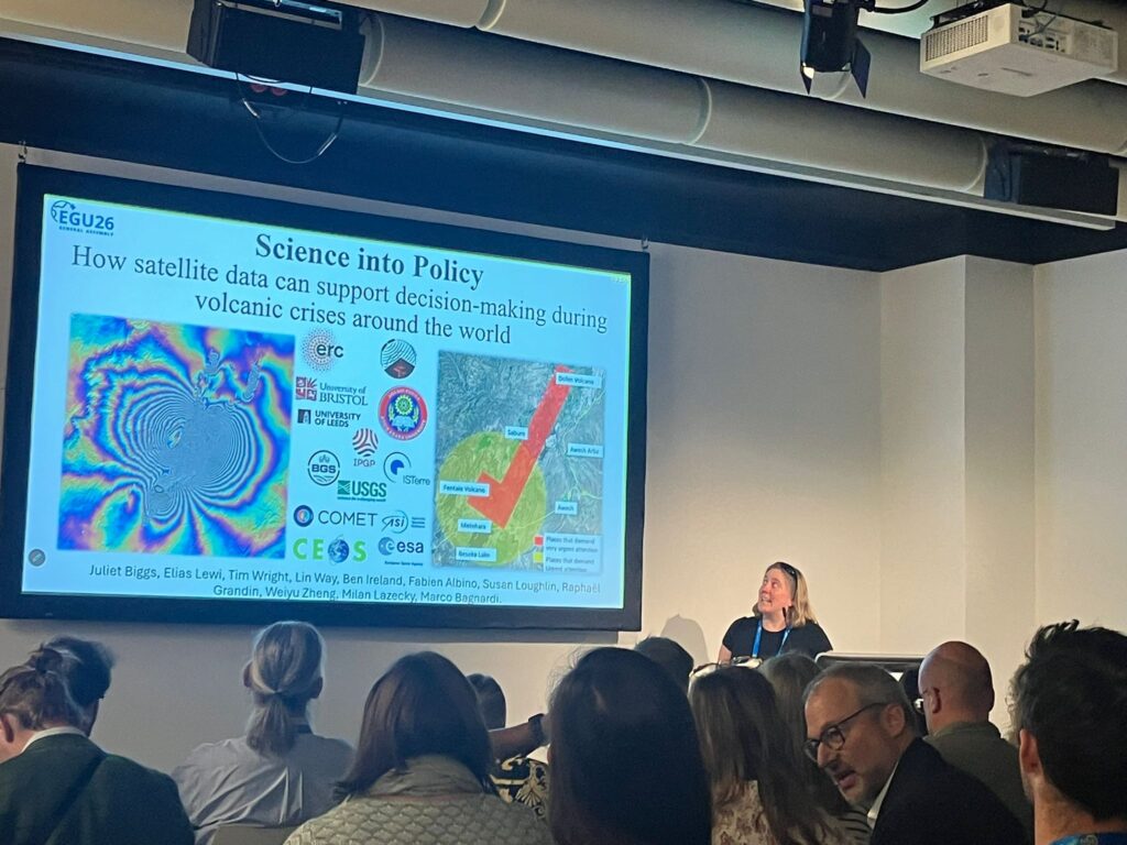
Wednesday is featured by Prof. Juliet Biggs presenting in the session EOS4.6 Strengthening Policy Through Science: Insights from the interface. Her talk, Science into Policy: how satellite data can support decision-making during volcanic crises around the world – a recent example from East Africa, highlighted how satellite observations and geodetic analysis can directly support decision-making during volcanic crises.
Juliet presenting in the session EOS 4.6
Thursday: Dyke Seismicity and Geodetic Methods
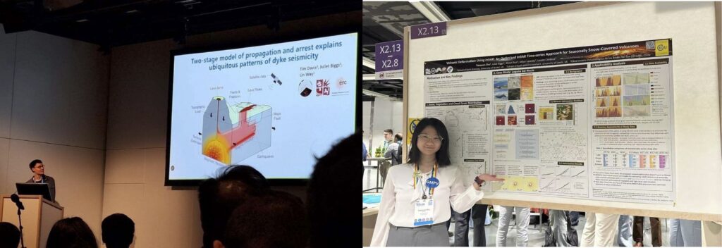
Thursday started with Tim Davis presenting in SM7.1 Beyond the Catalog: Unraveling the mechanisms of Earthquake Swarms and Sequences in Tectonic and Volcanic Regions. The session began with two talks on the seismicity of the 2025 Santorini intrusion, leading nicely into his talk, Two-stage model of propagation and arrest explains ubiquitous patterns of dyke seismicity. Heshowed that a 3D hydromechanical model can explain the observed patterns of dyke-related seismicity and deformation across multiple intrusions both before and after arrest.
In the afternoon, Tianyuan Zhu presented her poster in G3.3 Space, Land and Marine geodetic methods to advance lithospheric processes understanding and hazards assessment. Her presentation, Monitoring Volcanic Deformation Using InSAR: An Optimised InSAR Time-Series Approach for Seasonally Snow-Covered Volcanoes, focused on improving InSAR time-series analysis in seasonally snow-covered volcanic regions, enhancing the reliability of deformation measurements in challenging environments.
Thursday presentations from Tim and Tian
Friday: Volcanic Emissions
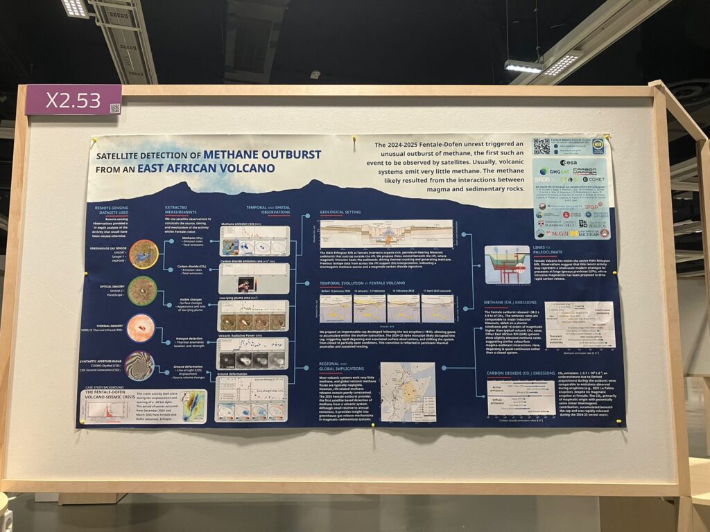
The week concluded with Edna Dualeh’s poster in the session GMPV11.5 Volcanic Eruptions and Climate: Observations. Her work, Satellite detection of methane outburst from an East African volcano, showed the first satellite observations of large, transient methane emission associated with magma–sediment interactions during a volcanic intrusion. Although Edna was unable to attend EGU, her work, presented on her behalf by Tim, attracted strong interest and discussion throughout the session.
Edna’s poster in session GMPV 11.5
Concluding remarks
EGU 2026 was a busy and rewarding week for the Bristol COMET Group, with contributions across oral, poster, and PICO sessions covering a wide range of topics in volcanology, tectonics, remote sensing, and decision support. It was an excellent opportunity to share new results, exchange ideas, and receive feedback from colleagues working on similar problems around the world. Beyond the presentations, the meeting also provided valuable time for the group to catch up with collaborators and discuss ongoing and future research in an inspiring scientific environment.
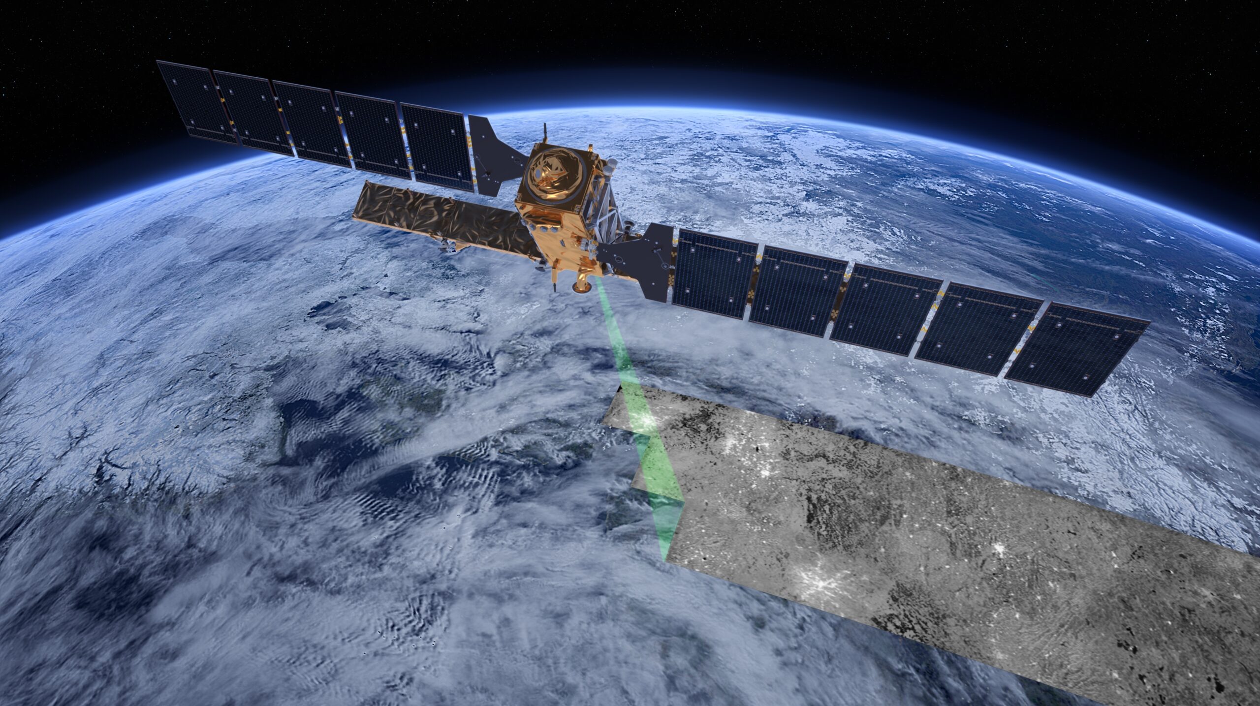
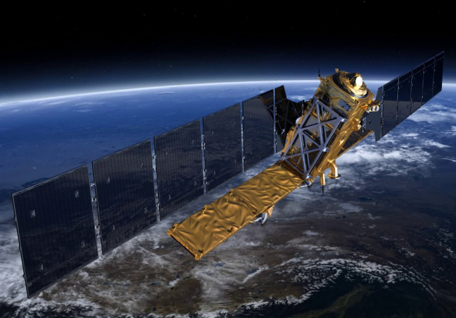
A new paper, from a team led by COMET Co-Director Professor Juliet Biggs, has marked ten years of operational service of the Sentinel-1 satellite by reviewing the ways in which it has transformed volcanology.
Use of data from Sentinel-1 (the first satellite of the ESA Copernicus programme) has been gladly adopted as common practice in the field over the last decade thanks to its long term, systematic archive of data, and a policy of open access.
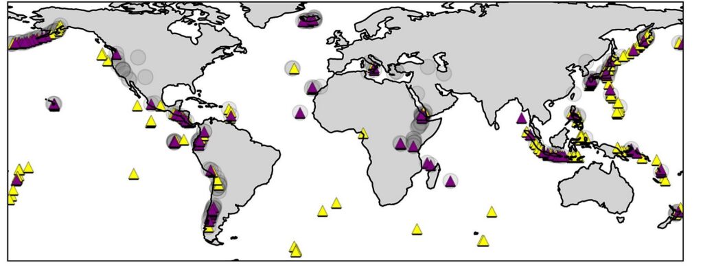
In this study, the team identified 233 high-priority volcanoes as requiring frequent satellite observation. Of these, data obtained by Sentinel-1 has been utilised in published research for about 90 of them. This kind of repeated usage highlights the growing impact of remote sensing satellite data in volcanology.
A map from the paper showing volcanoes considered a priority for satellite remote sensing. Those in purple have all had at least one interferogram published from Sentinel-1 data.
The team analysed a vast archive of 3.34 million interferogram images processed by COMET’s LICS system and applied machine learning to retrospectively detect the telltale signals of volcanic eruptions. A test on this scale clear demonstrates the promise for these automated approaches in large-scale monitoring.
Data from Sentinel-1 can be applied to monitoring a large range of volcanic settings, as demonstrated in various sites across the world. In Iceland, Hawai’i, and the Galápagos, Sentinel-1 InSAR is integrated into routine monitoring of frequently erupting basaltic volcanoes, and used to identify magma pathways and forecast the outcomes of unrest.
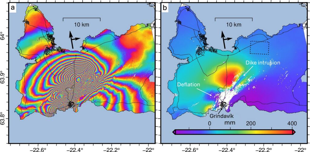
An interferogram produced by Sentinel-1 showing a dike intrusion and deflation of a shallow magma reservoir in Iceland in 2023.
In contrast, InSAR measurements could not be made, or were not useful, at several of the large explosive eruptions that occurred during the first decade, but Sentinel-1 SAR backscatter is increasingly being used to map damage associated with eruptive deposits and flank collapses.
These long term datasets of baseline monitoring have contributed significantly to the detection of subtle deformation signals, and identifying when a volcano first enters a stage of unrest. These datasets have provided new insights into complex subsurface processes, including interactions within magmatic plumbing systems, and those between magmatic and tectonic forces.
Even with the great advances we’ve seen from Sentinel-1, interpreting signals is still a challenge due to the amount of noise in the data, atmospheric interference, and complex natural surfaces. As such, it still relies heavily on being integrated with additional external datasets.
Lead author of the paper, Professor Juliet Biggs said of the new paper, “It was a great privilege to work with researchers from so many different countries and institutions to review the different ways in which Sentinel-1 data is being used by volcanologists. It was exciting to see that the routine acquisition strategy and open-access data policy has opened the doors to large scale systematic analysis, and enabled volcano observatories to integrate satellite data into their real-time monitoring systems.”
The research was supported not just by COMET but also by funding from ERC Horizon 2020. A full list of project funders and supporters can be found in the Acknowledgements section of the paper.
This paper highlights a decade of innovation in the field of remote sensing, and shows exciting possibilities for extending the pioneering work of Sentinel-1. Future studies promise improved resolution and coverage, which can enhance our global volcano monitoring capabilities.
“New satellites planned for the next decade will provide yet another step change in capabilities unlocking further advances in volcanology and volcano monitoring. “
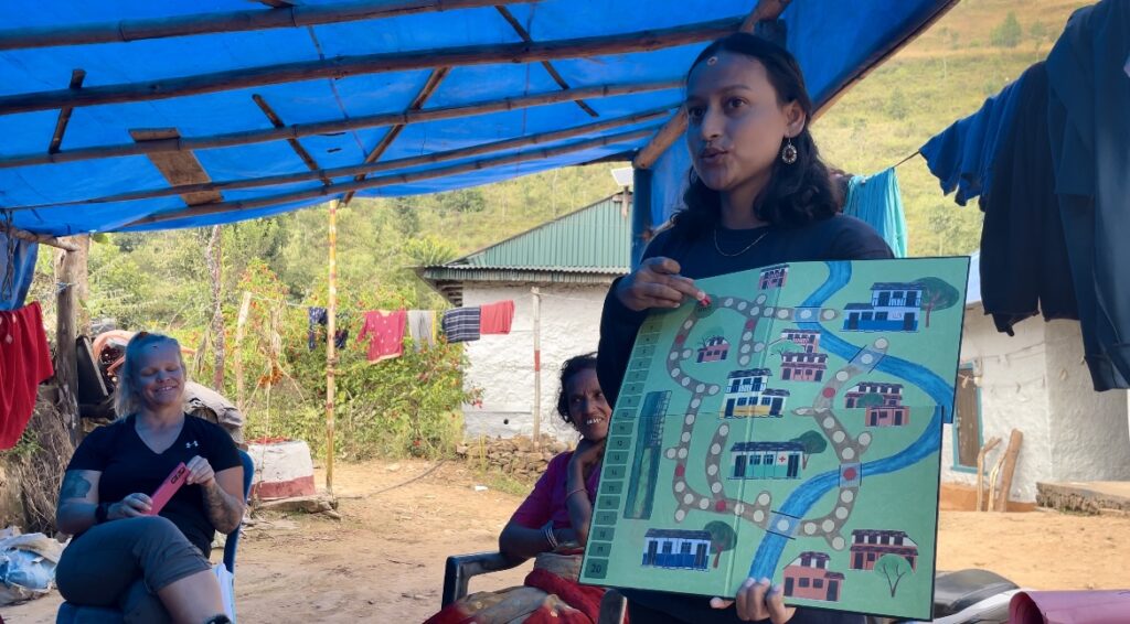
“Bhūkampa! Bhūkampa!” “Earthquake!” the shouts echo around the classroom. “I would have won!” a boy exclaims, begrudgingly sliding his counter back by 5. Students gather around the game board in collective frustration, determined to quickly make up for their lost points. The surrounding valley, however, remains peaceful; we’re sat outside the classroom, basking in the first warm days of the dry season. There is no hint of the earthquake that’s just happened, or the one that may be yet to come.
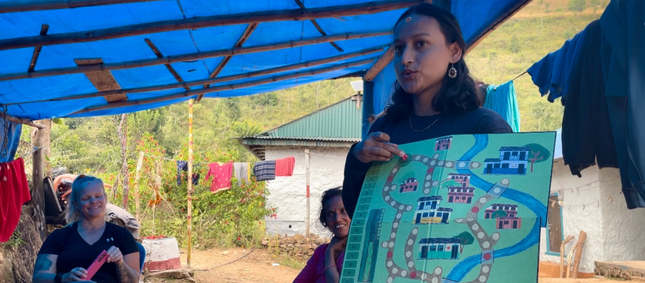
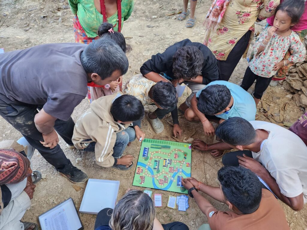
Playing the Disaster Ready! game as part of a community outreach session.
The game itself developed collaboratively, inspired by other so-called “Serious games” used in academic outreach, as well as by larger organisations such as the Red Cross. The underlying principle is to replicate, in some way, a physical or social reality. Through play, the participants learn more about this reality and develop strategies for dealing with the challenges it presents. The Disaster Ready! game aims to encapsulate this as a disaster risk reduction (DRR) education tool – being set within a rural Nepali community, players must move around the village, performing individual and collective actions, as well as acquiring response and recovery cards for when disaster strikes. Actions gain players points and include things such as packing an emergency bag, practicing “drop, cover, hold”, or making a collective emergency plan for their village. Disasters are triggered randomly by landing on red tiles, forcing players to draw a card from the hazard deck containing earthquakes ranging in magnitude from M1-M7.
Nirmala explaining the rules of the game in Nepali.
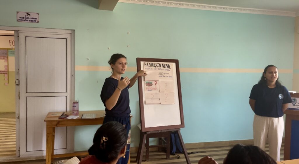
Across all the sessions I delivered during my time in Nepal, the overwhelming response to the Disaster Ready! game was one of curiosity and enthusiasm. Equivalent lecture style presentations on earthquake risk and preparedness, although similar in content, were often met with reserved interest, or polite disinterest. These presentations, me at the front, the audience facing, often felt othering – I was an outsider coming to lecture, not to listen. Playing the game went some way to dissolving these boundaries. The focus switched from my theoretical knowledge, well-intentioned but often naïve in the face of the everyday challenges communities are facing to the experiences of those who live with earthquake risk every day. Shared stories of worry and anxiety, of soup split by ground shaking, of laughter over how many nappies could fit in an emergency bag, replaced what could have been cold and distant knowledge. The game served to humanise the experience of living with earthquake risk and in doing so connected people over their shared realities, generating conversations around what it means to be prepared, both on an individual and community level. The enthusiasm of the children was especially contagious, and the highlight of most sessions was watching their eyes light up as they unpacked the game to begin playing. The Nepali education system, particularly in the most rural areas, is severely underfunded and poorly resourced. Some teachers lack any formal training and most rely on rote learning methods to instil information in their students. Noisy, dilapidated classrooms offer a poor learning environment, and many students struggle to concentrate as a result. This makes learning through a game, like Disaster Ready!, novel and exciting. It is an entirely new approach for many students, encouraging active participation, role play, decision making, and a chance for critical discussion in a system where children’s voices are rarely heard.
Nirmala and I delivering a session on hazards and preparedness in Nepal. Trialling a lecture-style format for comparison with uptake for the game.
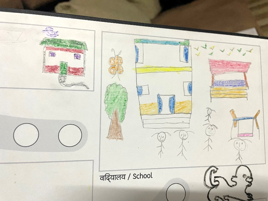
The game was so captivating in part due to its illustrations. These were done by artist Micheal Heap, who’s based at the Leeds Arts University. The initial illustrations were our “best guess” of how to represent a Nepali village. With neither of us having actually been to Nepal before, we based our drawings of houses and schools on those we could find on the internet. Of course, we also knew that this approach would fall short of capturing the vibrancy and life of Nepal, or the cultural cues known only to a native Nepali person. Because of this, we were keen to use Phase I of the trip to understand, artistically, how we could improve the game and embed it within a Nepali context. To do this, I ran a series of workshops with the children whilst in Nepal, encouraging them to draw their houses, villages, and surrounding environment on blank versions of the game boards. What we got back was a wealth of beautiful illustrations – dogs in characteristic Nepali style, flowers, butterflies, adorned temples, rice fields and tractors. These are the images that will bring the game to life.
Some of the children’s drawings. Houses, their school, a butterfly, and a Nepali dog.
Having returned from Nepal, the Disaster Ready! project is now in Phase II – re-development. This includes revising the illustrations on the board and cards based on the student’s drawings. We hope this will more fully capture the context of Nepal and give the students a sense of ownership over the game when it is sent back to them. Connecting with Nepali educators and teachers has also led to invaluable input into the game. This includes revising my attempts at Nepali translations – currently “passable” but overly formal for younger children and, I’m told, with an alarming lack of grammar. Phase II will also see the expansion of the game into other hazards such as wildfires, floods, and landslides. These hazards are felt more frequently than earthquakes by many communities in Nepal but can be just as devasting. The effects of climate change are anticipated to worsen the frequency and severity of these events in Nepal over the next few decades and the country is considered highly vulnerable to climate disasters by the UN.
Building these additional hazards into the Disaster Ready! game is therefore critical to a more holistic approach to community preparedness and risk education. Whilst the challenges of living with the threat of multiple hazards can be many, so too can the opportunities to increase preparedness and resilience to multiple events simultaneously. For example, an emergency bag is useful following an earthquake, but also after a flood, or whilst evacuating due to a wildfire. A community evacuation procedure can be adapted to multiple eventualities and even in its formation may strengthen the sense of collective preparedness and decision-making capacity within the community. This line of thinking can be extended well beyond the traditional disaster risk and preparedness remit. Many communities expressed that their primary vulnerability to disasters such as earthquakes, was in fact their everyday food precarity, lack of access to clean water, and the struggle to survive on incomes well below the poverty line. Asking people to pack non-perishable food in an emergency bag is hardly reasonable when they have insufficient food to eat that evening. In this sense, for many communities, installing a water tank, educating women, or providing agricultural training would do as much for disaster resilience as any DRR-specific actions, whilst simultaneously improving the day-to-day quality of life for many.
The future of the Disaster Ready! game remains somewhat uncertain, caught between ambitions for greater impact and a lack of funding to support our vision. Whilst in Nepal, many students and teachers asked to keep copies of the game, expressing their support for its continued use within their DRR curriculums. The five copies of the game that I took out with me were left for teachers and educators to continue to use, although ultimately, these will have only a very small impact in filling the large void of DRR resources in Nepal. This is where the vision for Phase III of the project comes in – expansion. What if we could print 150 copies of the game, to be distributed to 50 schools in Nepal? What impact could that have? Over 5 years this would translate to 15,000 students having played the Disaster Ready! game. By 2050 – the year that Nepal aims to be “disaster resilient” – over 75,000. These numbers have the potential to make a significant impact, locally, regionally, and maybe even nationally. Crucial to the success of any future phases of this project is of course partnering with and transferring autonomy over the game to local stakeholders. Phase III would therefore be carried out with an in-country partner such as an NGO or academic institution in Nepal, key to monitoring the use of the game over the next few years and evaluating its impact.
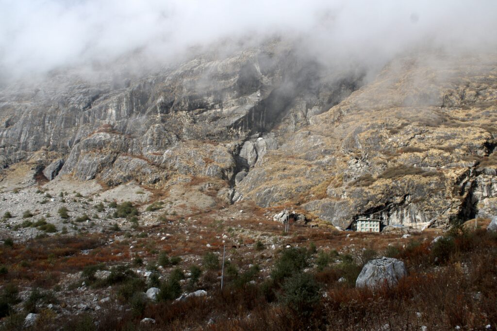
One of my final experiences in Nepal was to visit the village of Langtang, situated to the north of Kathmandu and accessible only by helicopter or 3 days of trekking through the jungle. For me, this experience came to represent many of the challenges that persist around delivering DRR education, both in Nepal and globally. But it also inspired me – this work is meaningful, necessary, and should be something that I strive to do throughout my career. The village of Langtang was one of the worst affected by the 2015 Gorkha earthquake, with over 300 casualties due to a landslide which all but wiped out the village. Walking along the hiking path through the valley you pass by what remains, now buried under 20 metres of rubble. My guide, Ram, explained that the landslide happened 30 minutes after the initial earthquake and that ultimately, the actions that people took in those intervening minutes proved critical. Those who were younger, and had generally had more access to education, knew that following the earthquake they should move into open space because of the increased risk of a landslide. These few people survived. But most people in the community, many of whom had never had the chance to engage with any DRR outreach or education, stayed behind. Sheltering in their homes, despite surviving the earthquake, they were left directly in the path of the landslide. The knowledge that saved lives, and that could have saved more if it had only been taught and shared more widely, can fundamentally be reduced down to only two sentences: “Landslide risk is higher following an earthquake. Move to open space and away from steep slopes”.
The remains of Langtang Village buried under the rubble of the landslide following the 2015 earthquake. Only one house, on the right, was left standing.
How many thousands of papers and conference presentations have been produced on the tectonics of the Himalayas? How many field campaigns have drawn on local knowledge and relied on the resources of local communities? And yet, for so many living in this region they did not have the most fundamental, two sentences of knowledge that would have kept them safe. This is in part the result of decades of so-called “helicopter research”, predominantly out of western universities and institutions. If colonial-era science was used to justify the exploitation of resources, then perhaps science under neocolonialism is marked by the extraction of knowledge without a commitment to reciprocity, dialogue, or delivering concrete benefit to communities in whose backyards we are working. This is one of my most lasting impressions – that sharing knowledge, in a way that truly empowers people and communities to understand their environment and to make their own decisions on preparedness and resilience, is fundamental to doing both DRR work and science well. The geoscience community has such a wealth of knowledge and resources, but currently this is struggling to reach the people that need it most. I sincerely hope that projects like Disaster Ready! will contribute to towards bridging this gap.
Want to support the project?
We are currently looking for funding to support Phase III of the project. If you know of suitable funding streams which could be worth applying to please reach out! Or if you have experience of DRR outreach, especially through “serious games” then we would love to collaborate and hear more.
Acknowledgements
A warm thank you to all those who have and continue to support the Disaster Ready! Project: Soroptimist International Leeds, COMET, Volunteers Initiative Nepal (VIN), Dr Claire Quinn, Dr Laura Gregory, Dr Peter Sutoris, Micheal Heap, and Nirmala Karki.
Manage Consent
To provide the best experiences, we use technologies like cookies to store and/or access device information. Consenting to these technologies will allow us to process data such as browsing behavior or unique IDs on this site. Not consenting or withdrawing consent, may adversely affect certain features and functions.
Functional
Always active
The technical storage or access is strictly necessary for the legitimate purpose of enabling the use of a specific service explicitly requested by the subscriber or user, or for the sole purpose of carrying out the transmission of a communication over an electronic communications network.
Preferences
The technical storage or access is necessary for the legitimate purpose of storing preferences that are not requested by the subscriber or user.
Statistics
The technical storage or access that is used exclusively for statistical purposes.The technical storage or access that is used exclusively for anonymous statistical purposes. Without a subpoena, voluntary compliance on the part of your Internet Service Provider, or additional records from a third party, information stored or retrieved for this purpose alone cannot usually be used to identify you.
Marketing
The technical storage or access is required to create user profiles to send advertising, or to track the user on a website or across several websites for similar marketing purposes.