
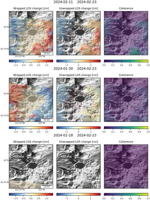
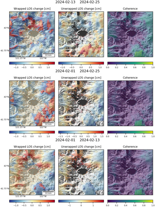
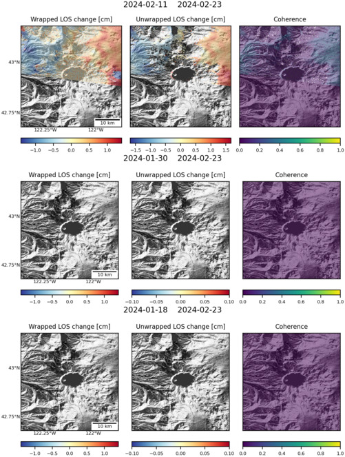
Observations of Deformation
| Volcano number: | 322160 |
|---|---|
| Region: | Canada and Western USA |
| Country: | United States |
| Geodetic measurements? | Yes |
| Deformation observation? | No |
| Measurement method(s): | GPS - continuous, EDM |
| Duration of observation: | 1980 - 1984, 2009 - present |
| Characteristics of deformation: | In 1980-1984 the U.S Geological Survey established and remeasured a trilateration network at Crater Lake, measuring slope distances with EDM. Repeat measurements of this network were probably within measurement error (Chadwick et al. 1985). |
| Reference(s): | Chadwick, W. W., Iwatsubo, E. Y., Swanson, D. A., and Ewert, J. W. (1985) Measurements of Slope Distances and Vertical Angles at Mount Baker and Mount Rainier, Washington, Mount Hood and Crater Lake, Oregon, and Mount Shasta and Lassen Peak, California, 1980-1984, US Department of the Interior, Geological Survey, Open File Report 85-205. |
| USGS Cascades Volcano Observatory (CVO) website http://volcanoes.usgs.gov/volcanoes/crater_lake/crater_lake_monitoring_125.html | |
| Location: | 42.93, -122.12 |
| REST API endpoint (JSON): | https://comet.nerc.ac.uk/wp-json/volcanodb/v1/volcano/403 |
Latest Sentinel-1 Data
Size: 501px x 669px (168.58 KB)
Size: 501px x 668px (172.77 KB)
Size: 501px x 669px (160.89 KB)