
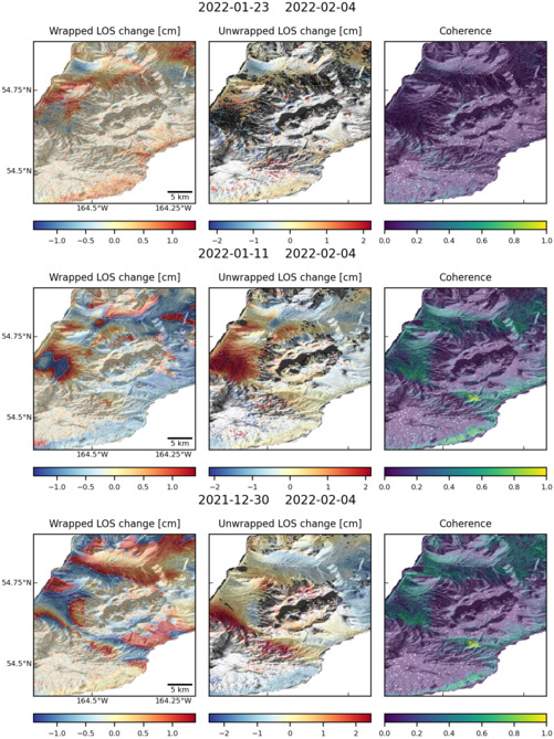
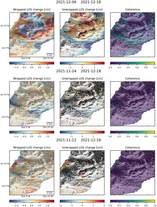
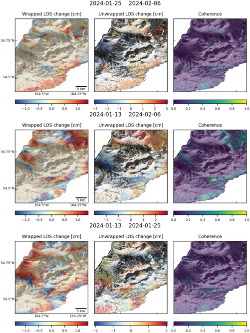
Observations of Deformation
| Volcano number: | 311350 |
|---|---|
| Region: | Alaska |
| Country: | United States |
| Geodetic measurements? | Yes |
| Deformation observation? | Yes |
| Measurement method(s): | InSAR, GPS - campaign |
| Duration of observation: | 1992 - 2000, 2003 - 2010 |
| Inferred cause(s) of deformation: | Hydrothermal, Magmatic, Uncertain |
| Characteristics of deformation: | GPS and InSAR measurements show that Fisher caldera has subsided at ~15 mm/yr between 1992 – 2010. Subsidence is modelled equally well by point, sill, and spheroid sources at depths of 4.5 – 7.5 km. The best fitting sill is 7 – 11 km long, 0.7 – 2.0 km wide and strikes N35° – 55º. Subsidence is attributed to cooling and crystallisation of magma intruded prior to the first deformation measurements. An alternative source would be a reduction of pore fluid pressure due to cooling of the hydrothermal system. |
| Reference(s): | Mann, Dorte, and Freymueller, J., 2003, Volcanic and tectonic deformation on Unimak Island in the Aleutian Arc, Alaska: Journal of Geophysical Research, v. 108, n. 2, p. 1-12. |
| Lu, Z., and Dzurisin, D., 2014, InSAR imaging of Aleutian volcanoes: Chichester, UK, Springer-Praxis, 390 p. | |
| U.S. Geological Survey Alaska Volcano Observatory (AVO) website http://www.avo.alaska.edu/volcanoes/volcinfo.php?volcname=Fisher | |
| Location: | 54.65, -164.43 |
| REST API endpoint (JSON): | https://comet.nerc.ac.uk/wp-json/volcanodb/v1/volcano/889 |
Latest Sentinel-1 Data
Size: 501px x 669px (160.35 KB)
Size: 501px x 660px (151.65 KB)
Size: 501px x 668px (155.58 KB)