
Observations of Deformation
| Volcano number: | 384010 |
|---|---|
| Region: | Atlantic Ocean |
| Country: | Cape Verde |
| Geodetic measurements? | Yes |
| Deformation observation? | Yes |
| Measurement method(s): | InSAR, GPS - campaign, Tiltmeter, Seismic, CO2, microgravity |
| Duration of observation: | 1993 to 2008, 1998 to 2001 |
| Inferred cause(s) of deformation: | Magmatic, Faulting/tectonics |
| Characteristics of deformation: | Fogo erupted in April 1995 after 43 years of dormancy. About 46 10^6 m^3 of lava erupted during 7.5 weeks from vents on the SW flank of Pico do Fogo into Cha das Caldeiras. ERS SAR data between 1993–1998 show ground deformation due to a feeder dike but lack evidence for any volcano-wide deformation related to volume changes of a shallow magma reservoir. This suggests that Fogo is fed from a relatively deep, mantle-lithospheric source (>16.5 km depth), consistent with petrological data (Amelung & Day, 2002). |
| Reference(s): | Amelung, F., & Day, S. (2002). InSAR observations of the 1995 Fogo, Cape Verde, eruption: Implications for the effects of collapse events upon island volcanoes. Geophysical research letters, 29(12), 47-1. |
| Fonseca, J. F., Faria, B. V., Lima, N. P., Heleno, S. I., Lazaro, C., d’Oreye, N. F., ... & Matos, J. L. (2003). Multiparameter monitoring of Fogo Island, Cape Verde, for volcanic risk mitigation. Journal of volcanology and geothermal research, 125(1), 39-56. | |
| Smithsonian Institution Global Volcanism Program http://www.volcano.si.edu/volcano.cfm?vn=384010 | |
| Location: | 14.95, -24.35 |
| REST API endpoint (JSON): | https://comet.nerc.ac.uk/wp-json/volcanodb/v1/volcano/1300 |
Latest Sentinel-1 Data
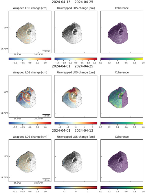
Size: 501px x 669px (75.36 KB)

Size: 501px x 669px (81.10 KB)
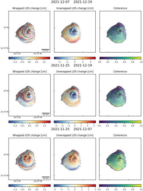
Size: 501px x 668px (81.20 KB)
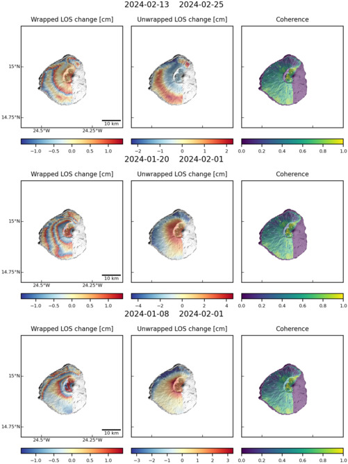
Size: 501px x 669px (77.93 KB)