
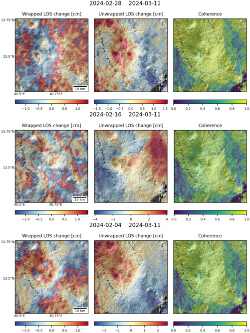
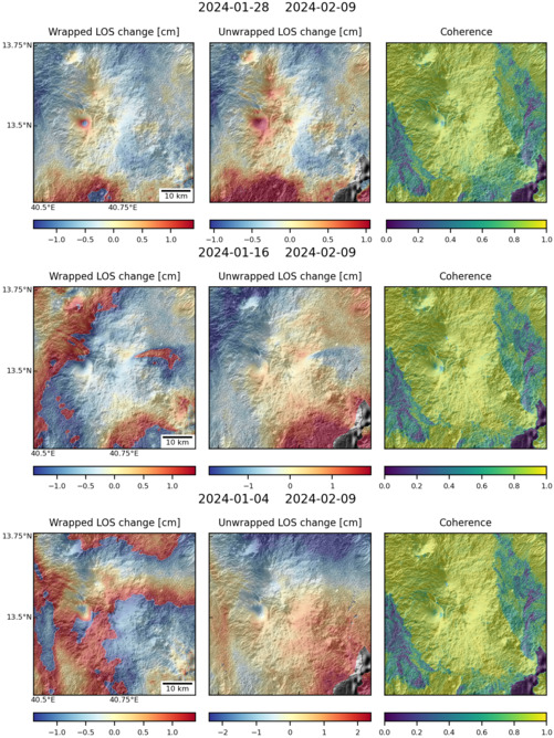
Observations of Deformation
| Volcano number: | 221091 |
|---|---|
| Region: | Africa and Red Sea |
| Country: | Ethiopia |
| Geodetic measurements? | Yes |
| Deformation observation? | No |
| Measurement method(s): | InSAR |
| Duration of observation: | 2005 - 2010 |
| Characteristics of deformation: | Hayli Gubbi is the southernmost volcano in the Erta Ale range. Pagli et al. (2014), for the purposes of investigating regional velocity fields, have looked at Envisat InSAR data covering this volcano. They report no deformation. |
| Reference(s): | Pagli, C. et al., 2014. Current plate boundary deformation of the Afar rift from a 3-D velocity field inversion of InSAR and GPS. Journal of Geophysical Research: Solid Earth, 119(11), pp. 8562-8575. |
| NASA Landsat7 image (worldwind.arc.nasa.gov) n.d. | |
| Location: | 13.5, 40.72 |
| REST API endpoint (JSON): | https://comet.nerc.ac.uk/wp-json/volcanodb/v1/volcano/5243 |
Latest Sentinel-1 Data
Size: 501px x 669px (181.12 KB)
Size: 501px x 669px (174.72 KB)