
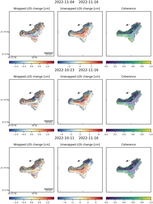
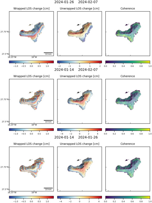
Observations of Deformation
| Volcano number: | 383020 |
|---|---|
| Region: | Atlantic Ocean |
| Country: | Spain |
| Geodetic measurements? | Yes |
| Deformation observation? | Yes |
| Measurement method(s): | InSAR, GPS - continuous, GPS - campaign, Tiltmeter |
| Inferred cause(s) of deformation: | Magmatic |
| Characteristics of deformation: | Deformation is associated with a period of unrest and eruption during 2011 to 2012. On 12 October 2011, a submarine NW-SE fissural eruption commenced. |
| Reference(s): | López, C., Blanco, M. J., Abella, R., Brenes, B., Cabrera Rodríguez, V. M., Casas, B., & Villasante‐Marcos, V. (2012). Monitoring the volcanic unrest of El Hierro (Canary Islands) before the onset of the 2011–2012 submarine eruption. Geophysical Research Letters, 39(13). |
| González, P. J., Samsonov, S. V., Pepe, S., Tiampo, K. F., Tizzani, P., Casu, F., ... & Sansosti, E. (2013). Magma storage and migration associated with the 2011–2012 El Hierro eruption: Implications for crustal magmatic systems at oceanic island volcanoes. Journal of Geophysical Research: Solid Earth, 118(8), 4361-4377. | |
| Arnoso, J., F. G. Montesinos, M. Benavent, and E. J. Vélez (2012), The 2011 volcanic crisis at El Hierro (Canary Islands): monitoring ground deformation through tiltmeter and gravimetric observations, Geophys. Res. Abstr., 14, EGU2012–5373. | |
| Smithsonian Institution Global Volcanism Program http://www.volcano.si.edu/volcano.cfm?vn=383020 | |
| Location: | 27.73, -18.03 |
| REST API endpoint (JSON): | https://comet.nerc.ac.uk/wp-json/volcanodb/v1/volcano/1287 |
Latest Sentinel-1 Data
Size: 501px x 669px (73.50 KB)
Size: 501px x 669px (74.98 KB)