Karymsky

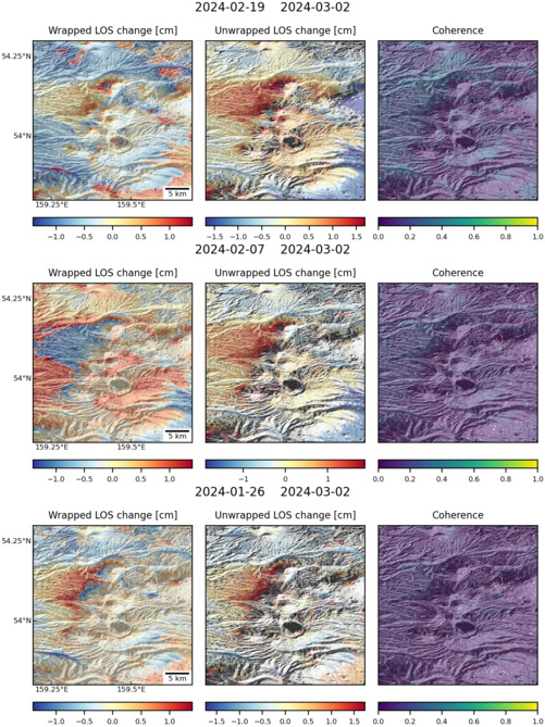
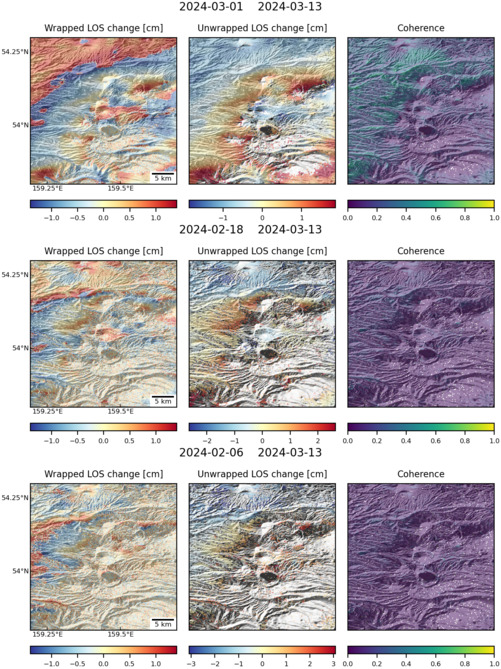
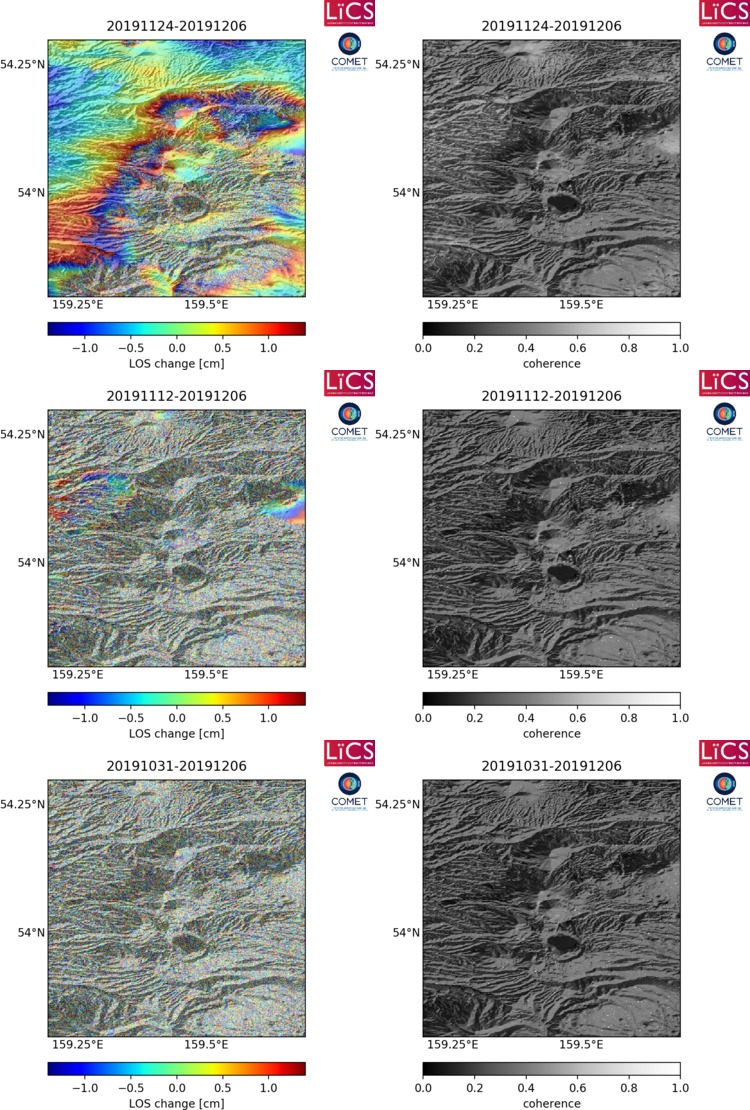
Observations of Deformation

Volcano number:300130
Region:
Country:Russia
Geodetic measurements?Yes
Deformation observation?Yes
Measurement method(s):InSAR, Levelling, triangulation
Duration of observation:1975 - present; 1992 to 2003 (InSAR)
Inferred cause(s) of deformation:Magmatic
Characteristics of deformation:

Repeated geodetic measurements since 1975 revealed ongoing activity in Karymsky Volcanic Center (Walter, 2007).  At a small scale, co-eruptive subsidence has been measured during an eruptive phases in (Maguskin and Sharoglazova, 1993).
At a larger scale, widespread extension is measured between Karymsky Stratovolcano and Akademia Nauk Caldera. Overall, deformation is characterised by continuous extension. Walter (2007) summarises this deformation as:  “The horizontal deformation data suggest almost continuous extension since 1975 (Maguskin and Sharoglazova, 1993). A distance increase was measured during the eruptive phase from 1975–1977; elongation then decreased and even reversed to become a slight distance shortening at the end of the eruptive period (1981–1983). After the eruptive period ended in 1983, a distance increase was measured again (Maguskin and Sharoglazova, 1993). The distance further increased until 1995, so that at least an 11-year period of extensional deformation preceded the 1996 eruption.”
As the spatial pattern of deformation is radial-extensional, authors suggest that deformation is due to magma accumulation in the crust within magma reservoirs (Maguskin and Sharoglazova, 1993). Two magma reservoirs are proposed: a small shallow reservoir is thought to exist at a depth of 4–5 km (Gordeev et al., 1998a and Gordeev et al., 1998b); and a larger, potentially common source below Karymsky Volcano and Akademia Nauk Caldera, possibly at a depth of 18 km Fedotov (1998). 
In 1983-1996 deformation was characterised by inflation and studies show that is was likely due to a deep reservoir (Maguskin and Sharoglazova, 1993 and Zobin et al., 2003), maybe in a north–south elongated form (Pavlov et al., 2003).
Pritchard and Simons present ERS-1 and -2 and RADARSAT data for northern Kamchatka between 1992 and 2003, although most volcanoes are only covered during the last three years. A complete list is found in GSA Data Repository Item 2004139.
The Institute of Volcanology and Seismology (IVS FEB RAS) and Kamchatka Volcanic Eruption Response Team (KVERT) are responsible for monitoring volcanoes and providing aviation alerts.

Reference(s):Zobin, V. M., Levina, V. I., & Maguskin, M. A. (2003). Seismicity and crustal deformation preceding the January 1996 eruptions at Karymsky Volcanic Center, Kamchatka. Bulletin of volcanology, 65(7), 477-485.
Pritchard, M. E., & Simons, M. (2004). Surveying volcanic arcs with satellite radar interferometry: The central Andes, Kamchatka, and beyond. GSA Today, 14(8), 4-11.
GSA Data Repository Item 2004139. Tables DR1 and DR2 and Figures DR1–DR3, is available on request from Documents Secretary, GSA, P.O. Box 9140, Boulder, CO 80301-9140, USA, editing@geosociety.org, or at www.geosociety.org/pubs/ft2004.htm
Smithsonian Institution Global Volcanism Program
http://www.volcano.si.edu/volcano.cfm?vn=300130
Walter, T. R. (2007). How a tectonic earthquake may wake up volcanoes: Stress transfer during the 1996 earthquake–eruption sequence at the Karymsky Volcanic Group, Kamchatka. Earth and Planetary Science Letters, 264(3), 347-359.
Location:54.049, 159.443
REST API endpoint (JSON):https://comet.nerc.ac.uk/wp-json/volcanodb/v1/volcano/5352

Latest Sentinel-1 Data

Filename: karymsky_038A_03576_131307.jpg
Size: 501px x 669px (177.67 KB)
Filename: karymsky_060D_03564_141313.jpg
Size: 501px x 669px (177.51 KB)
Filename: karymsky_060D_03564_131313.jpg
Size: 750px x 1110px (296.02 KB)