Observations of Deformation
| Volcano number: | 311080 |
|---|---|
| Region: | Iceland and Arctic Ocean |
| Country: | Iceland |
| Geodetic measurements? | Yes |
| Deformation observation? | No |
| Measurement method(s): | InSAR, EDM, LiDAR |
| Inferred cause(s) of deformation: | ArrayIce cap research / Glacier |
| Characteristics of deformation: |
The different snow and ice types on a glacier may be subdivided according to the glacier-facies concept. The surticial expression of some facies may be detected at the end ofthe balance year by the use ofvisible and near-infrared image data from the Landsat multispectral scanner (MSS) and thematic mapper (TM) sensors (Williams et al., 1991)
The construction of digital elevation models (DEMs) of glaciers, ice caps, and ice sheets is an important application of remote sensing in glaciology. DEMs are used to determine mass balance via volume change (Haeberli et al. 1999; Krabill et al. 1999; Barrand et al.,), to delineate catchments of ice and water flow (Elvehøy, et al., 2009), and as inputs to hydrology and ice flow models (e.g. Kääb and Funk 1999; Hubbard et al. 2000 ; Arnold et al. 2006b; Joughin et al. 2009). Remote-sensing technologies have been a boon to this field, reducing the effort needed for fieldwork and extending coverage to previously inaccessible locations. Satellite radar and laser altimetry have been particularly useful, because the techniques measure surface elevation directly (Bamber and Rivera 2007). Although satellite altimetry is highly accurate over large areas, its relatively low spatial resolution means it can only be used at the scale of large glaciated regions, ice caps, and ice sheets (Rignot et al., 2003; Zwally et al. 2005; Pritchard et al. 2009; Moholdt et al. 2010). For this reason, higher resolution multispectral satellite imagery or airborne data are often used for studying smaller ice caps and mountain glaciers (Pope et al., 2013). |
| Reference(s): | Williams, R. S., Hall, D. K., & Benson, C. S. (1991). Analysis of glacier facies using satellite techniques. Journal of Glaciology, 37(125), 120-128. |
| Pope, A. J. (2009). Recent Changes to Langjökull Icecap, Iceland: An investigation integrating airborne LiDAR and satellite imagery (Doctoral dissertation, Scott Polar Research Institute, University of Cambridge). | |
| Pope, A., Willis, I. C., Rees, W. G., Arnold, N. S., & Pálsson, F. (2013). Combining airborne lidar and Landsat ETM+ data with photoclinometry to produce a digital elevation model for Langjökull, Iceland. International journal of remote sensing, 34(4), 1005-1025. | |
| Location: | 64.85, -19.7 |
| REST API endpoint (JSON): | https://comet.nerc.ac.uk/wp-json/volcanodb/v1/volcano/4226 |
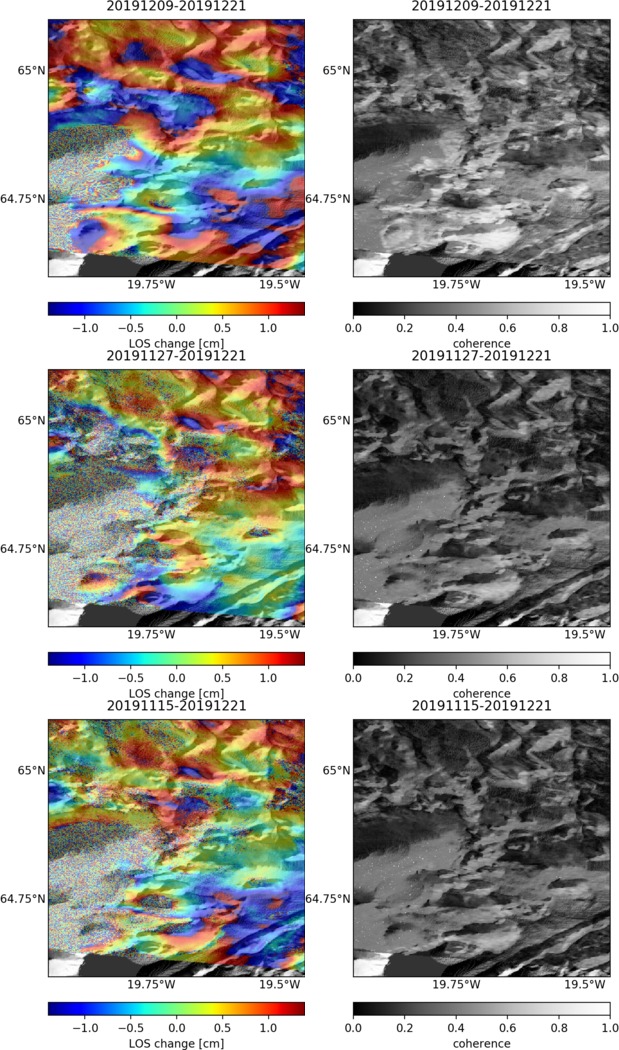
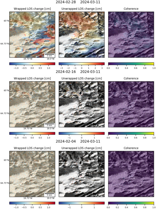
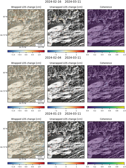
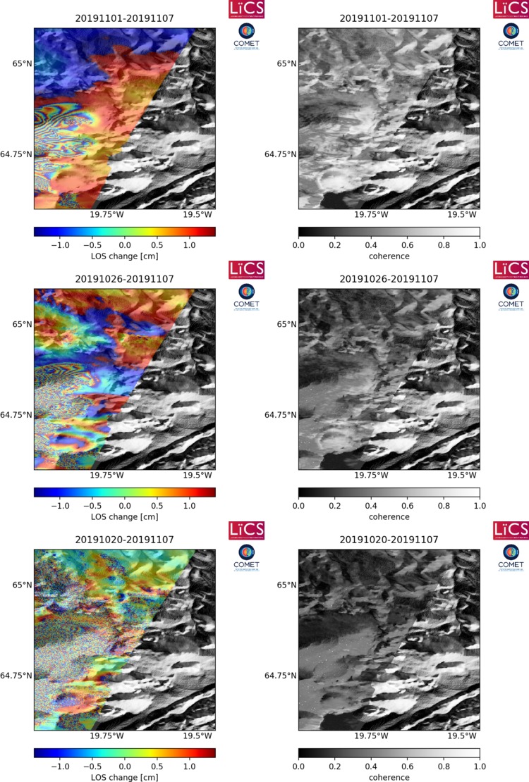
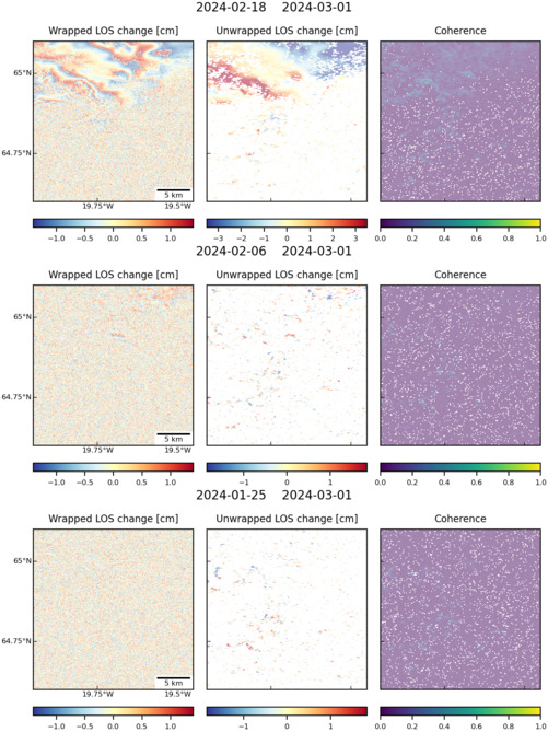
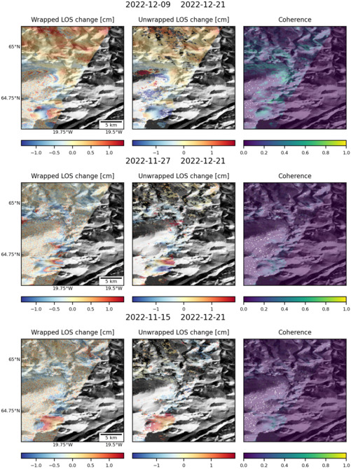
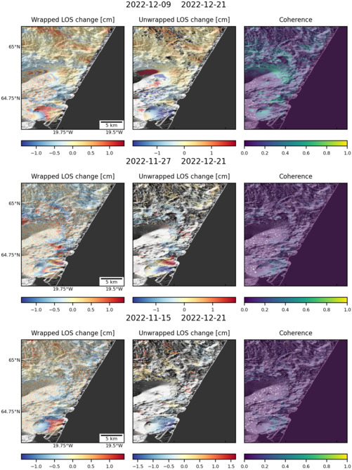
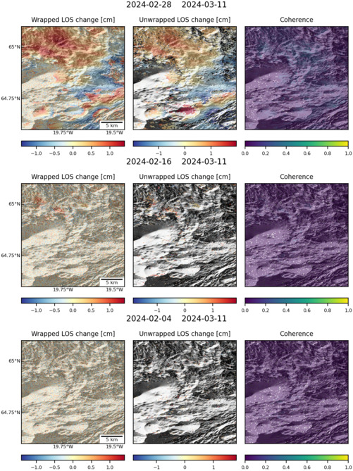
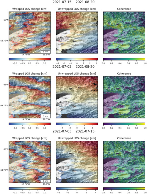
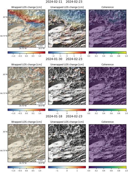
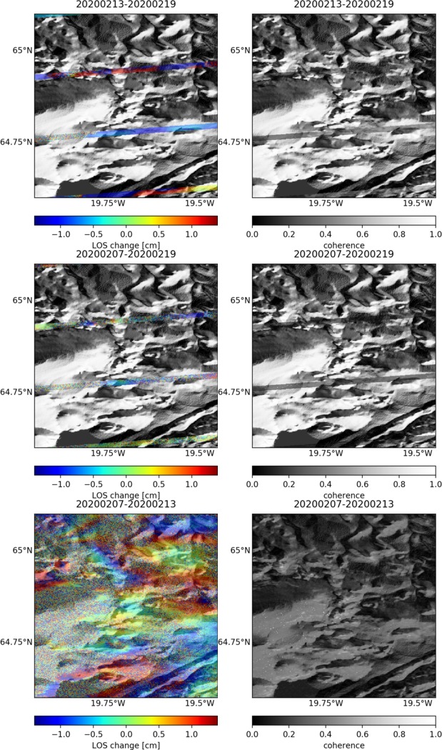
Latest Sentinel-1 Data

Size: 501px x 666px (154.85 KB)
Size: 619px x 1050px (225.72 KB)
Size: 501px x 669px (160.63 KB)
Size: 501px x 669px (174.78 KB)
Size: 750px x 1110px (247.83 KB)
Size: 501px x 669px (134.09 KB)
Size: 501px x 669px (154.51 KB)

Size: 501px x 669px (134.59 KB)
Size: 501px x 669px (133.57 KB)
Size: 501px x 669px (171.00 KB)
Size: 501px x 669px (174.93 KB)
Size: 501px x 669px (172.04 KB)
Size: 619px x 1050px (232.66 KB)