
Observations of Deformation
| Volcano number: | 221115 |
|---|---|
| Region: | Africa and Red Sea |
| Country: | Ethiopia |
| Geodetic measurements? | Yes |
| Deformation observation? | Yes |
| Measurement method(s): | InSAR, GPS - continuous |
| Duration of observation: | 2005 - 2009 |
| Inferred cause(s) of deformation: | Magmatic |
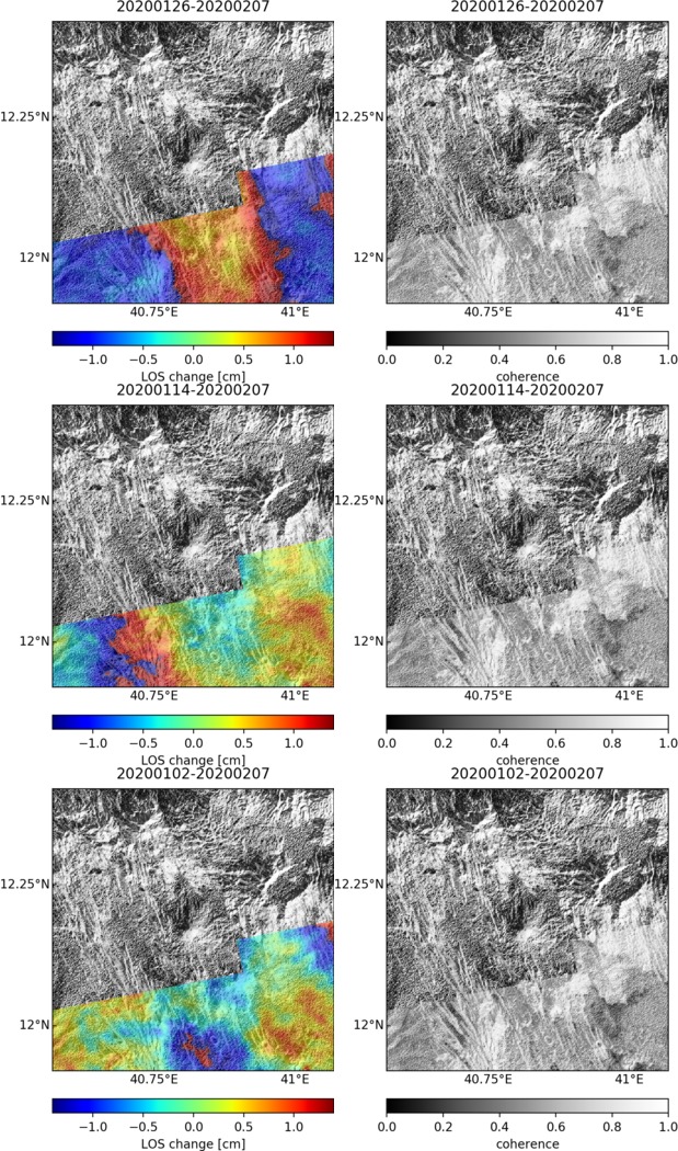
| Characteristics of deformation: | Manda Hararo sits within the faulted and fissured Karhabi graben. In 2009 a field observations, undertaken following a measurement of high SO2 from the area, identified a’a basalt flows originating from 4-5 km fissures. The earliest dyke intrusion recorded geodetically date from 2005. InSAR studies (Gradin et al. 2010a) report seperate 13 dyke intrusions between 2005 and 2009. Kinematic inversions from Gradin et al. (2010a) of InSAR data reveal that dikes, at an average 5 km depth, opened by 0.8–3.5 m throughout this time. It is estimated each have volumes of 0.04–0.2 km3. The September 2005 megadyke had a length of 60 km (Hamling et al. 2014), 12 m opening and a volume greater than 1 km3 (Gradin et al. 2010a). See Gradin et al. (2010b) Figure 1 for timeline of dyke intrusions 2005 – 2009. |
| Reference(s): | Grandin, R., Socquet, A., Jacques, E., Mazzoni, N., de Chabalier, J. B., & King, G. C. P. (2010a). Sequence of rifting in Afar, Manda‐Hararo rift, Ethiopia, 2005–2009: Time‐space evolution and interactions between dikes from interferometric synthetic aperture radar and static stress change modeling. Journal of Geophysical Research: Solid Earth (1978–2012), 115(B10). |
| Grandin, R., A. Socquet, M.-P. Doin, E. Jacques, J.-B. de Chabalier, and G. C. P. King (2010b), Transient rift opening in response to multiple dike injections in the Manda Hararo rift (Afar, Ethiopia) imaged by time-dependent elastic inversion of interferometric synthetic aperture radar data, J. Geophys. Res., 115, B09403, doi:10.1029/2009JB006883. | |
| Grandin, R., et al. (2009), September 2005 Manda Hararo-Dabbahu rifting event, Afar (Ethiopia): Constraints provided by geodetic data, J. Geophys. Res., 114, B08404, doi:10.1029/2008JB005843. | |
| Hamling, Ian J., Atalay Ayele, Laura Bennati, Eric Calais, Cynthia J. Ebinger, Derek Keir, Elias Lewi, Tim J. Wright, and Gezahegn Yirgu. (2009). Geodetic observations of the ongoing Dabbahu rifting episode: new dyke intrusions in 2006 and 2007. Geophysical Journal International 178, no. 2. 989-1003 | |
| Nasa Landsat Imagery 1999. | |
| Location: | 12.17, 40.82 |
| REST API endpoint (JSON): | https://comet.nerc.ac.uk/wp-json/volcanodb/v1/volcano/1373 |
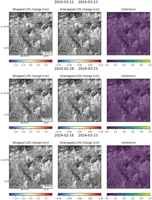
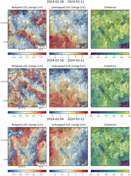
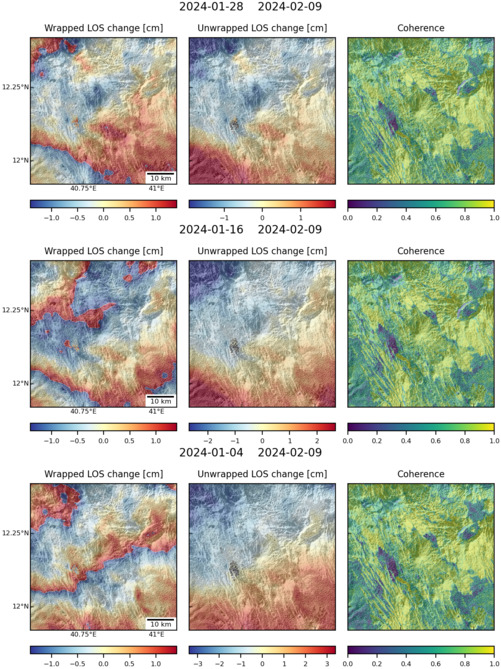
Latest Sentinel-1 Data
Size: 619px x 1050px (283.36 KB)
Size: 501px x 660px (137.32 KB)
Size: 501px x 669px (181.41 KB)
Size: 501px x 669px (177.35 KB)