
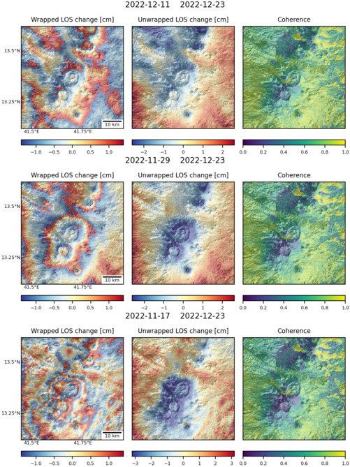
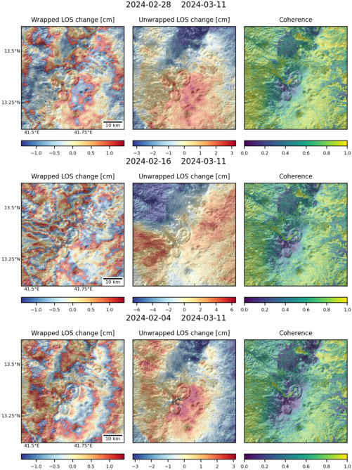
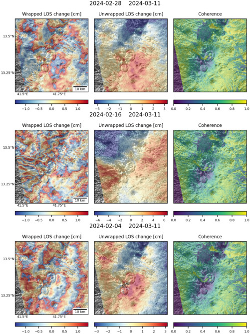
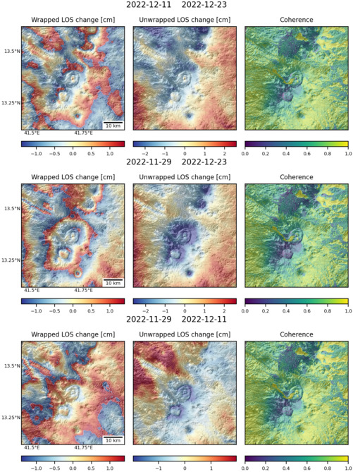
Observations of Deformation
| Volcano number: | 221101 |
|---|---|
| Region: | Africa and Red Sea |
| Country: | Eritrea |
| Geodetic measurements? | Yes |
| Deformation observation? | Yes |
| Measurement method(s): | InSAR, Lidar |
| Duration of observation: | 4 Months from June to September 2011/ 11 days for the TerraSar-X and 9 days for the COSMO-SkyMed satellite images |
| Inferred cause(s) of deformation: | Surface deposits, Eruption deposits |
| Reference(s): | Sawamura, P., Vernier, J. P., Barnes, J. E., Berkoff, T. A., Welton, E. J., Alados-Arboledas, L., & Lange, D. (2012). Stratospheric AOD after the 2011 eruption of Nabro volcano measured by lidars over the Northern Hemisphere. Environmental Research Letters, 7(3), 034013. |
| Goitom, B., Oppenheimer, C., Hammond, J. O., Grandin, R., Barnie, T., Donovan, A., ... & Carn, S. A. (2015). First recorded eruption of Nabro volcano, Eritrea, 2011. Bulletin of volcanology, 77(10), 85. | |
| Location: | 13.37, 41.7 |
| REST API endpoint (JSON): | https://comet.nerc.ac.uk/wp-json/volcanodb/v1/volcano/4204 |
Latest Sentinel-1 Data
Size: 501px x 669px (176.47 KB)
Size: 501px x 668px (184.30 KB)
Size: 501px x 669px (185.28 KB)
Size: 501px x 669px (173.36 KB)