Observations of Deformation
| Volcano number: | 263100 |
|---|---|
| Region: | Indonesia |
| Country: | Java |
| Geodetic measurements? | Yes |
| Deformation observation? | Yes |
| Measurement method(s): | GPS - campaign |
| Duration of observation: | 10/1998; 03/1999; 12/1999; 06/2001; 11/2002; 06/2003 |
| Inferred cause(s) of deformation: | Magmatic, Uncertain |
| Characteristics of deformation: | Papandayan is fortunate enough to be the site of a large and well-established network of seven GPS stations, and campaign surveys monitoring deformation of the volcano first began in 1998, carried out by the Department of Geodetic Engineering, Institute of Technology, Bandung. A 2006 paper by Abidin et al summarises seven such surveys over a period of five years, including the recent eruption which occurred November-December 2002. |
| Reference(s): | Abidin, H.Z. et al. 2006. Ground deformation of Papandayan volcano before, during, and after the 2002 eruption as detected by GPS surveys. GPS Solutions, 10 (2), 75-84 |
| Janssen, V. et al. 2002. Low-cost GPS-based volcano deformation monitoring at Mt. Papandayan, Indonesia. Journal of Volcanology and Geothermal Research, 115 (1-2), 139-151 | |
| Location: | -7.32, 107.73 |
| REST API endpoint (JSON): | https://comet.nerc.ac.uk/wp-json/volcanodb/v1/volcano/3935 |
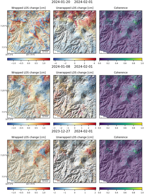
Latest Sentinel-1 Data

Size: 501px x 672px (185.33 KB)

Size: 501px x 672px (188.94 KB)

Size: 734px x 1110px (310.62 KB)
