
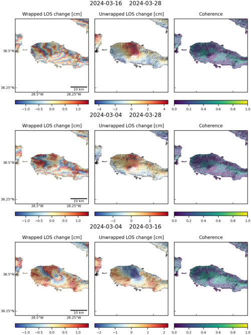
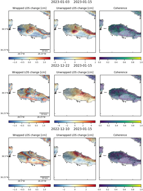
Observations of Deformation
| Volcano number: | 382020 |
|---|---|
| Region: | Atlantic Ocean |
| Country: | Portugal |
| Geodetic measurements? | Yes |
| Deformation observation? | Yes |
| Measurement method(s): | InSAR, GPS - campaign |
| Inferred cause(s) of deformation: | Surface deposits, Uncertain |
| Characteristics of deformation: | An integrated InSAR and GPS vertical deformation map, between 2006 and 2010, identified subsidence of the summit crater of Pico Island at a rate of 9 mm/yr (Catalão et al., 2010). |
| Reference(s): | Catalão, J., Nico, G., Hanssen, R., & Catita, C. (2010). Integration of INSAR and GPS for vertical deformation monitoring: a case study in Faial and Pico islands. In Proc. Fringe 2009 Workshop, Frascati, Italy (Vol. 30). |
| Hildenbrand, A., Marques, F. O., Catalão, J., Catita, C. M. S., & Costa, A. C. G. (2012). Large-scale active slump of the southeastern flank of Pico Island, Azores. Geology, 40(10), 939-942. | |
| Smithsonian Institution Global Volcanism Program http://www.volcano.si.edu/volcano.cfm?vn=382020 | |
| Location: | 38.47, -28.4 |
| REST API endpoint (JSON): | https://comet.nerc.ac.uk/wp-json/volcanodb/v1/volcano/961 |
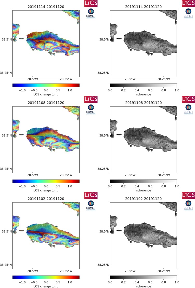
Latest Sentinel-1 Data
Size: 501px x 669px (93.34 KB)
Size: 501px x 666px (87.98 KB)
Size: 750px x 1110px (141.38 KB)