
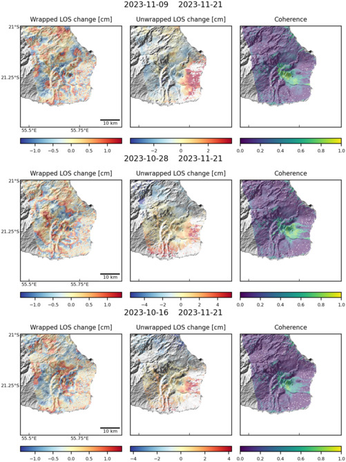
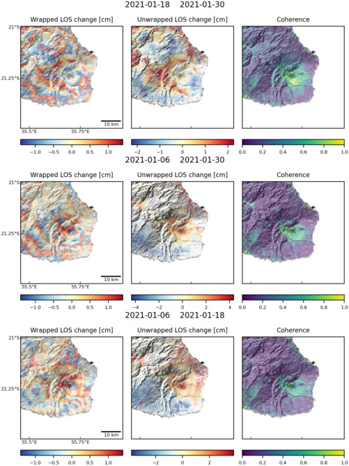
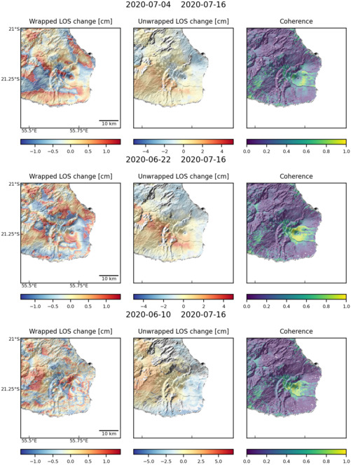
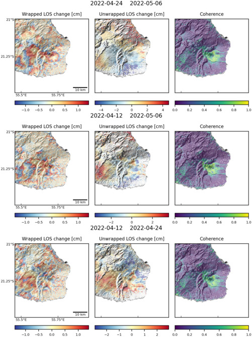
Observations of Deformation
| Volcano number: | 233020 |
|---|---|
| Region: | Middle East and Indian Ocean |
| Country: | France |
| Geodetic measurements? | Yes |
| Deformation observation? | Yes |
| Measurement method(s): | InSAR, GPS - continuous |
| Duration of observation: | 2003, 2004 to present |
| Inferred cause(s) of deformation: | Magmatic |
| Characteristics of deformation: | Piton de la Fournaise volcano forms the SE part of La Réunion, an oceanic basaltic island, with high eruptive frequency of the Piton de La Fournaise volcano of two eruptions per year.
|
| Reference(s): | Froger, J. L., Fukushima, Y., Briole, P., Staudacher, T., Souriot, T., & Villeneuve, N. (2004). The deformation field of the August 2003 eruption at Piton de la Fournaise, Reunion Island, mapped by ASAR interferometry. Geophysical research letters, 31(14). |
| Smithsonian Institution Global Volcanism Program http://www.volcano.si.edu/volcano.cfm?vn=233020 | |
| Peltier, A., M. Bianchi, E. Kaminski, J-C Komorowski, A. Rucci, T. Staudacher (2010a), PSInSAR as a new tool to monitor pre-eruptive volcano ground deformation: validation using GPS measurements on Piton de la Fournaise, Geophys. Res. Lett., 37, L12301, doi:10.1029/2010GL043846 | |
| Location: | -21.244, 55.708 |
| REST API endpoint (JSON): | https://comet.nerc.ac.uk/wp-json/volcanodb/v1/volcano/1895 |
Latest Sentinel-1 Data
Size: 501px x 669px (125.33 KB)
Size: 501px x 669px (128.17 KB)
Size: 501px x 663px (118.84 KB)
Size: 501px x 669px (128.98 KB)