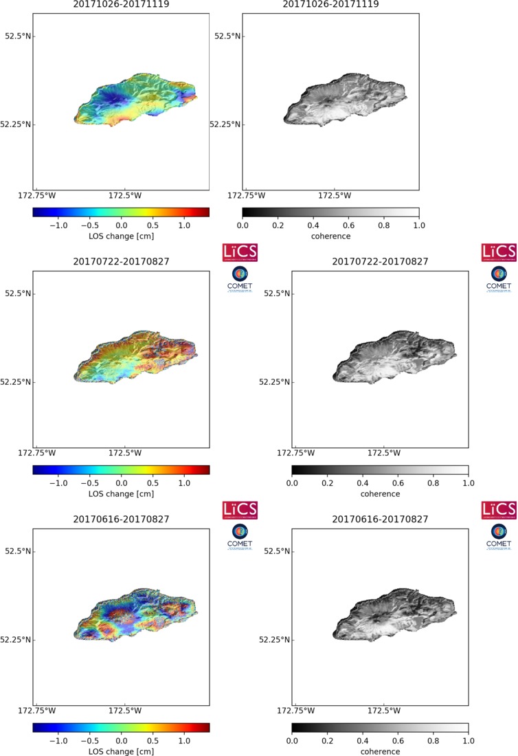
Observations of Deformation
| Volcano number: | 311180 |
|---|---|
| Region: | Alaska |
| Country: | United States |
| Geodetic measurements? | Yes |
| Deformation observation? | Yes |
| Measurement method(s): | InSAR |
| Duration of observation: | 1992 - 2007 |
| Characteristics of deformation: | There are two centers of deformation on Seguam island. The caldera on the western half of the island is characterised by a constant subsidence rate of 1.5 cm/yr. Deformation on the eastern half of the island is variable in time alternating between periods of uplift and subsidence. During 1993, coeruptive interferograms show uplift at a rate of ~5 cm/yr. Subsidence then occurred between late 1993 – late 2008 at a rate of ~1.6 cm/yr. Until September 2000, uplift resumed at an average rate of ~2 cm/yr. Between September 2000 and July 2005, the volcano again subsided at ~1.4 cm/yr and finally from July 2005 – 2007, the volcano uplifted at ~0.8 cm/yr. |
| Reference(s): | Price, E. J. (2004). Dynamic deformation of Seguam Island, Aleutian Islands, Alaska, 1993–2000: Implications for magmatic and hydrothermal processes. Journal of Geophysical Research, 109(4), 15. doi:10.1029/2003JB002671. |
| Masterlark, T., & Lu, Z. (2004). Transient volcano deformation sources imaged with InSAR—application to Seguam island. Journal of Geophysical Research, 109, B01401. doi:10.1029/ 2003JB002568. | |
| Lee, C. W., Lu, Z., Won, J. S., Jung, H. S., & Dzurisin, D. (2013). Dynamic deformation of Seguam Island, Alaska, 1992–2008, from multi-interferogram InSAR processing. Journal of Volcanology and Geothermal Research, 260, 43–51. | |
| Lu, Z., and Dzurisin, D., 2014, InSAR imaging of Aleutian volcanoes: Chichester, UK, Springer-Praxis, 390 p. | |
| U.S. Geological Survey Alaska Volcano Observatory (AVO) website http://www.avo.alaska.edu/volcanoes/volcinfo.php?volcname=Seguam | |
| Location: | 52.315, -172.51 |
| REST API endpoint (JSON): | https://comet.nerc.ac.uk/wp-json/volcanodb/v1/volcano/1018 |
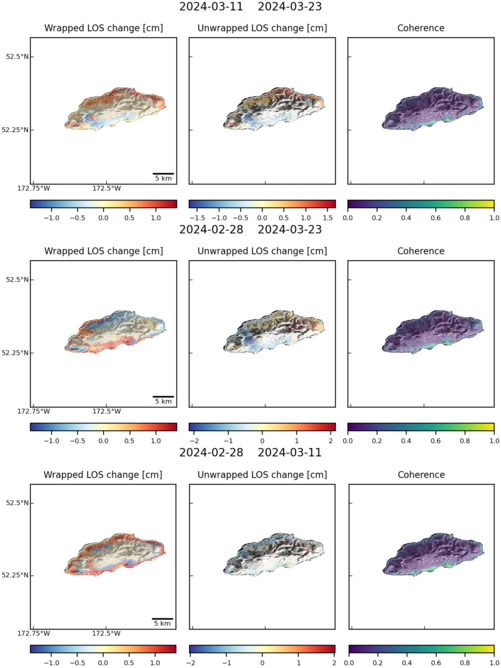
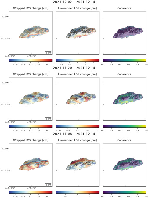
Latest Sentinel-1 Data
Size: 754px x 1100px (110.07 KB)
Size: 501px x 668px (74.28 KB)
Size: 501px x 669px (74.34 KB)