
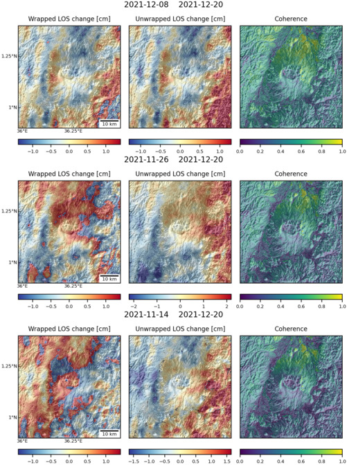
Observations of Deformation
| Volcano number: | 222052 |
|---|---|
| Region: | Africa and Red Sea |
| Country: | Kenya |
| Geodetic measurements? | Yes |
| Deformation observation? | Yes |
| Measurement method(s): | InSAR |
| Duration of observation: | January 2007 - January 2010 |
| Inferred cause(s) of deformation: | Hydrothermal, Magmatic |
| Characteristics of deformation: | Subsidence has been observed at Silali between 2007 – 2010. A radially symmetric signal centred on the calderas western edge (-1.6 +/- 0.4 cm/yr los displacement) was observed using ALOS data. This deformation is believed to have occurred at a linear rate of -1.5 +/- 0.8 cm/yr, and can be modelled as a point geometry at a depth of 3.9 km (Robertson, 2015). |
| Reference(s): | Robertson, E. 2015. Magma storage and transport at Kenyan Rift volcanoes: a remote sensing perspective. Chapter 2. Ph.D Thesis, University of Bristol, UK. |
| Smithsonian Institution Global Volcanism Program http://volcano.si.edu/volcano.cfm?vn=222052 | |
| Location: | 1.15, 36.23 |
| REST API endpoint (JSON): | https://comet.nerc.ac.uk/wp-json/volcanodb/v1/volcano/3192 |
Latest Sentinel-1 Data

Size: 501px x 672px (176.41 KB)
Size: 501px x 672px (176.27 KB)