
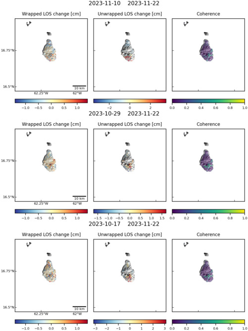
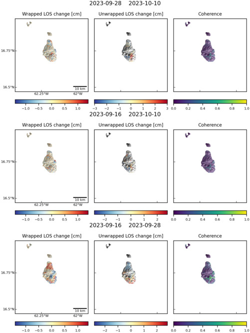
Observations of Deformation
| Volcano number: | 360050 |
|---|---|
| Region: | West Indies |
| Country: | United Kingdom |
| Geodetic measurements? | Yes |
| Deformation observation? | Yes |
| Measurement method(s): | InSAR, GPS - continuous, GPS - campaign, Strainmeter, Tiltmeter, EDM |
| Duration of observation: | 1995-2014 |
| Inferred cause(s) of deformation: | Magmatic, Surface deposits |
| Characteristics of deformation: | |
| Reference(s): | Mattioli G. S., Dixon T. H., Farina F. F., Howell E. S., Jansma P. E., Smith A. L. (1998) GPS measurement of surface deformation around Soufrière Hills Volcano, Montserrat, from October 1995 to July 1996. Geophysical Research Letters 25:3417–3420. |
| Mattioli G. S., Herd R. A., Strutt M. H., Ryan G., Widiwijayanti C., Voight B. (2010) Long term surface deformation of Soufrière Hills Volcano, Montserrat from GPS geodesy: inferences from simple elastic inverse models. Geophysical Research Letters 37:L00E13, http://dx.doi.org/10.1029/2009GL042268. | |
| Voight B., Hoblitt R., Clarke A., Lockhart A., Miller A., Lynch L., McMahon J. (1998) Remarkable cyclic ground deformation monitored in real-time on Montserrat, and its use in eruption forecasting. Geophysical Research Letters 25:3405–3408. http://dx.doi.org/10.1126/science.283.5405.1138 | |
| Wadge G., Mattioli G. S., Herd R. A. (2006) Ground deformation at Soufrière Hills Volcano, Montserrat during 1998–2000 measured by radar interferometry and GPS. Journal of Volcanology and Geothermal Research 152:157–173. | |
| Odbert H. M., Ryan G. A., Mattioli G. S., Hautmann S., Gottsmann J., Fournier N., Herd R. A. (2014) in The Eruption of Soufrière Hills Volcano, Montserrat from 2000 to 2010, Volcano geodesy at the Soufrière Hills Volcano, Montserrat: a review, Geological Society, London, Memoirs, eds Wadge G., Robertson R. E. A., Voight B. http://dx.doi.org/10.1144/M39.11, 39, pp 195–217. | |
| Location: | 16.72, -62.18 |
| REST API endpoint (JSON): | https://comet.nerc.ac.uk/wp-json/volcanodb/v1/volcano/183 |
Latest Sentinel-1 Data

Size: 750px x 1110px (98.04 KB)
Size: 501px x 669px (60.60 KB)
Size: 501px x 669px (61.02 KB)