
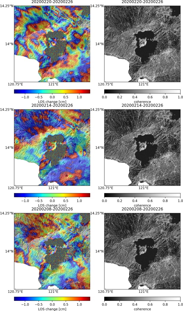
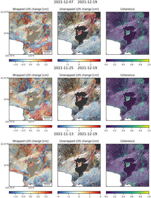
Observations of Deformation
| Volcano number: | 273070 |
|---|---|
| Region: | Philippines and SE Asia |
| Country: | Philippines |
| Geodetic measurements? | Yes |
| Deformation observation? | Yes |
| Measurement method(s): | InSAR, GPS - continuous |
| Duration of observation: | 2007-2011 (InSAR), 1998-1999 (GPS) |
| Inferred cause(s) of deformation: | Hydrothermal, Magmatic |
| Characteristics of deformation: | Deformation related to pressure changes, with the best fitting Mogi source located at a half-space depth of 3.07 km (Morales et al., 2015). |
| Reference(s): | Morales Rivera, A.M., Amelung, F. and Eco, R., 2015, May. Volcano Deformation and Modeling on Active Volcanoes in the Philippines from ALOS InSAR Time Series. In ESA Special Publication (Vol. 731, p. 74). |
| Lowry, A.R., Hamburger, M.W., Meertens, C.M. and Ramos, E.G., 2001. GPS monitoring of crustal deformation at Taal Volcano, Philippines. Journal of Volcanology and Geothermal Research, 105(1), pp.35-47. | |
| Location: | 14.002, 120.993 |
| REST API endpoint (JSON): | https://comet.nerc.ac.uk/wp-json/volcanodb/v1/volcano/3603 |
Latest Sentinel-1 Data
Size: 619px x 1050px (259.80 KB)
Size: 501px x 660px (166.43 KB)

Size: 501px x 668px (170.97 KB)