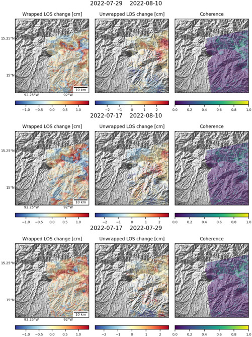
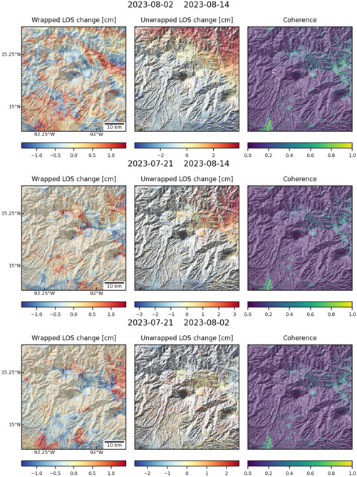
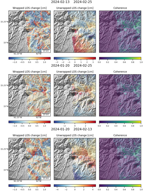
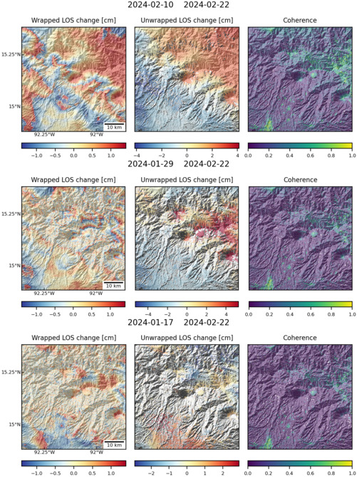
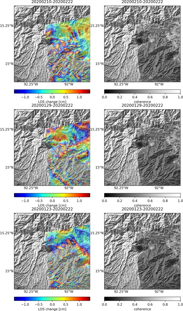
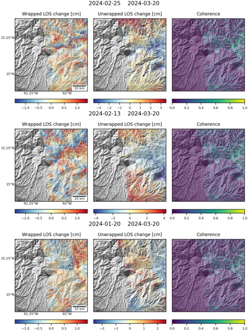
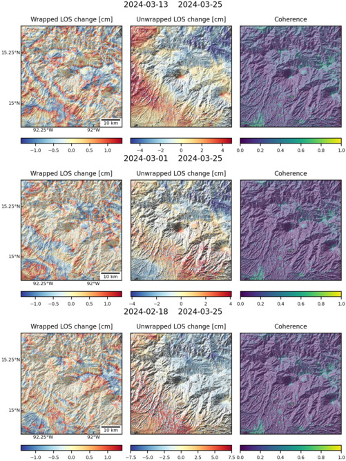
Observations of Deformation
| Volcano number: | 341130 |
|---|---|
| Region: | Mexico and Central America |
| Country: | Mexico/Guatemala |
| Geodetic measurements? | No |
| Measurement method(s): | No measurements |
| Characteristics of deformation: | Tacaná volcano is seismically and geochemically monitored, however there is currently no ground based deformation monitoring (De la Cruz-Reyna & Tilling, 2015). Previous regional InSAR studies of Mexican and Central American Volcanoes have not covered Tacaná due to it’s position at the northern end of the Central American Volcanic Arc (Chaussard et al., 2013, Ebmeier et al., 2013). |
| Reference(s): | De la Cruz-Reyna, S., & Tilling, R.I. (2015), Risk Management of El Chichón and Tacaná Volcanoes: Lessons Learned from Past Volcanic Crises, from: Scolamacchia, T., & Macías, J.L., (2015), Active Volcanoes of Chiapas (Mexico): El Chichón and Tacaná, pp 155-174, doi: 10.1007/978-3-642-25890-9_8 |
| Chaussard, E., F. Amelung, and Y. Aoki (2013), Characterization of open and closed volcanic systems in Indonesia and Mexico using InSAR time series, J. Geophys. Res. Solid Earth, 118, 3957–3969, doi:10.1002/jgrb.50288. | |
| Ebmeier, S. K., J. Biggs, T. A. Mather and F. Amelung (2013), Applicability of InSAR to tropical volcanoes: insights from Central America, Geological Society of London Special Publications, 380, Remote-sensing of volcanoes and volcanic processes: Integrating observation and modelling, doi:10.1144/SP380.2. | |
| Location: | 15.132, -92.109 |
| REST API endpoint (JSON): | https://comet.nerc.ac.uk/wp-json/volcanodb/v1/volcano/617 |
Latest Sentinel-1 Data
Size: 501px x 669px (178.47 KB)
Size: 501px x 669px (189.01 KB)
Size: 501px x 669px (177.56 KB)
Size: 501px x 669px (190.05 KB)
Size: 619px x 1050px (300.94 KB)
Size: 501px x 669px (177.68 KB)
Size: 501px x 668px (189.58 KB)