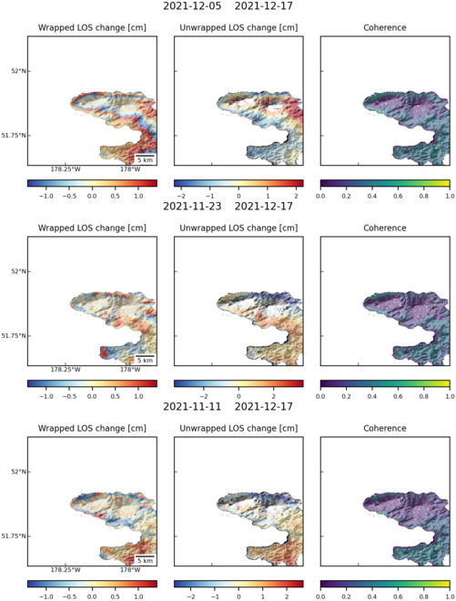
Observations of Deformation
| Volcano number: | 311080 |
|---|---|
| Region: | Alaska |
| Country: | United States |
| Geodetic measurements? | Yes |
| Deformation observation? | Yes |
| Measurement method(s): | InSAR |
| Duration of observation: | 2004 - 2009 |
| Inferred cause(s) of deformation: | Magmatic |
| Characteristics of deformation: | During October – November 2005, an episode of surface uplift (3 – 5 cm) occurred encompassing both Tanaga and Takawanga volcanoes. The broad region of uplift is modelled as a pressurising magma reservoir using a point source or a shallow-dipping prolate source that is elongate in the east-west direction. The source depth is inferred to be 5 – 8 km with a volume increase of 0.002 – 0.008 km³. |
| Reference(s): | Lu, Z., and Dzurisin, D., 2014, InSAR imaging of Aleutian volcanoes: Chichester, UK, Springer-Praxis, 390 p. |
| U.S. Geological Survey Alaska Volcano Observatory (AVO) website http://www.avo.alaska.edu/volcanoes/volcinfo.php?volcname=Tanaga | |
| Location: | 51.885, -178.146 |
| REST API endpoint (JSON): | https://comet.nerc.ac.uk/wp-json/volcanodb/v1/volcano/1045 |
Latest Sentinel-1 Data
Size: 501px x 660px (88.82 KB)

Size: 501px x 669px (87.81 KB)