
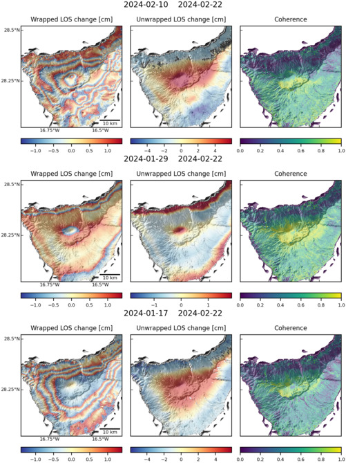
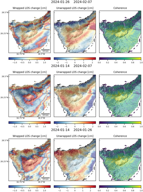
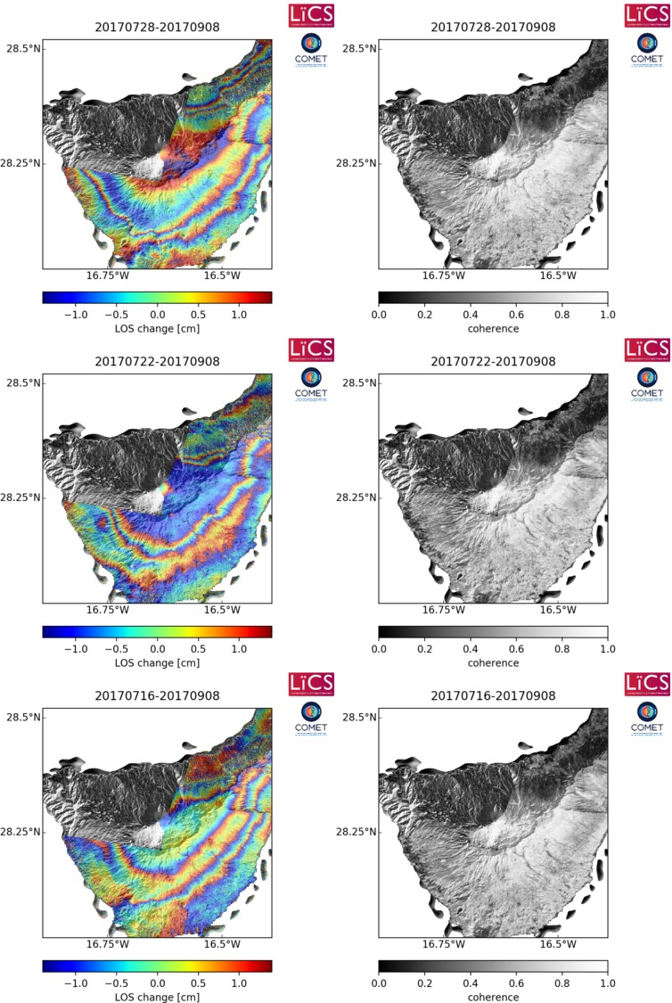
Observations of Deformation
| Volcano number: | 383030 |
|---|---|
| Region: | Atlantic Ocean |
| Country: | Spain |
| Geodetic measurements? | Yes |
| Deformation observation? | Yes |
| Measurement method(s): | InSAR, GPS - continuous, GPS - campaign, Levelling, Triangulation, trilateration |
| Duration of observation: | 1982 to 2000, 2000, 1992 to 2005 |
| Inferred cause(s) of deformation: | Magmatic, Surface deposits, water table changes, seismic crisis in 2004, sinking of the dense core of the island into a weak lithosphere |
| Characteristics of deformation: | A 17-benchmark geodetic network was set up in 1982, located in the southern part of the caldera. The network was used to conduct triangulation, trilateration and levelling profiles. No displacements were found from 1982 to 2000 during the observation of both the geodetic network and levelling profile (M.J. Sevilla, 2002, personal communication with Fernández). |
| Reference(s): | Fernández, J., Tizzani, P., Manzo, M., Borgia, A., González, P. J., Martí, J., ... & Lanari, R. (2009). Gravity‐driven deformation of Tenerife measured by InSAR time series analysis. Geophysical Research Letters, 36(4). |
| Fernández, J., Yu, T. T., Rodrıguez-Velasco, G., González-Matesanz, J., Romero, R., Rodrıguez, G., ... & Blanco, M. J. (2003). New geodetic monitoring system in the volcanic island of Tenerife, Canaries, Spain. Combination of InSAR and GPS techniques. Journal of volcanology and geothermal research, 124(3), 241-253. | |
| Smithsonian Institution Global Volcanism Program http://www.volcano.si.edu/volcano.cfm?vn=383030 | |
| Location: | 28.271, -16.641 |
| REST API endpoint (JSON): | https://comet.nerc.ac.uk/wp-json/volcanodb/v1/volcano/1291 |
Latest Sentinel-1 Data
Size: 501px x 669px (143.29 KB)
Size: 501px x 667px (141.92 KB)
Size: 754px x 1125px (234.72 KB)