
Observations of Deformation
| Volcano number: | 261090 |
|---|---|
| Region: | Indonesia |
| Country: | Sumatra |
| Geodetic measurements? | Yes |
| Deformation observation? | Yes |
| Measurement method(s): | No measurements, 14C values in stratigraphy |
| Duration of observation: | 33.5ka-present |
| Inferred cause(s) of deformation: | Magmatic |
| Characteristics of deformation: | Evidence from a 2015 paper by de Silva et al suggests that Toba has been uplifting in an unsteady, episodic manner since approximately 33.7ky. This study utilised the variations in 14C values of lake sediments deposited on the slopes of certain islands within the Toba crater lake. Through this method, the authors estimated that Samosir island has since experienced ~700m of uplift in the east, while the deformation in the west has been much less pronounced. A more in-depth analysis of the stratigraphy suggested that uplift rates were highest between 33.7-22.5 ka at 4.9 cm/yr, but have since diminished to less than 0.7 cm/yr from 22.5ka onwards. Combining these figures with numerical models suggests that the deformation is more likely to be caused by intrusion of new material beneath the caldera, than by relaxation as a cause of caldera collapse, as was proposed by Chesner & Rose, 1991. This inference of continued magmatic activity since the caldera collapse at ~74ky is supported by ongoing hydrothermal and fumarolic activities observed at the volcano. |
| Reference(s): | de Silva, S. et al. 2015. Resurgent Toba—field, chronologic, and model constraints on time scales and mechanisms of resurgence at large calderas. Frontiers in Earth Science, 3. DOI: 10.3389/feart.2015.00025 |
| Location: | 2.58, 98.83 |
| REST API endpoint (JSON): | https://comet.nerc.ac.uk/wp-json/volcanodb/v1/volcano/3569 |
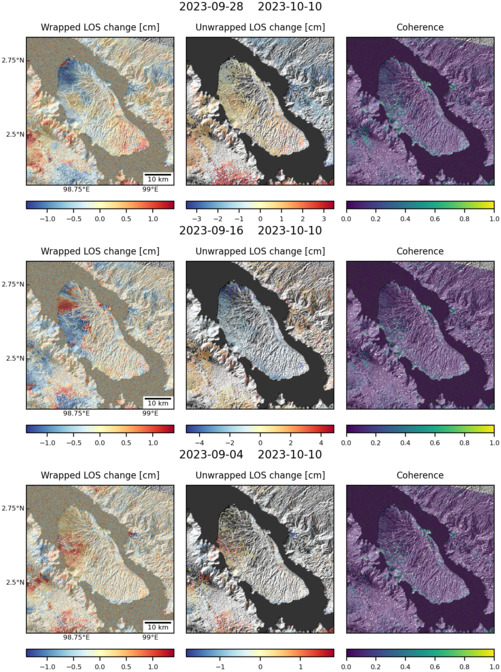
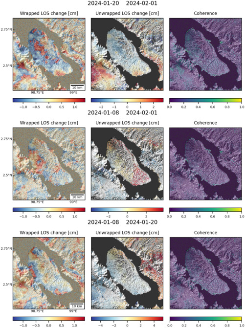
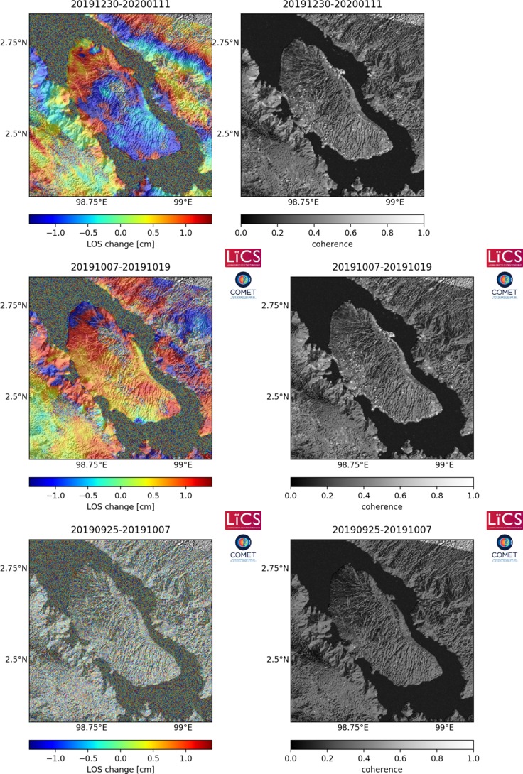
Latest Sentinel-1 Data
Size: 501px x 672px (168.76 KB)
Size: 501px x 671px (168.25 KB)
Size: 736px x 1090px (275.84 KB)