Observations of Deformation
| Volcano number: | 300240 |
|---|---|
| Region: | Kamchatka and Mainland Asia |
| Country: | Russia |
| Geodetic measurements? | Yes |
| Deformation observation? | Yes |
| Measurement method(s): | InSAR |
| Duration of observation: | 1992 to 2003 |
| Inferred cause(s) of deformation: | Surface deposits |
| Characteristics of deformation: | Pritchard and Simons present ERS-1 and -2 and RADARSAT data for northern Kamchatka between 1992 and 2003, although most volcanoes are only covered during the last three years. They show clear subsidence of the New Tolbachik basaltic lavas (erupted in 1975–1976; ~2 km3; e.g., Fedotov and Masurenkov, 1991) in interferograms spanning 15 July 1992–17 June 2000 and 2 September 2000–18 August 2003. There is a maximum of ~2.5 cm/yr line of site subsidence and it is likely caused by thermal contraction, relaxation of the underlying substrate, and closing of pore space in the lavas. |
| Reference(s): | Smithsonian Institution Global Volcanism Program http://www.volcano.si.edu/volcano.cfm?vn=300240 |
| Pritchard, M. E., & Simons, M. (2004). Surveying volcanic arcs with satellite radar interferometry: The central Andes, Kamchatka, and beyond. GSA Today, 14(8), 4-11. GSA Data Repository Item 2004139. Tables DR1 and DR2 and Figures DR1–DR3, is available on request from Documents Secretary, GSA, P.O. Box 9140, Boulder, CO 80301-9140, USA, editing@geosociety.org, or at www.geosociety.org/pubs/ft2004.htm | |
| Fedotov, S.A., and Masurenkov, Y.P., editors, 1991, Active volcanoes of Kamchatka: Moscow, Nauka Publishers, 302 p | |
| Location: | 55.832, 160.326 |
| REST API endpoint (JSON): | https://comet.nerc.ac.uk/wp-json/volcanodb/v1/volcano/5359 |
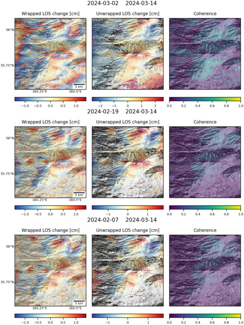
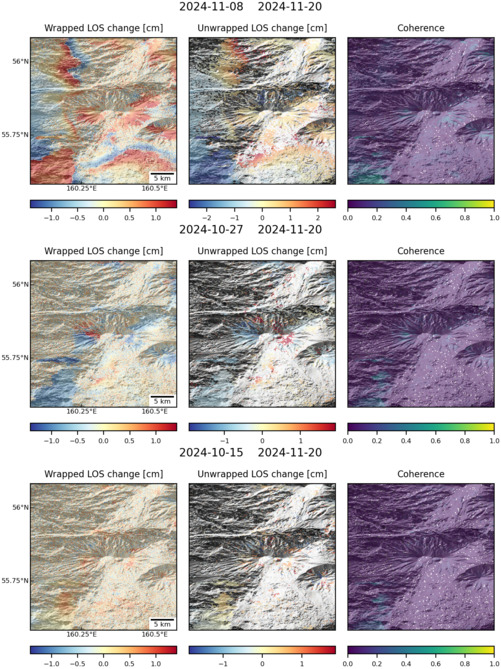
Latest Sentinel-1 Data

Size: 619px x 1050px (245.39 KB)

Size: 501px x 669px (170.75 KB)

Size: 501px x 669px (168.66 KB)

Size: 501px x 669px (169.79 KB)
