
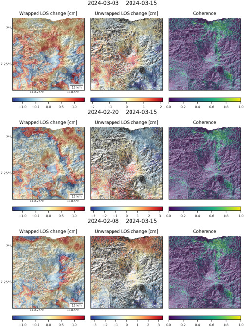
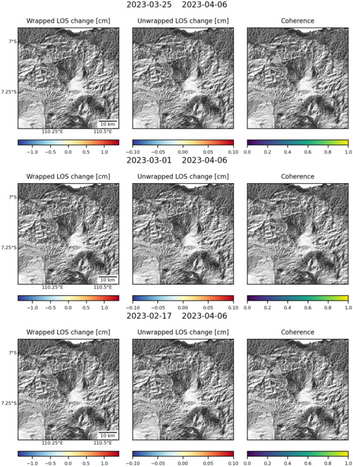
Observations of Deformation
| Volcano number: | 263230 |
|---|---|
| Region: | Indonesia |
| Country: | Java |
| Geodetic measurements? | Yes |
| Deformation observation? | Yes |
| Measurement method(s): | InSAR |
| Duration of observation: | 2002-2006 |
| Inferred cause(s) of deformation: | Faulting/tectonics |
| Characteristics of deformation: | Though not the direct subject of the study, Ungaran volcano was included in Kuehn et al’s land subsidence survey of the city of Semarang in Sumatra. This study used the Stable Points Network (SPN) technique to measure ground displacement – the SPN technique is a relatively modern synthetic aperture radar-based method, which utilises backscattering objects on the ground surface to measure displacement with millimetre-scale accuracy. The survey was performed using images acquired between 2002 and 2006, and covers an area of approximately 375km2. |
| Reference(s): | Kuehn, F. et al. 2010. Detection of land subsidence in Semarang, Indonesia, using stable points network (SPN) technique. Environmental Earth Sciences, 60 (5), 909-921. DOI: 10.1007/s12665-009-0227-x |
| Location: | -7.18, 110.33 |
| REST API endpoint (JSON): | https://comet.nerc.ac.uk/wp-json/volcanodb/v1/volcano/4036 |
Latest Sentinel-1 Data
Size: 501px x 672px (189.69 KB)
Size: 501px x 663px (151.63 KB)