
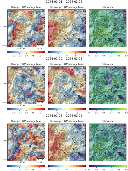
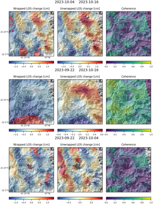
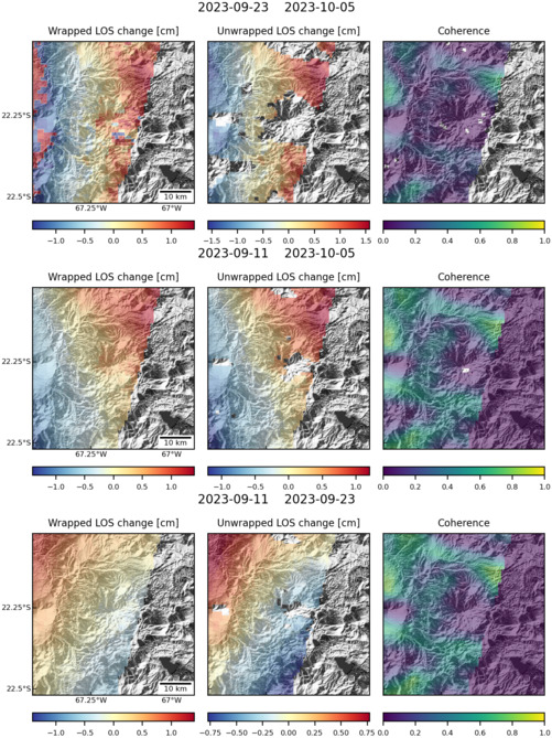
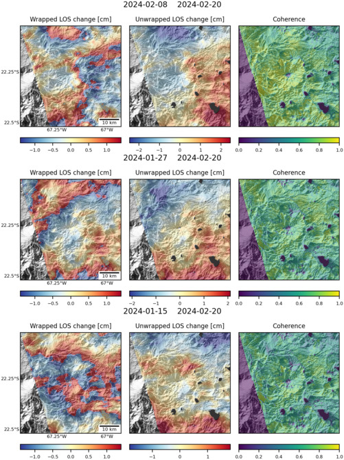
Observations of Deformation
| Volcano number: | 355838 |
|---|---|
| Region: | South America |
| Country: | Bolivia |
| Geodetic measurements? | Yes |
| Deformation observation? | Yes |
| Measurement method(s): | InSAR |
| Duration of observation: | 1992-2011 |
| Inferred cause(s) of deformation: | Magmatic |
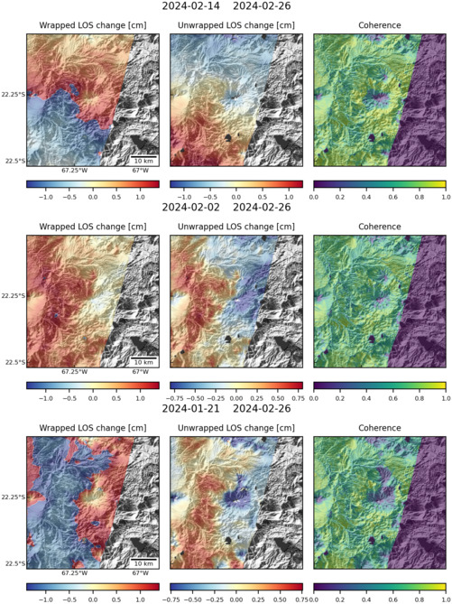
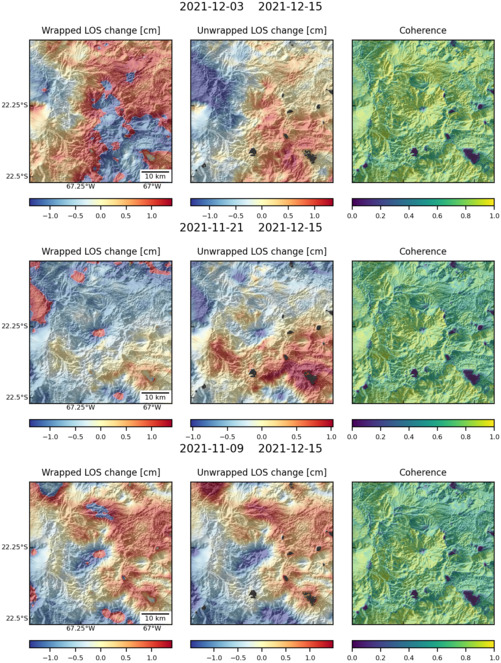
| Characteristics of deformation: | Between 1992 and 2011, an area around Uturuncu volcano over 70 km across has been uplifting at an approximately constant rate of 1 cm/year. The uplifting area is surrounded by a ‘moat’ that is subsiding at ~0.2 cm/year (Henderson and Pritchard, 2013). Various explanation have been proposed for this deformation, including melt rising from the lower to mid crust, lateral migration of melt in the mid crust, and diapir formation (Henderson and Pritchard, 2013) |
| Reference(s): | Henderson S. T., and M. E. Pritchard (2013), Decadal volcanic deformation in the Central Andes Volcanic Zone revealed by InSAR time series, Geochem. Geophys. Geosyst., 14, 1358–1374, doi:10.1002/ggge.20074. |
| Location: | -22.27, -67.18 |
| REST API endpoint (JSON): | https://comet.nerc.ac.uk/wp-json/volcanodb/v1/volcano/4666 |
Latest Sentinel-1 Data
Size: 501px x 668px (170.59 KB)
Size: 501px x 669px (158.90 KB)
Size: 501px x 669px (160.89 KB)
Size: 501px x 669px (174.41 KB)
Size: 501px x 667px (171.33 KB)
Size: 501px x 663px (169.91 KB)