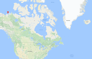
Pablo J Gonzalez is a COMET researcher at the University of Liverpool. He is currently (August 2017) carrying out a field campaign in the Canadian Arctic funded by the NERC British Arctic Office under the UK-Canada bursaries project Ice-landforms characterization due to permafrost dynamics around the Pingo National Landmark, Tuktoyaktuk, Northwest Territories, Canada.
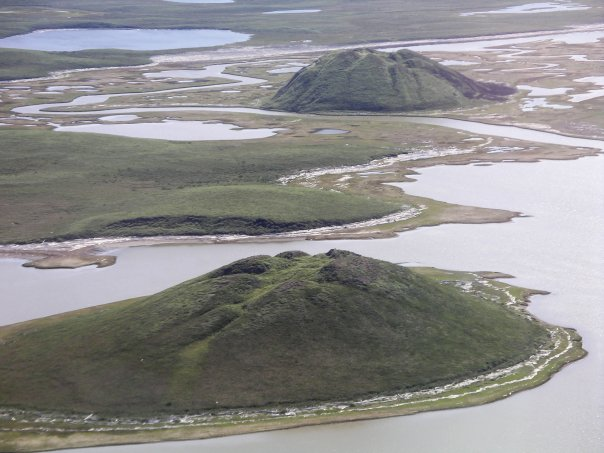
Permafrost dynamics, related to ice aggradation and thawing, are effective climatic indicators. Pingos (conical ice-cored hills, Fig. 1) concentrate large amounts of ice near the surface and, hence are highly sensitive systems to environmental changes.
Thus, the morphology and dynamics of pingos can be used to monitor regional effects of climate change over wide regions in the Arctic. However, we can identify two main difficulties in using pingos for environmental monitoring:
- The relationship of pingo morphology with its origin and permafrost conditions has not been established quantitatively.
- Monitoring pingo dynamics (growth, stability or collapse) has not been possible due to their small size (<300 m) and remote locations.
In this project, we aim to increase our understanding of pingo dynamics to fully exploit their potential as climate indicators. Here, we will apply novel methods to retrieve high spatial resolution (1-m) and very-high precision (<1m) topography based on satellite and drone technology.
The essential field work (late August 2017) is being carried out in collaboration with scientists from the Canada Centre for Remote Sensing, Natural Resources Canada (Dr. Yu Zhang and Dr. Sergey Samsonov), who are currently working in the area under the Polar Knowledge Canada project “Monitoring Land Surface and Permafrost Conditions along the Inuvik-Tuktoyaktuk Highway Corridor”.
This UK-Canada project will establish, for the first time, new and unique morphometric descriptions of a large number of pingos; conduct an exploratory analysis to establish links between current morphology with respect to genetics (origin), environmental conditions and stage of evolution; and unequivocally demonstrate the systematic decline, stability or growth of pingos in Tuktoyaktuk (Fig. 2), which could be linked to current climate change in the Western Canadian Arctic.